Wednesday, June 2, 2021

Day 28 -- Wendover to Winnemucca, Nevada -- 231 Miles

There's not a lot of points of interest to capture a person's attention when you drive the 231 miles from Wendover to Winnemucca, Nevada. Sure there are lots of tiny towns from bygone days sporting tumble weeds and boarded up main streets; places like Golconda and Wells; places that time has long ago forgotten.

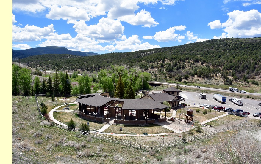
On the positive side, there are a couple of "Don't Miss" options that we always try to include in our itinerary when we're traveling Interstate 80 across the Great Basin. Those two are the Overland Trail Museum on the West side of Elko and the Elko city museum spotted next to Elko's events center and city park. Both are really great places to stop on a lunch hour, or just to stretch your legs after a long drive.

We stopped at the Elko city museum on our way east during the first week of our vacation. They had made lots of changes since our last visit, and we had an excellent time viewing the wonderful art in the changing gallery in the museum annex. We also enjoyed the original part of the museum that we always revisit for its quality displays.

Today, as we drove west, we wanted to stop and visit the Overland Trail Museum hoping to combine a museum tour with our lunch hour. But imagine our horror when we exited the Interstate and drove up to the entrance gate and found it locked! Not satisfied with seeing the closed, and seemingly locked gate from the truck window, I got out and went over to test the integrity of the lock.

Yup, it WAS locked for sure and pasted to the gate was a rather lame message that said: "in accordance with CDC directives, the museum is closed." To help potential guests understand, the sign included a phone number should those guests want to call and have it explained verbally.

Naturally, I called the number since I could easily see two or three cars in the museum parking lot about a thousand feet from the locked gate where I stood. However, as one might expect in such an inane situation, the listed phone number was "not in service at this time."

Now we've been on the road for nearly a month and have been to countless museums and RV camps and grocery stores and, well, you name it, and few are even requiring a mask anymore. Once in a great while we'll encounter someone with a mask on anyway, but they're definitely in the minority. So, we wonder, what's up with the Overland Trail Museum? Evidently, the bad phone number on the gate was going to be no help answering that question.

For a few moments I toyed with the idea of driving in the outbound traffic gate as IT was open. But instead, I just steered the rig back onto the Interstate and continued heading west. It took a while to get over that bit of disappointment, but we focused our attention on our DVD book, though a more improbable story you'd have a hard time finding. The tail involves an Irish family that has decided to become Mormons in the year 1850, and the story details the trials and tribulations they face as they board a ship in Liverpool, England, and cross the Atlantic to New York.

Since the story was meant to be somewhat charming, it managed it keep our interest, but I won't bore you with the plot details. In short, I suspect the family will probably succeed in outwitting everyone from the heavy-handed rich parents of their chance female traveling companion, to the many and sundry American holligans hoping to take advantage of the family's naivete.

Since we couldn't have lunch at the trail museum, we settled for a semi-shaded lunch spot in a casino parking lot across the street from "The Owl Club Casino and Restaurant" in Battle Mountain, right next to the Union Pacific mainline. Though the line was quiet through most of our lunch hour, a fast freight did announce itself in time for me to grab the camera and dash out to shoot the locomotive. Then, as an afterthought, I started shooting the spectaucularly-color graffiti on the sides of many of the train cars as they sped past at sixty miles per hour.

This brings me to the topic of this blog: railroad car grafitti.

I don't know how many years it has been happening, but painting the name of your girlfriend or streetgang or favorite band on the sides of boxcars, refrigerator cars, or even mesh-sided automobile-carrying cars has become as common as people living on the streets in America. I've never been sure why railroads accept the practice, but maybe it's just impossible to stop.

I visited the "National Railroad Museum" website to learn more about railroad graffiti. They had this to say: "Modern American graffiti, as we know it, began in the United States and is attributed to a Philidelphia high school student known as “Cornbread.” Trying to attract the attention of a girl in 1967, he began signing his name, or “tagging,” public areas of the city."

"The form exploded in New York during the 1970s as “TAKI 183” and “Tracy 168” would “bomb” subway cars with their imaginative signatures, spreading the graffiti idea throughout the region the train traveled. The growth of street gangs and the political and social changes that characterized the 1960’s and 1970’s, whose sometimes illegal and divisive tactics marginalized the art form, while simultaneously bringing it into mainstream American culture."

"Today graffiti is alternately lauded by art critics and enthusiasts, while demonized by property owners, creating tension and discussion within the community about issues ranging from vandalism to free speech."

As you can see from the photos, shooting the cars while they're flashing past is certainly not optimum. But seldom are we ever close enough to parked freight cars to do any photography. Plus, tresspassing on railroad property is seldom safe in these times of home-grown terrorists looking to disrupt society. Railroad employees are specifically trained to look out for folks lurking around on railroad property.

To read more about railroad graffiti go to: https://nationalrrmuseum.org/blog/from-boxcars-to-big-boy-the-story-of-railroad-graffiti/

Tuesday, June 1, 2021

Day 27 -- Springville, Utah to Wendover, Nevada -- 185 Miles

At first I thought that describing today's events probably wouldn't fill a 3"x5" index card since it involved mostly driving under a blazing sun across a witheringly hot desert. There wasn't any fascinating places to pull over once we reached the boundaries of civilization and headed out across the infamous salt flats that straddle the border between Utah and Nevada. Places to stop are few and are mostly exit opportunities for the infrequent side roads.

However, before we departed the green hills of western Utah, I had one important stop to make. If you've been reading this blog as we’ve traveled this spring, you know that our route today is simply a reversal of our departure itinerary from Nevada to Utah in early May. You will probably also remember that once we had crossed into Utah we left the Interstate 80 Route that passes through Salt Lake City and dropped south toward the towns of Grantsville, Toole, Stockton, and beyond.

The purpose of this deviation from Interstate 80 was to enable us to make a very specific stop in the remote desert village of Fairfield more than an hour's drive south and west of Salt Lake City. Back in 1858 this now quiet, sparsely-settled village adjoined a bustling army post known as Camp Floyd, which housed a couple of thousand regular army soldiers.

The army post existed where it did because the U.S. government and the Mormon Church very nearly ended up in a war back in 1857. The reasons for the war can be attributed more to political posturing than to any real threat posed by the Mormon Church, but President Buchanan nevertheless dispatched General Albert Sidney Johnston to the Utah Territory to take charge and "bring order” to the supposedly unruly Mormons.

Mormons, who had been victimized incessantly for more than two decades by various governments, knew what bringing order meant to the U.S. Military. Brigham Young immediately recognized the threat and issued a call to all Mormons to return to Salt Lake City to help defend their church and their brethren. At the same time, young men in Salt Lake City and the surrounding local areas were organized and made ready to repulse an invasion.

In order to delay the army that the Mormons knew was advancing from the east, Mormon's fortified the canyon approaches to Salt Lake City and made ready to ambush any soldiers who might venture there. In addition, cavalry forces traveled east to meet the oncoming supply trains that were traveling separately from the federal troops. Once found, the trains were attacked, ransacked, and put to the torch.

Mormon efforts to destroy the army's supply trains were extraordinarily successful. They were so successful that the army had to halt their advance while still in the Wyoming Territory and wait for more supply wagons to reach them from the east. Ultimately, the army never received enough supplies to wage any sort of conflict with the Mormons and were forced to spend the winter of 1857/1858 bivouacked on the plains in close to starvation conditions.

Fortunately, cooler heads eventually prevailed and war was averted. However the Mormons had to agree to allow a U.S. army post to exist in the Utah Territory for the protection of overland immigrants and as well as all other citizens of the United States. The Mormons agreed to this demand with the stipulation that the fort had to be well removed from any settled areas.

And that's how the fort known as Camp Floyd came to be established, though it only existed for a little over two years. Along with Camp Floyd, the civilian town of Fairfield sprang to life which soon grew into the second largest town in the territory. The Mormons were never comfortable with the existence of the fort, nor of the lawless nature of the town of Fairfield. But opportunities for commerce at both the fort and the town were a boon to local farmers and ranchers for the short time both existed.

Eventually, Camp Floyd was closed and abandoned when the American Civil War broke out in April of 1861. By August of 1861 the Fort was abandoned, the furnishing and supplies sold off, and the soldiers marched off to join in the war effort. Most of the fort's buildings were dismantled for their materials or moved to local farms or ranches, and virtually nothing remains of the fort today save one building which now houses a museum devoted to this particular episode in history.

The museum building once housed the post commissary. Across the street from this sole remaining Camp Floyd building is a two-story structure that was once a way station for both the pony express riders and the overland stage line employees. Concetta and I visited the museum on our way east in May, and photographed the way station. We found both to be well worth a stop to get acquainted with the story of the fort.

Unfortunately, what we missed doing in May was visit the fort cemetery which was situated just down the road to the southwest from the museum. Today I intended for us to recify that bit of oversight. Even though we were told at the museum that only soldiers were buried at the fort and no civilians, I just had to see for myself.

So why am I intersted in the saga of Camp Floyd? Because back in 1861, between the firing on Fort Sumpter that began our Civil War, and the August date that Camp Floyd's troops marched off to fight in that war, my great great Grandfather, John Stephen Daley, was supposedly murdered by Indians, perhaps somewhere in the Camp Floyd area. John, who lived in Springville, Utah, about fifty miles to the east and south, had loaded up his wagon to deliver supplies to an unknown location and was never seen again. I figured if John had been murdered, perhaps the soldiers found him and brought him back to Camp Floyd for burial, especially if he had no identification on him.

Visiting the cemetery today didn't exactly prove that John wasn't buried there, since it doesn't appear that civilians were noted in the record. But he might be there since the cemetery in his home town contains no stone for him that I have found. It's certainly a mystery that I hope to solve someday. At any rate, it felt great to finally get to see a place I've only read about for many years.

And that was our one "adventure" for the day. Right now we're camped in Wendover, Nevada, and tomorrow we'll be headed down Interstate 80 toward Reno. We do plan a stop at the Overland Trail museum in Elko, as that facility is just too good to miss when you're in the area. Tomorrow night we'll be in Winnemucca, which should be our last night on the road.

Monday, May 31, 2021

Day 26 -- Green River to Springville, Utah -- 132 Miles

Today turned out to be exciting and even somewhat out of the ordinary. We rolled out of Green River at our usual hour around 9:00 A.M. and made our first stop a local cut-rate gas station that seemed to have no customers until we arrived. That's usually a bad sign, but since empty gas stations are easier to enter as well as exit with a 32-foot rig, I chose it specifically for its obvious customer absence.

Once we had gassed up, we quickly left Green River behind while using Concetta and her handheld IPhone to navigate us to the tiny town of Springville, Utah, which lay up the road about 132 miles.

As usual, Utah's desert landscape was glowing in the early morning sun, and we enjoyed every mile that we traveled on Interstate 70 and on Utah Routes 6 and 191. Early on we passed through many of the towns that my various relatives spoke about when I was a child. Names like Price, Castle Dale, Soldier Summit, Helper, Scofield, and Clear Creek came and went on the roadside signs as we climbed the grade out of the desert lowlands (photo top left).

When it got close to lunch hour, we just happened to be approaching a roadside rest where we'd stopped at the very beginning of this vacation. I'm not sure what the name of the stop is on the map, but Utah has gone to the expense of erecting a replica railroad station and roundhouse to entertain travelers, as well as installed several charging stations for electric vehicles (photo lower right).

The last time we stopped at this place I had hoped to grab a few photos of the recreated train station and roundhouse, as well as hike up the adjacent hill to the real railroad tracks and grab a photo of a passing train. Unfortunately, that day it was gray and overcast and seemed to be threatening rain, and I didn't end up accomplising any of my goals.

Today turned out to be a much nicer day for fulfilling my previous intentions. Though cloudy, the day was mostly sunny, and I successfully turned our lunch hour into 90 minutes of both eating and taking several dozen photos. The hike up the hill to the railroad tracks was a little tough on this old duffer, but I made it. I didn't see or hear any trains coming, but I just decided to wait until one appeared around the distant bend before I retraced my steps back to the rig.

The first thing I noticed, even while I was down in the parking lot and a hundred feet below my future track-side vantage point, was the wonderful sandstone geological features that had been exposed by the railroad cutting through the mountain for their tracks. There seemed to be alternating layers of creamy, blocky sandstone, and dark, almost black sand or mudstone. You'd have a foot or so of the creamy sandstone, mysteriously broken into large cube-sized chunks. Then you'd have a couple of feet composed of literally hundreds of thin layers of mudstone piled one atop the other. It is possible that the dark layer was mixed with volcanic ash. (photo lower left).

Every time the sun would pop from behind a cloud and illuminate the hillside, I would fire off as many photos of that incredibly interesting geology as I could. Then, since I was still waiting for the train to arrive, I spent the overcast moments both looking for artifacts and studying exfoliated pieces of the cream-colored sandstone for evidence of fossils. Sadly, and try as I might, I didn't find any fossil evidence.

Meanwhile, a hundred feet below me in the parking lot, Concetta was beginning to think I had gotten totally lost. But when I finally gave up waiting for the train, taking photos, and looking for fossils, I hiked back down the mountain and let her know I was still alive. But, I told her, I was headed back out again because on my walk back to the rig I came across a couple of RVers who were in need of some assistance.

Before arriving at the rest stop, these RVers had noticed that the "skin" on one of their driver's side lockers had peeled off the support structure and bent double in the slipstream. They wondered if I had any Bungee cords, and I told them that I did, and I would go retrieve my collection and return.

After telling Concetta about my mission, I rummaged through my emergency stash, pulled out my container of Bungees and, for good measure, grabbed a brand new 50-foot roll of eighth-inch nylon line. Once back at their rig, I saw in my absence they had tied up the locker door skin with a knotted length of coaxial cable, which seemed to do the job. However, I insisted that they take my roll of nylon line just in case.

I always thoroughly enjoy helping out other RVers. More than once in our travels we too have been the recipients of some very good deeds by both fellow travelers and by members of the public we have encountered quite by chance.

During all this time, the train still had not appeared on the tracks above the rest stop, so we decided to move on. Naturally, we hadn't driven more than a couple of miles, and we passed the train coming up the canyon. Had I been able to remain just another half hour, I would have had my shot. But oh, well, better luck next time.

Amazingly, we hadn't driven more than another quarter of an hour, and we rounded a bend and encountered a huge two-lane traffic jam. When I say huge, I mean the double line of cars, trucks, and RVs of all descriptions stretched ahead as far as we could see down the canyon, perhaps as much as three miles, before it disappeared around a distant bend. We both assumed that there must be some giant accident like an overturned oil tanker or six-car pileup to create such a mess.

Very quickly our rate of travel was reduced from 60mph to less than 5 mph. We kept going, but you could almost walk as fast. Foot-by-foot we crept over the hill and down the canyon, side by side with a multitude of folks doing the same thing. Unfortunately, we had only just finished our murder mystery so didn't have that entertainment to take our minds off the tedium of the jam. I went ahead and popped John Denver into the machine, and we listened to "Rocky Mountain High," and other Denver favorites.

When, after nearly an hour, we finally arrived at where the two lanes became one lane, traffic suddenly took off like a shot, and we rolled away from that point at our usual 60mph. To our astonishment, there had been no huge accident at all. The entire debacle had to be chalked up to the Memorial Day traffic overtaxing the carrying capacity of Utah Highway 6/191.

Once past the jam, we very quickly rolled into Springville, our destination for the night. Rather then head right for the camp, we took what we hoped would be a few moments for me to stop by the Springville Cemetery and visit the grave of my two times great grandmother. Here in Springville my Mormon ancestors have lived and prospered since the first wagons arrived in 1847.

Alas, though I have located the grave in the past, and have even photographed it, I was unable to locate it today. I strolled around for a good forty-five minutes, but never saw a single "Daley" family member grave. After that bit of disappointment, we traveled on to our KOA camp in Springville, thus ending a really fascinating day.

Sunday, May 30, 2021

Day 25 -- Montrose, Colorado to Green River, Utah -- 162 Miles

We just drove today and listened to a murder mystery by John Sandford. I thought the story believable and well told as well. Makes me kinda miss my mystery-writing days way back when. Although I finished my one and only attempt many years ago, I couldn't interest an agent in the book. So, I moved on to bigger and better things.

One of those bigger and better things has been traveling, a passtime in which I have been desperately in love since my folks took my brother and me on our very first vacation back when I wasn't old enough to spell vacation. Later, when Mom discovered genealogy and we spent most vacations exploring the western United States in search of our ancestors, my love for seeing our magnificent country grew exponentially.

In those days the predominence of our ancestors lived in or around Utah and Colorado, so that's where we did much of our traveling. Today, "the Happy Wanderers" just happened to be traveling between Colorado and Utah, and we took a few photos along the way. We didn't stop to do any exploring, but included here are a few shots of the scenery along our route of travel (photo above).

Quite at random, we chose as our lunch hour stopping place a patch of ground off Interstate 70 that just happened to contain a cell tower. The tower must have belonged to Verizon as our internet devices were extremely pleased with our choice (photo below).

The 18-wheeler you see in the the above photo was sitting on the shoulder of the on-ramp when we drove up. I took so many photos of the rig while I was looking for good shots of the sky that I think it made the driver nervous, and he soon cranked up his truck and drove off. Here's another shot of the truck below.

As an added benefit, while tramping around looking for photo angles, I found on old cast-off RV sewer hose that had obviously lain out in the desert for years. Still, even though the hose was useless, the fitting on the end, which came complete with a Jubilee Clamp, would be super useful to someone in an energency.

We had encountered just such an emergency in our Steamboat Springs camp this trip. Two female campers next to us had just laboriously completed setting up their camp and discovered, to their embarrassment, that their sewer hose was three feet too short. They had two separate sections that would work to extend their reach, but they had no connecting device to join the two sections. Their only other choice was to break down the camp trailer, move it three feet, then set it up all over again.

Thinking that I probably had some sort of fitting in my stash of largely unused spare equipment, I dug around and found just the perfect connector. I hadn't used the piece for years and years so offered it to them, and I even offered to do the installation. Twenty minutes later they were all set up and super happy. I could easily envision the connector that I found today coming in handy in just such an emergency in the future.

So anyway, here are the photos, and as you can see, the main subject today was the magnificence of the sky and it's super expressive clouds. Enjoy!

The photo above was crafted using three separate shots. Nothing fancy, just a bit of Microsoft Paint. Just wanted to see if I could do it.

Saturday, May 29, 2021

Day 24 -- All day in Montrose, Colorado -- Under 50 Miles

Today we needed to go back to do what I failed to do yesterday. We had visited the Montrose Botanical Garden, and I shot over 100 photos and spent a couple of hours doing it. Trouble was, I handn't seated the memory card properly the last time I had moved it from the camera to the laptop and back again. No memory card meant no photos shot. Though I think the camera had been telling me all morning that no photos were being saved, I chose to ignore the little red message and go on shooting.

What the camera had been telling me was that it would put the picture I just shot on the reviewing screen, but it wouldn't be moving that image to memory. I thought that since I could see the image, the image was being saved. I had never seen the little red warning before and thought I could troubleshoot the problem back in the RV.

So right after breakfast today we went back to the Montrose Botanical Garden to begin at the beginning. Lots of the photo setups I could still remember, so I could easily repeat them. Others I probably missed today while no doubt interjecting others I hadn't taken yesterday. I guess it really doesn't matter since most of them will be used for garden-setup ideas, or suggestions for plants that thrive in the high desert. We just love what we turn up on these trips in the way of garden design, and every shot is potentially food for thought.

Yesterday Concetta and I were alone in the gardens. But today there were more folks touring with us. Still, the grounds are large enough so that you're really not tripping over each other. Besides, most of the others strolling the garden paths stayed only briefly. As for us, we always have trouble tearing ourselves away so we ended up staying until nearly lunchtime.

For lunch we decided to drive ourselves into the country toward the Colorado town of Ouray and pick the ideal spot beside a rushing river with snow-capped peaks in the distance. Yes, we knew this was a sort of "pie-in-the-sky" search, but we were hopeful. We tried a couple of potential sites as we climbed in elevation, but they didn't suit.

Then, out of the blue, a roadside sign announced that a hiker's trailhead access was on the right, and we took that slender road down into the canyon of the Uncompahgre River and eased into a tiny parking lot. A couple of mountain bikers, who arrived about the same time we did, sort of looked at us quizzically as we nestled in at the edge of the tiny parking lot and turned off the engine. But in the end they shrugged and rode on down the road.

Incredibly enough, the spot that we had randomly picked turned out to be just a few paces from a rushing river, and the whole scene was backed up by snow-capped mountains way off to the east of us. The surrounding terrain looked very much like the sage and sand we're used to in Carson City. Plus, here and there, tiny orange wildflowers had somehow captured a bit of space between the various sage plants and seemed to be thriving despite their diminutive size.

After lunch we put on our hiking boots and headed down to the Uncompahgre River and the adjacent park to see what we could see. Dark clouds festooned the heavens, but every once in while the sun would poke through the clouds making an occassional photograph possible.

At the park entrance we encountered a plaque identifying the small sanctuary beside the river as the "Dennis Weaver Memorial Park." Concetta did the research and discovered the Dennis Weaver on the plaque was the same Dennis Weaver in the TV Show "Gun Smoke."

I found this information on the web about the Dennis Weaver Park: "The Dennis Weaver® Memorial Park is a magical place of reflection and relaxation dedicated to the memory and vision of actor/environmentalist Dennis Weaver."

"This 80-acre public park is a permanent wildlife preserve along the lush Uncompahgre River corridor and is at the entrance to Dennis Weaver’s eco-friendly RiverSage Subdivision surrounded by 130 acres of open green space including the park. Within the park are miles of winding hiking and biking trails with spectacular mountain and river vistas."

The theme of Weaver's park is living your life as free as the eagle. To that end, the designers have used a large sculpture of sandstone blocks topped by a truly giant eagle. On the sandstone blocks visitors are encouraged to pile three small stones of their own, one atop another, and leave them standing tall on the sculpture. We found the idea pretty uplifting and spiritual and promptly found our own stones and did our tiny sculptures as so many had done before us.

After stretching our lunch hour well into the afternoon, we loaded up and headed back to Montrose, stopping briefly for yours truly to do some antiques shopping. On our way up the mountain we had seen a stretch Route 550 with no less than four antique shops arranged side-by-side. There was no way to pass up an opportunity like that.

Not finding any antiques that I wanted, though I really tried hard, we were soon back on the road toward Montrose. Stopping only to top up the tank for tomorrow's drive to Green River, Utah, and to pick up some groceries, we were back in camp by cocktail hour. Yesterday might have been a disappointment, but today MORE THAN made up for it. Someday we'd like to come back to Montrose, pick a camp somewhere along today's route, and stay a few more days. There's a lot to do here, and we certainly had a great time.

Friday, May 28, 2021

Day 23 -- All day in Montrose, Colorado -- No Miles

Sorry to say that, although we spent much of the day photographing a Botanical garden and the Ute Indian museum, no photographs were captured due a faultily-seated memory card. All I can say is, "Shucky Darn."

However, we're going back tomorrow to the Botanical Gardens to reshoot.

Thursday, May 27, 2021

Day 22 -- Silt to Montrose, Colorado -- 156 Miles

Sometimes you just have to take the road less traveled," I said to Concetta when the incredible vista out our RV front window prompted her to tell me that we were certainly lucky to be able to see what we were seeing. Today, while it would have been much easier on the rig and on the driver to take the Interstate to our next camp, we elected to take the little-used back road when we left our camp in Silt, Colorado this morning.

It didn't go smoothly at first. Instead of heading west on the Interstate toward Grand Junction from our camp in Silt, Colorado, we headed east toward Denver, even though we had no intention of reaching the mile-high city. Our intention was to jump on Colorado Route 133 south over McClure Pass that would eventually land us in the town of Delta, Colorado on Interstate 50.

Trouble was, I didn't notice on the map that you first had to exit Interstate 70 via Colorado Route 82. Route 82 would eventually give you a choice between heading south as we intended, and heading east toward Aspen. Since we arrived at the Route 82 turnoff ignorant of the fact we needed to exit, we drove another couple of miles on Interstate 70 before we figured out we'd made a mistake.

Fortunately, it was fairly easy to exit Interstate 70 in a couple of miles, cross over the east-bound stream of cars to the west-bound side, then make another stab at exiting where we were suppose to exit.

Let me just say that the trouble we took to find the exit for Route 82, then segway over to Route 133 when the opportunity presented itself, was more than worth it. At the time, we had no idea that we would soon be climbing McClure Pass, elevation 8753 feet, and that the scenery would turn out to be so magnificent.

Naturally, climbing the pass on a narrow mountain road didn't afford many opportunities for photographs, but we stopped when we could. The shot of Concetta standing in front of the RV was taken very near the top of the pass. Stopping certainly made me nervous as nothing but a steep dropoff could be seen as we pulled into a tiny patch of dirt beside the winding road. I put a block under the front wheel to make me feel a tiny bit better about parking on an incline, then I rushed to capture the photo (photo below left).

Though the view was to die for, we didn't tary. We got our photo and jumped right back in the RV and got going again. In just another mile or so, we topped the pass and began the low-gear descent. By the time we stopped for lunch on the far side of the pass we had traversed some of the most beautiful mountain country that we have ever seen.

Not only was the scenery fantastic, but we experienced very little traffic over the whole stretch of the road, and much of the time we had the glorious alpine world totally to ourselves.

When we were about 25 miles from the intersection of Route 133 and Interstate 50 at the town of Delta, Colorado, the Route designation transitioned to Route 92, but this time we noticed the change and planned accordingly. Our intention was to find a camp for the night in either the town of Montrose to the east of Delta, or Grand Junction to the west.

The canyon through which we had been traveling also hosted the north fork of the Gunnison River for much of our drive, which made for some pretty photographs. However the narrow canyon also made for some non-existent cell phone coverage. Our intention, once we got a few bars on the cell phone, was to call the KOA campgrounds in both Montrose and Grand Junction to see who would let us have a space for the night.

Finally, as we broke out of the confines of the Gunnison River Canyon we managed to connect with Montrose, and they agreed to let us have a spot for the night. They would not agree to let us have more than one night as all their spaces were booked for the Memorial Day weekend.

Once we reached the town of Delta, we took a few minutes and stopped by a Safeway to top up our grocery supplies. We then headed east toward the town of Montrose just a couple of dozen miles away. However, we didn't get far, as within just a few blocks we came upon a whole line of rusty cars from the 1940s and 1950s sitting beside Delta's main street (photo right).

"I can't pass this by without shooting these cars," I told Concetta, and I pulled alongside the curb and turned off the engine. Then for the next ten minutes I wandered the grounds shooting the assembled cars and trucks from every angle. It wasn't until I was about to leave that I spotted the "No Tresspassing" sign.

Once I had recrossed the street I noticed that the owner of the rusty cars had still more cars on that side as well. In fact, there was a great big sign announcing that the whole operation was known as "Orval's Used Cars and Collectibles." Well, I figured, I better see if I can go find Orval and appologize for tresspassing on his used car lot.

And that's what I did. Turned out, Orval and I got along as if we'd known each other for years. We traded stories of rusty cars we had known and loved, and as I was leaving, Orval and I shook hands and he gave me a broad grin and told me to come back any time. I think he really, honestly meant it. Once again, I realized that the best part of being on the road was the people we meet who enrich our lives, if only for a few moments.

Back on the road, it was only few minutes, and we were pulling up the driveway of the Montrose KOA. As I got ready to go inside the office, Concetta reminded me to ask to be put on a cancellation waiting list so that we might lock down a space for the Memorial Day holiday if it was at all possible.

It turned out that getting the space for the next three days was a piece of cake. When I asked about getting on a list in case someone cancelled, the clerk, whose name was Chelsea, told me there was no such list. "Well," I said. "Can I be the first person on the list you COULD have?"

That cracked her up, and she said that I could. "But," she paused a moment, then went on, "I think I have a space you could have for three days. Someone HAS just cancelled. It's sort of a long way from the laundry room and this office, but it's available."

"I'll take it," I told her, and that was the end of our quest for somewhere to stay over Memorial Day weekend. Right here in the good ol' Montrose KOA we're going to hang out, do some laundry, clean the RV perhaps, and go visit whatever local sights that intrigue us. Come Sunday morning we'll be back on the road and looking for new adventures, so stay tuned.

Wednesday, May 26, 2021

Day 21 -- Rawlins, Wyoming to Silt, Colorado -- 216 Miles

Today we had just about everything we might want in a scenic drive: we had light traffic; we had mile after mile of green rolling hills; we had occasional sightings of rushing water sprinkled with rapids; we had incredible geology; and we had a place to mail a letter which we've been trying to mail for days. The only thing we didn't have was sunshine.

A lack of sunshine really puts a crimp in our ability to capture decent photographs. Sure, we can take a cow's protrait and use fill-in flash. The cow doesn't mind, but to me the photo still looks flat considering you took it out in a pasture.

I did manage to capture a "herd" of pronghorns today quite by accident. The creatures are so shy that they bolt at the mere hint of your presence. This time I eased to a stop on the shoulder and parked. Then I eased open the door and slipped out. At that point each and every proghorn perked up, looked in my direction, and waited to see if I was a threat.

There was no way around it, I wanted to get about fifty feet closer to capture their photo. So, rather than walk directly toward the herd, I walked more or less down the highway, parallel to where they were standing, being as nonchalant as I could. But almost in unison the herd stood erect, and began to ease away while never taking their eyes off me. The seemed to know that I was toying with them.

Naturally, I took what photos I could though I wasn't using the camera with the longest telephoto lens. The photos you see are but a tiny crop of a much larger shot, so don't mind the grain. But we've been trying to get a good photo this entire trip and today was the first time I managed to get close enough to capture a herd.

And that was the excitement for the morning. Bt the time our lunch hour rolled around, the sun had begun to peek through the clouds, but we weren't anyplace with something interesting to shoot. In fact, we were in the parking lot of the Walmart in the town of Craig, Colorado where we planned to do a bit of shopping.

Lunch and shopping over, we sought out and found Route 13 out of town and continued to head south toward our evening destination of Rifle, Colorado. We hadn't made any reservations, so we weren't sure where we'd actually end up, but the drive through the Danforth Hills was pretty breathtaking.

If you're a fan of geology, this canyon drive on Route 13 is certainly for you. Much of the terrain is sculpted from hundreds of vertical feet of layered sandstone. But a significant part of that layered sandstone has, over time, been bent and folded and pushed into nearly vertical strata, so that the layers of sandstone stand like soldiers shoulder to shoulder. Often I found myself silently cussing the fact that the narrow pavement and no pull-offs kept us from photographing what we considered to be some amazing after-effects of plate tectonics.

Sometime after lunch, for what seemed like the briefest of moments, the sun actually came out just as we were approaching a roadside history marker. We took that opportunity to stop, stretch our legs, and take a few photographs of our surroundings. The photographs here are from that rest stop.

About three o'clock today we finally rolled into the town of Rifle having no firm idea where we would find a camp. We knew there were a couple of state camps in the Good Sam guide. But that was about it. Since the gas tank was about half low, we rolled into the first station we encountered.

It was while I stood filling the tank that a young man rolled in on the other side of the pumps, got out, said hello to me, and began filling his tank as well. When we made eye contact again, I asked him if he knew of a nearby camp in Rifle. He said no, but he knew there was a KOA just seven minutes east on Interstate 70.

After I had finished topping up the tank, I got back in the cab and asked Concetta to look up the KOA on her IPhone, then call them and see if they had a space available. Since we were getting close to the Memorial Day weekend, we knew that space was going to become tough to get.

Thankfully, once again our luck held out, and the KOA had three spaces left, one of which they agreed to rent to us for just one night. Once we had arrived and went into the office to finish with the paperwork, I asked the clerk to put us on a waiting list in case anyone cancelled for Memorial Day. If we manage to get to stay here, we'll just use this KOA as our base of operations for a few days, and travel around to see the sights in this part of Colorado.

If no space becomes available, we'll just move on and trust that we'll find somewhere to camp over Memorial Day, even if it's in the Walmart parking lot. For now, we have an absolutely wonderful spot here in the KOA in the town of Silt, a map point which, until today, I had never heard of, let alone visited. But the camp is obviously well run as it's basically immaculant. The grass is cut, the spaces have concrete patios just outside your door, and the road noise from nearby Interstate 70 is pretty minimal.

But the most incredible thing about this camp is that it's located right on the banks of the tumultuous Colorado River. Just a stone's throw from our rig, one of the most famous rivers in all of America rushes by with all the careless abandon of that aquatic highway that John Wesley Powell first explored from end to end in 1869 and lived to tell the tale.

Tuesday, May 25, 2021

Day 20 -- Riverton to Rawlins, by way of Fort Washakie, Wyoming -- 181 Miles

This morning was the first morning in ages that I didn't need at least a flannel shirt on when I went out to pack up the electric, water, and sewer lines and get us ready to roll. It was just a lovely t-shirt temperature after all the cold and rainy weather that we experienced in Idaho and Montana.

Our goal today was to drive south to the city of Lander, Wyoming, about 25 miles away, and from there drive a further 15 miles to the north and west on Route 287 to visit the gravesite of Sacagawea. As anyone knows who has traveled the backroads of many of the states lying north and west of St. Louis, Missouri, there are historical markers for Lewis and Clark's 1803 expedition just about everywhere. And, although Sacagawea did not begin the expedition with Lewis and Clark's Corp of Discovery, her inclusion midway through their trek to the Pacific Coast proved to be enormously invaluable.

Once we reached the city of Lander, population just over seven thousand, we rather easily found our way to Route 287 for the trip to the cemetery. There is no actual town where the cemetery is located, but a one-time frontier military post and town, Fort Washakie, is just down the road. Since the grave was located on the Shoshone reservation, we knew we needed to proceed with a great deal of sensitivity. We did not want to simply pull up to what is undoubtedly a sacred native American burial ground and start snapping photos.

Fortunately, just after we pulled into the parking lot, a native American woman pulled in and made ready to visit one of the graves. I went over and politely asked if there would be any difficulty with our visiting Sacagawea's grave. I told her that I was fully aware that the tribe considered it a sacred site.

The lovely woman immediately put me at ease. With a big smile, she said, "Oh heavens no. People come here all the time to visit, and the tribe is quite comfortable with that."

I could see the bronze statue at the very farthest edge of the cemetery. "Should we walk around to get to the grave," I asked. I had spotted a road that led to the very top of the hill when we drove in.

The woman hadn't lost her friendly smile. "Oh heck no," she said. "There's a path that cuts right up the middle. You can just use the path."

And so we did. The ground was a tad uneven and rocky for a couple of seniors to navigate, but we made it. On our way to the top we saw a man spreading some red clay earth over several graves to our far right. He looked up then, and we waved and called a good morning to him. He smiled and called a good morning back to us.

Once at the top of the hill, we spent some time reading the plaques adjacent to the bronze statue of Sacagawea. One of the plaques seemed to say that her actual grave lay somewhere east of where we were standing. The plaque had orginally read "west," but someone had long ago scratched out the word and scratched in the word "east" underneath. We scanned the hillside full of grave markers, but didn't see an obvious "special" marker.

I decided it was time to interview the man tending the graves. I walked over and complimented him on the care he was taking by spreading the rust-colored earth so carefully.

"Well," he said, "these are my grandparents. It's been a long time since I've been here."

I told him I had noted the Wisconsin plate on his truck as I walked past.

"Used to live there," the man said, "but I live here now. My Dad's 92 years old and I came to take care of him."

And then we stood there talking about a half dozen different things. At some point I asked his name and he told me Greg. "Mine's Tom," I said, and we shook hands. "I sure admire what you're doing here."

"Well, so often the young folks won't do it," Greg said.

By now we'd gotten to know each other pretty well, and I decided to pose my question about the location of Sacagawea's grave. "Hmmm," he said, I think it's over there behind the shed." Then he paused, thought for a moment, then corrected himself. "Come to think of it, I think that big granite stone over there is her's." He pointed across the hill to a gray, granite obolisk.

And so it proved to be. Before we parted, Greg and I shook hands once again, and I told him it sure had been a pleasure talking with him. I told him that my wife and I just loved the preservation of history, and I admired him for doing his part in keeping up his grandparent's graves. He thanked me and we parted friends.

I picked my way through the forest of grave markers and soon stood before Sacagawea's Stone. The stones for her two sons lay on either side. There is some controversary as whether she is actually buried on that spot, but I didn't care. A connection that Concetta and I had made many years ago, as we drove countless segments of the Lewis and Clark Trail, had been made.

After leaving the cemetery, we drove the 15 miles back to Lander, did some shopping, had our lunch, then visited the local museum, which was very nicely done and quite large. But when two o'clock rolled around, we decided we'd better hit the road, as we still had to find a camp before the sun went down.

The balance of the afternoon was spent driving from Lander to Rawlins, Wyoming through some of the most spectacularly beautiful country we'd ever seen. Thank goodness we were able at one point to pull over and campture some of the beauty. There were just miles and miles of green rolling hills and jagged sandstone outcroppings known as the "Wind River Range." Overhead, in complete sycopation with the emerald green of the landscape was the sparkling blue vault of the sky, studded with hundreds and hundreds of fluffy white clouds.

We rolled into Rawlins pretty late this afternoon and missed cocktail hour, but our travel day was close to the best we've had on this trip. We don't really know where we're headed tomorrow, but I'm sure more great adventures are just around the next bend.

Monday, May 24, 2021

Day 19 -- Cody to Riverton, Wyoming -- 138 Miles

Wow! What a day! Even though we awoke to somewhat "troubled skies," at our camp in Cody this morning, by the time we were headed down Route 120 toward our primary destination, Wyoming's town of Thermopolis, the skies had begun to clear and take on their familiar (for Wyoming) bright blue hue. Before long, the then cloud-filled skies were so fetching that we started looking for a place to pull over and take a few pictures (photo left).

Anywhere would due as today our windshield was just filled with georgeous geology, mostly sandstone cliffs and canyons in wildly different colors. It's probably a good thing that there was seldom any place to pull over and do photography as we would have been countless extra hours reaching our evening destination of Riverton, Wyoming.

Fortunately, photo ops were few and far between, and this allowed us to get to Thermopolis and the "Wyoming Dinosaur Center and Dig sites" by lunch time. We've been on the road for 19 days now, and we've been constantly watching for just such an opportunity. For various logistical reasons, we passed up a dinosaur museum in southern Wyoming, one of the premier ones in the country we read. So when the Thermopolis museum popped up on the radar screen, we were determined to see it.

To quote their brochure, "The Wyoming Dinosaur Center was established in 1995 and is home to an unparalleled fossil collection from around the world and amazing discoveries from Wyoming. As one of the world's top ten dinosaur museums, visitors gain an interactive prehistoric experience like no other."

From our perspective, we were totally captivated by the incredible paleontological specimens they had on display in their museum. We got to see samples of fossils in a sandstone matrix as big as a large coffee table, something that we'd never seen before. All types of sea creatures, extinct for hundreds of millions of years, were featured in these display cases.

Beyond the confines of the display case area are the full-sized recreations of dinosaurs, and this space is HUGE! They keep the lights low in this area, perhaps to protect whatever genuine fossils that have been used in the reconstructions. Fortunately, I has able to choose a speed on the camera of 1/1250 of a second, and overexpose for one full stop, to make the photographs more viewable.

The museum comes with a nice gift shop, a good deal of which is devoted to items attractive to children. Naturally, I gravitated to the book area for adults as you can always use one more book on geology or paleontology. Though most such books are pretty pricey, I setttled on a child's picture book of rocks and minerals which had some glorious rock photography. I also bought a small pocket book by Robert T. Bakker, whom you may remember from TV. Way back in the 1970s and 1980s, Robert Bakker was constantly on TV from one of his digs in Wyoming or Montana, and Concetta and I used to just love to watch him for his enthusiasm for his craft.

I looked for Bakker on Wikipedia and they had this to say: "Robert Thomas Bakker (born March 24, 1945) is an American paleontologist who helped reshape modern theories about dinosaurs, particularly by adding support to the theory that some dinosaurs were endothermic (warm-blooded). Along with his mentor John Ostrom, Bakker was responsible for initiating the ongoing "dinosaur renaissance" in paleontological studies, beginning with Bakker's article "Dinosaur Renaissance" in the April 1975 issue of Scientific American. His specialty is the ecological context and behavior of dinosaurs."

"Bakker has been a major proponent of the theory that dinosaurs were warm-blooded, smart, fast, and adaptable. He published his first paper on dinosaur endothermy in 1968. His seminal work, The Dinosaur Heresies, was published in 1986. He revealed the first evidence of parental care at nesting sites for Allosaurus. He also observed evidence in support of Eldredge and Gould's theory of punctuated equilibrium in dinosaur populations. Bakker currently serves as the Curator of Paleontology for the Houston Museum of Natural Science."

Bob Bakker is definiately in my top 10 individuals of whom I would love to meet someday

But the best part of our visit to the Wyoming Dinosaur Center was yet to come. Along with our entrance fee, Concetta and I had paid an extra fee to board a van and be conveyed up the mountain to an actual dig site. NOW we were over the moon. We never, ever pass up an opportunity to visit a dig site.

Assembled in the van with us were seven other poeple, including one man who was obviously well-versed in such topics and added greatly to our guide's narrative by asking probing questions, the answers for which we all benefitted.

The trek up the mountain took about a quarter hour, and then we were assembed inside a roofed structure meant to protect the dig and the diggers from the worst of Wyoming's weather. Our guide told us that the diggers only had about a five-month window during which they were able to access the site before the trip up and down the narrow dirt track became too dangerous.

The dig was concerned with a patch of ground that dated to the "Morrison layer" of the Jurassic, about 148 million years ago. The museum guide told us that the sandstone in the Morrison layer was sort of green in nature compared to other layers, but I had a little trouble seeing that. Still, whatever color the layer was, the fact that we were looking at a piece of ground that had once been at or near sea level and now was on a mountainside some 5,000 feet in the air was downright startling.

But the story got even better. The guide let us gaze at the enclosed field of lumpy earth for quite some time before he went on to describe how this patch of lumpy-looking dirt had once been on the shore of a near sea-level water source, and all the uneven lumps were actually where the feet of dozens of several sizes of dinosaurs had trod and retrod the ground as they came and drank the water.

We probably spent about a half hour asking all the questions we wanted of our guide, taking our photographs, and wandering the grounds, then we loaded up for the trip back to the Center. Though the opportunity was not offered to us today, the Center also offers programs where guests are allowed to work on actual digs, something I'd just jump at the chance to do someday.

After leaving Thermopolis, we were treated to some of the finest canyon travel and views we have ever experienced as we drove the Wind River Canyon from Thermopolis to Riverton, about an hour's drive. At the south end of the canyon lies the Boysen Reservoir, which sits behind a large dam. The dam feeds a continuous stream of water into the canyon which, from our observation, must be a delightful place to both fish and river-raft.

At one point I decided to pull over and shoot the towering canyon walls, and I was extremely pleased to seee a river raft coming toward me. Before long, the raft had entered a series of rapids in the canyon beneath me, an upbeatable photo opportunity. All too soon the opportunity was over, but to me it seemed the perfect end to a perfect day.

Sunday, May 23, 2021

Day 18 -- Bozeman, Montana to Cody, Wyoming -- 204 Miles

Today we decided to whimp out and abandon Montana and the incessant rainy weather there. With that thought in mind, we continued our eastward sojourn on Interstate 90 as it drifted southeast, then jumped off in the town of Laurel, Montana and took Route 310 south in search of Shangri La.

We stayed on Route 310 until just after leaving the town of Bridger, Montana, then took Route 72 in a southwesterly direction until it turned into Wyoming Route 120. About that time, the blessed sun finally began to make its appearance. It's almost as if Montana had been hoarding all the rain and snow, and Wyoming was simply having none of it. One moment everything was gray and sullen, and the next moment we had broken free of the Idaho/Montana winter weather curse and emerged full-strength into summer.

For the rest of the drive into Cody, Wyoming we stopped occassionally just to photograph the sky. Although we spent the biggest percentage of our day listening to the grind and slap of the Nevada-dessicated windshield wipers, all the weather-related angst of the past few days melted away as the sun burst upon us over Wyoming's grand hills and valleys.

So, since we didn't stop at any attractions today, there are no photographs to share with you other than the ones you see below. I hope you enjoy the sunshine and beautiful fluffy clouds as much as we enjoyed it in person.