Saturday, June 16, 2018

Day 37 - Riverton to Rock Springs, Wyoming - 140 Miles

Today we cruised, we stopped, then we cruised some more. In the end we made 140 miles, about twice our usual on this trip, though I wouldn't be able to explain why. It seemed like we stopped every bit as much as we cruised.

I wasn't quite certain exactly what direction we needed to go this morning, even to get out of Riverton, so we made our first stop right away. Part of the reason is that I had forgotten to glance at the map this morning and memorize the route, and part was because we'd seen one of the brown historic interest signs as we left the RV camp telling us that just a mile or so off Riverton's main street was the "1838 mountain man rendezvous site.

Now, I didn't hold out much hope that there would be anything of interest at the rendezvous site other than a graffiti-covered marker, but I thought, what the heck, I have to stop anyway to review our intended destination for the day. So we pulled into the side road and started into the heart of what turned out to be Riverton's wrecking yard heaven, where wrecked cars outnumbered people. Still, we spent the time as we cruised by the hundreds of man's monuments to industrial excess discussing the possibility that someone there might have a windshield for our 1983 Toyota Cressida.

Unfortunately, after we drove the required distance mentioned by the historic interest sign on main street, we found another sign that told us to "Turn right" for the 1838 Rendezvous Site." When we'd gone another couple of blocks and discovered yet another turn, this time a left, we had all but decided to rethink our off-road experience, especially since the road had turned to rutted dirt and gravel at the aforementioned right jog.

At that point, since we didn't have the patience to keep discovering new "legs" of the rendezvous site road, we pulled the rig into a field which had a large enough place to turn around, then parked. I told Concetta we'd just look at the map where we were, then retrace our tracks back to the highway and resume our exit from town.

But Concetta said I really ought to at least get out and photograph the street sign nearest us which sported the alluring name of "Fur Trapper Lane," I told her okay, I'd do it, but then we'd head back. When I got out of the rig to shoot the street sign, I happened to walk a bit to the east and there, right below us, was the open field that was meant to be thought of as the site of the 1838 Rendezvous.

When I had shot the street sign, I got back in the rig and told Concetta that we were going to forge ahead as our quarry was but a hundred yards away. Once there, I got out and strolled around the clearing, shooting photos in all directions, so that I might eventually do the necessary research and perhaps discover where I had miraculously photographed the correct spots.

Though I'm not an expert on the mountain-man rendezvous that took place all those years ago in 1838, I found on the web a discussion of the annual re-enactment that takes place where I was standing. Read on:

"The fun starts with a parade down Main Street in Riverton, followed by opening ceremonies and Native American dancing. Then the 1838 Mountain Man Rendezvous begins with black powder shooting, hawk ‘n knife competitions and numerous seminars centered around the fur trapping era. And ‘Traders Row’ is a great place to bargain for a souvenir."

"The organizers of the 1838 Mountain Man Rendezvous pride themselves on having a “beginners” or “teaching” rendezvous with seminars offered. Family day activities for kids and “nonparticipants" in the rendezvous. There are seminars on fire starting with flint and steel, dutch oven cooking, flint knapping, Teepee set-up and organization, various trapping methods, historical information about the era, and many others."

"The 1838 Mountain Man Rendezvous is open to the public and family friendly. For those “beginner” rendezvousers, who are looking to join a richly rewarding and fun event you will not disappointed! Also, pets are welcome but must be kept on a leash."

Of course, I hadn't yet researched the foregoing, so once I had exhausted the potential shooting angles, and Concetta and I had dragged out the map and decided on our route, we reversed our tour out past the tons of moldering iron, rubber, and glass and regained Riverton's main street. From there it was an easy task to grab Route 789 south and began our sojourn for the day.

Which we did...for all of 15 miles or so, until we entered the town of Hudson and discovered it was Carnival Day and they were having a car show right on main street. Well, not wanting to slight the good people of Hudson, I pulled right over and announced that we just HAD to go photograph the cars.

Concetta presented no counter argument, so we parked in a convenient lot across the street from the festivities, then quickly set out to "stretch our legs."

Save for a couple of seemingly stock Model A Fords, virtually all of the assembled vehicles had been modified or "improved" in some way. Still, it was a beautiful blue-sky day, the cars were sporting a variety of festive colors, and I knew that the camera was just itching to photograph something.

So for the next thirty minutes or more we wandered hither and yon, shooting anything and everything that gleamed under the summer sun, and a couple of times we actually met and introduced ourselves to car owners. The first person we met was Steve Warner who had a lovely purple 1972 Plymouth Duster that he had acquired in Kansas City and had the previous owner ship to him. Steve turned out to be just a great guy to talk with, and I ended up recounting my entire history with my first car, a 1959 Plymouth station wagon that had more than one opportunity to kill me, but thankfully failed.

The second guy, Jake Griffin, was just as easy to talk to, and we spent a few minutes with him. Jake had brought his grandmother's 1951 Plymouth, which was in original condition, and I think Jake intended to keep it that way. I say that because ordinarily Jake produces hot show cars for other folks and was proud to point out that he had "done" the black Camaro that another car-show enthusiast was displaying just a few spaces away. But Jake's granny had sold him the '51 because, she said, he was the only grandchild with any sense.

Finally, and with reluctance, Concetta and I retraced our steps to the RV to resume our journey south. We stopped on the way at the local bakery, just across the street from the car show, to inquire about homemade cookies and bread, but they were already sold out, most likely to the car-show guys and other participants. It was time to get moving as it was mid morning and we hadn't gone twenty miles yet.

Our next stop was the town of Lander, named just as the county in our home state of Nevada, for Frederick Lander, an explorer around the west in the 1840s. In Lander we thought we knew where we were going, but we were wrong. So, since we were lost anyway, we stopped to do a bit of grocery shopping. Once that was accomplished, I accosted the first person we met in the parking lot and asked for directions. The guy knew exactly what we needed to do, and immediately pointed us in the direction from whence we had just come.

Okay, so reaffirming that asking questions is almost always the best thing to do when you're lost, we happily turned the RV back in the direction of the Lander downtown, through which we had just cruised, and set off again. But not for long. Since we had found the cupboard to be bare in the Hudson bakery, I was on the lookout for another bakery as we rolled through Lander. Then, when I saw a sign for a coffee house and bakery on main street, I immediately stopped in a miraculously available parking spot and dashed back to try my hand at homemade cookie gathering.

Once inside the shop I scanned the lighted cases for anything resembling cookies but didn't see any. I wondered if the very quiet and shy young student standing near me at the order counter might know if the bakery did cookies, so I just asked her. Having put shyness in my past decades ago, I find nowadays that it's just best to ask a stranger what you want to know rather than wander around fruitlessly in the dark.

Well, it was obvious that the young student was still in her shy stage of life because I could tell her blood pressure went up by at least 20% and she couldn't bring herself to look in my direction. Finally, she managed to croak out that she didn't know. It took her so long to answer that I had by then noticed a stack of cookies right next to the register, which I helpfully pointed out to my young confidant just in case she should ever need to know. She only managed a nod at that point.

When I got to the register I ordered a dozen cookies and the two clerks looked at each other like I'd just asked them to bake me a cake while I waited. "Ah," the first clerk said, I don't think we have that many." He looked toward the female clerk, but she just shrugged.

I pointed to the cookies on the counter and said, "These all you got?"

The male clerk nodded and agreed that they were.

"Can I have all of them?" I asked.

Both clerks agreed that I could, and said they'd discount the per-cookie price since I was buying all of them.

And that was the sum total of my cookie adventure. After paying for my new lunchtime snack, I dashed back to the rig, and soon we were off in the correct direction toward the famous South Pass and further adventures.

South Pass is famous among people like myself who study the westward migration of the 19th century. Before South Pass was discovered and fully utilized, wagon trains were most often involved in some perilous journeys over the Sierra mountains on their way to the California gold fields, or to the Oregon Territory. Steep and rocky ascents, repeated fordings of raging mountain streams, and the disassembly of wagons so they could be winched up the faces of cliffs were commonplace in the emigrant's quest for the Pacific Coast. But with South Pass the ascent was so gradual and rock free that the emigrants hardly knew they were climbing.

As Concetta and I cruised over South Pass in the opposite direction that the emigrants had made their laboriously slow way up the gradual grade, we enjoyed some of the most open and lovely scenery that we have yet experienced. We stopped often to take photos, read the various historic markers, and enjoyed the incredible cloud-filled vault of the blue sky as it enveloped the beautiful rolling landscape above the historic plains of Wyoming.

Once we reached Rock Springs and Interstate 80 it was time to get back to business, find a camp, and get settled in before the mass of humanity figured out that there wasn't 20 hours of daylight in a travel day. We always try to get settled by 3:00 p.m. if possible, which almost always ensures us a nice space somewhere. Today we arrived a bit late and didn't make the Rock Springs KOA until 4:00 p.m. There the line to check in was already growing, and we were third. But we succeeded in getting a nice spot with a view of coaches on each side, the camp laundry, and the rumbling Interstate to the south. But you know, sometimes you have to grab what you can and savor the times you found a mountain stream to camp beside.

And when you go seeking the very best camp spot on the mountain, beside your favorite stream, or on a lovely beach somewhere, we wish you exciting destinations and memorable travels from the Davises, the Happy Wanderers.

Friday, June 15, 2018

Day 36 - Worland to Riverton, Wyoming - 88 Miles

Wow! Did we have a great day! Part planning, part serendipity, the whole day turned out to be challenging, entertaining, educational, stimulating, delicious, and intoxicating. As an added bonus, it was nicely blessed with kind, friendly people wherever we went.

Last night we stayed in the town of Worland, Wyoming, where our somewhat "rustic" RV camp turned out to be directly across the street from a fabulous and modern museum. Once we had set up camp, we dashed right over to see what the museum had to offer since it advertised that it was open until 5:30 p.m.

We had only to step through the door, and a very nice older gentleman took us under his wing and patiently explained all the museum's exhibit rooms and told us where to find them. Then he turned us loose to explore on our own. The first exhibit room was devoted to some of our favorite sciences of geology, paleontology, and archaeology. Here, there was everything from bones of early bison to fossils from much older plants and animals.

On one exhibit card we learned that: "Primitive primates prospered during the Paleocene Epoch (66-56 million years ago). Researchers in the Fort Union formation have unearthed some of the oldest primate fossils ever found. Scientists around the world recognize their significance. These finds, and the hope of uncovering more, make the Big Horn Basin [of Wyoming] one of the best places on earth to dig for clues about primate evolution. The Fort Union formation is: "a geologic unit containing sandstones, shales, and coal beds in Wyoming, Montana, and parts of adjacent states. In the Powder River Basin, it contains important economic deposits of coal, uranium, and coal-bed methane."

Speaking of coal, Wyoming has been the nation’s leading coal producer since 1986. The state provides about 40% of America’s coal through the top 10 producing mines located in the Powder River Basin. Most Wyoming coal is sub-bituminous, which makes it an attractive choice for power plants because it has less sulfur and burns at around 8,400 to 8,800 BTUs per pound.

Concetta and I had not yet seen much evidence of Wyoming's coal production until we were headed for the Vore Buffalo jump near Sundance, Wyoming. But at one point we passed a vast railroad yard that held almost no other types of railcars except coal hoppers. Later, as we drove back from Sundance, and were headed for the city of Gillette on Interstate 90, we passed the Dry Fork coal producing surface mine and were intrigued to see that the coal seam was perfectly visible from the freeway and looked to be at least twenty-feet thick.

Interestingly, the Dry Fork Mine that we saw provides fuel for the Dry Fork Power Station via a conveyor system approximately one mile in length. The station uses pulverized coal technology and the latest generation of pollution control technologies, which results in very low emissions. Indeed, Concetta and I looked closely at the power station's several exhaust stacks, and we did not see any pollution entering the atmosphere at all.

Design capacity of Dry Fork Station is 422 megawatts; however, the maximum net generation is estimated to be 385 Megawatts. One megawatt of capacity is generally considered to be sufficient electric power for 800 homes, so the Dry Fork Station’s output would theoretically provide enough electricity for 308,000 homes.

The next part of the museum's pre-history exhibit revolved around Native Americans and their relationship with the American Bison, or buffalo. One exhibit that especially impressed me depicted the Indians' technique for caching meat supplies underground pending a future need for the supplies in times of poor hunting. As the exhibit placard explained: "Hunter-gatherers were keenly aware of how uncertain their food supply might be during a harsh winter. Setting aside some meat from a kill was good insurance against a possible shortage."

"Food left for later use had to be protected from scavengers. Large leg bones, shoulder blades, and pelvic bones from earlier kills were stacked around the reserved meat in the cache." In one cache depicted in the exhibit, the placard explained: "The skull of a five-year-old mammoth was placed on the top. Snow and slush packed around the cache pile would freeze into a solid, impenetrable wall." The cache being portrayed in the museum exhibit was found intact, which meant the group never found the need to return for it. Perhaps we can assume good fortune for them.

At this point Concetta and I moved on to the historical section of the museum where we especially enjoyed the section on shepherds and sheep herding. Two things I learned that I had never known before: first, the narrow shepherd's crook that you almost always see in museums was not meant to catch the sheep by the head and neck, but by one foot. I always wondered why the crook was so narrow, and now I know; the second thing we learned was about sheep branding. Sheep aren't branded with a hot branding iron like cattle, they're branded with a smaller implement that is dipped in paint.

Naturally, once again we were treated to a full-scale version of the traditional sheep wagon, something that we had not seen until this trip, and now we somehow see at nearly every museum at which we stop.

Okay, so that's it for last night since you didn't get much of a discussion of what we did yesterday in last night's blog. Today we set off from Worland at around 8:30 a.m., stopped almost immediately to shop at a local grocery store, than were on the road again by 9:40 a.m., with our larder and refrigerator filled.

Our immediate goal for the morning's activity was to take Route 789 south twenty-one miles to Kirby, Wyoming, and visit the almost incongruously small whiskey distiller known as "Wyoming Whiskey." The location of Wyoming Whiskey is so improbable, and so easily missed, that we sailed right past the turnoff without even slowing down. Fortunately, we caught the error immediately and we stopped on the shoulder, reversed direction when no cars appeared on the horizon, and took a second chance at the Kirby turnoff.

If you've ever been to a near ghost town in your life, you can easily visualize Kirby. I think there are actually people living in Kirby, but few of the houses appear to have occupants. Abandoned vehicles abound. Yards are mostly weeds. Streets are mostly dirt. And we saw no actual movement in town other than the couple of cars headed to the distillery.

Okay, we're nothing if not game to try most adventures, big AND small. But truth be known, I did have my doubts at how this particular adventure was going to turn out. We parked the rig across the street since the parking lot for the tasting room was for small cars only, and perhaps only six of them. The across-the-street house didn't appear to have any residents at present to object, so we locked up and walked over to the twenty by twenty-four-foot building that was Wyoming Whiskey's tasting room.

Well, it didn't take too many steps inside the building before we realized that we had nothing to worry about. The two girls on duty, Reilly and Shelby, were just as pleasant as could be, didn't seem to mind if we wandered around, took photos, or played with all the souvenirs for sale. In fact, the two girls went way out of their way to answer all our questions, offer us samples, and just generally make us feel at home.

When we first walked in there was a group of young adults doing a tasting, some of whom were from Munich, Germany. But those folks were winding up their tour and soon left. This meant that Concetta and I were the only customers waiting on the next tour, a span of about 40 minutes. Okay, they were offering their own blend of very nice -- and strong -- black coffee, and I could spend quite a bit of time savoring a few cups. Also, as Concetta and I noticed that they had their own special blend of bourbon-infused maple syrup and barbecue sauce which the girls were more than willing to let us taste. So off to the kitchen we went to do our own "tasting."

About this time the door flew open and an 11 or 12-year-old youngster with a shock of red hair, the color of Lucille Ball's, strode into the room and walked right up to me. Thrusting out his hand, he said, "My name's Luke, what's yours."

Surprised as I could be, I shook hands with him, then said, "I'm Tom. Howya doin'?"

He told me he was doing fine, and then we got into a ten-minute conversation about everything under the sun, and he kept right up as if he'd been talking to adults all his life. At one point I asked him, "well what are you shooting for in your life? You want to be a whiskey distiller, or perhaps you'd like to be a pilot?"

He looked at me for a long moment, perhaps wondering how I would react, but then he said, "farmer." My dad's a farmer, my grandfather was a farmer, and that's what I want to be, a farmer."

I told him I thought that idea was great since Americans would always need someone to grow their food. I asked what he and his dad were growing.

"Corn and soybeans mostly," Luke said.

Then we went on to discuss a farm I'd seen in Iowa that didn't clear the corn stock slash before planting the soybeans and he told me on his farm their combine chewed up the pieces and spit them out as a sort of chaff that gets plowed under. I suppose I could of learned a lot more about farming, but about that time his parents finally came in along with Luke's younger brother who had even more red hair than Luke did.

Before long it was time for tour to begin and Luke and his parents and brother, along with Concetta and me, were the only customers. Shelby was our guide, and, unfortunately Shelby doesn't exactly have a voice made for tour guiding. Much of what she said was lost on the wind, but the gist of how the Wyoming Whiskey distillery came into being has to do with bad luck in the Cattle business due to an attack of Bovine Brucellosis.

With most of the herd gone, the owners decided to start something totally new and whiskey was what they came up with. Now, less than a decade later, Wyoming Whiskey is producing about 2,000 cases on average a year. They have several warehouses full of oak barrels aging into maturity. And they have a impressive crew of eight workers to make it all happen. You just gotta love Americans and their entrepreneurial spirit.

Shelby took us all over the property, upstairs and downstairs, in the fermenting room, in the barrel branding room, in the aging warehouse, in the bottling room, you name it. There didn't appear to be any part of the operation off limits. With Shelby's soft voice, and the noise level in some parts of the operation, I didn't get too much down in my notebook. But I did learn that their mixture is 70% corn mash, 20% wheat, and 10% barley. A barrel of whiskey holds right at 53 gallons, but they only put 52 gallons in them so they don't get explosions. In the barrel room we learned that an empty barrel weighs 100 pounds, and when full of whiskey it weighs a hefty 500 pounds. I also learned that their barrel plugs are made of poplar, and that they drill into the plugs themselves to insert a pipette to sample the contents of a barrel. Thereafter, Shelby said, the hold in the barrel plug seems to seal itself.

Okay, so let's get over to the tasting room and do some, well, tasting. Seriously, the sample of the single-barrel, most expensive, whiskey I found a little too high octane for me. Concetta and I found that the next one down, the two-barrel choice, was much better for us. We put a couple of bottles aside of that choice. After sipping about four different choices we made a selection of everything we wanted to buy, thanked Reilly and Shelby very much for their kind attention and interesting tour, and we made our way back to the RV. It certainly had been an educational -- and tasty -- morning.

As a parting note here, though I didn't realize that Luke and his family were leaving before we had finished with our purchases, Concetta did get a chance to talk to Luke's parents and compliment both boys on their manners, their rapt attentiveness during the tour, and their intelligent questions about the operation. For boys who were, perhaps, just nine and eleven years old, they were just superbly behaved and intelligent kids. I'm sure both will go far in their lives.

Our next quest, after leaving Kirby, was to find a nice spot to pull over and have lunch. The next town on the map looked to be Thermopolis, so we set that town as our destination and set off. So for we'd only gone 21 miles today, but damn we were having a great time.

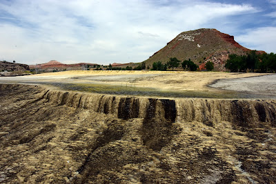
Thermopolis turned out to be a superb choice for lunch. On the north side of town, the first thing you lay eyes on as you approach is a giant park with a couple of swimming pools, oceans of green grass and forests of trees, and the most spectacular hot pools, of mineral-laden water that you can expect to see outside of Yellowstone Park.

Naturally, when the opportunity arose, we cranked the wheel over, exited Route 789, and rolled into the park entrance -- almost. The first thing we saw as we approached the park entrance is a railroad overpass that was exactly 12 feet above the tarmac. Now I'm pretty sure that our rig will clear that, but I was not willing to bet money on the fact. I put the rig in reverse and backed away from the entrance. It was at that point that Concetta saw the sign that said, "RVs use the park entrance two blocks south."

Well that was a relief. We did get to visit the beautiful park, but we didn't have to trust the guy who measured the overpass to be correct in his measurement. With that we drove the two blocks, rolled right on into the park, pulled into a parking area almost devoid of cars, and found a nice place under a tree for our lunch.

After lunch we set out to walk the hot pools and they were something to see for sure. Maybe not quite as incredible as Yellowstone Park, but not as crowded either. The park had erected a boardwalk all around the pools, and we walked for about forty-five minutes, getting a good buffeting by the wind, but feeling good about the fresh air, the wonderful scenery, and the peaceful nature of the setting. We even got to climb aboard a suspension bridge that spanned the Big Horn River, and walk to the other side, which afforded us a terrific view of the park.

Once our noon respite was over, we once again headed south and finished up in the town of Riverton that sported a Good Sam sanctioned camp. The camp turned out to be a tad down at the heels, but, incredibly, the laundry room here is without a doubt the largest and most well-appointed that we have yet seen. Will wonders never cease?

Tomorrow, I'd like to try seeing the auto collection that is purported to be housed here in Riverton. After that, I don't have a clue where we'll be tomorrow. Sometimes it's just better to be surprised. And if decide to take to the road and see what tomorrow brings, we wish you exciting destinations and memorable travels from the Davises, the Happy Wanderers.

Thursday, June 14, 2018

Day 35 - Buffalo to Worland, Wyoming - 90 Miles

Today I would like to make this blog about rocks. I don't know as much as I'd like to about rocks and today, just to tease me, they kept cropping up in the conversation. It's because in Wyoming the highway department has thoughtfully placed geologic road signs along many of it's rural highways to help you identify the rocks alongside which you are driving.

For instance, this morning as we were climbing to the top of Powder River Pass, 9,666 feet above sea level, we passed a sign just before the summit that announced that the rocks at the top were 3 billion years old. Evidently, these rocks called "Gneiss" are some of the oldest rocks on earth.

Naturally, I wondered how Gneiss is formed. I found this answer at https://www.reference.com:

"Gneiss is formed from the high-temperature metamorphism of existing igneous rocks, generally granite or diorite. The rocks that form gneiss are exposed to extreme pressures and temperatures of between 600 and 700 degrees Celsius. These temperatures cause the individual minerals to migrate, forming distinct bands through the rock."

"Gneiss does not have any particular mineral composition, and the term refers only to the banded texture. However, it only forms from igneous rocks and so tends to contain minerals not found in metamorphic rocks formed from sedimentary rock, such as marble. Despite the general appearance of banding, the distinct structures are elongated granular structures, so unlike schist, gneiss does not cleave along its bands."

"The processes that creates gneiss can recreate normal granite if carried on long enough, and gneiss can also form from gabbro or shale. Schist and quartzite may be formed alongside gneiss, along with other types of metamorphic rock formed from igneous rocks."

"Gneiss is very common and actually forms the majority of the Earth's lower crust, so any deep tunneling encounters gneiss. The oldest rocks yet found are gneiss, with the oldest dated to over 4 billion years old, older than most estimates of the beginnings of life on Earth."

Okay, with the 3 billion-year-old rocks at the very tippy top of the mountain you expect the rocks further down the mountain would steadily get older. But that's not what we experienced. As we descended from Powder River Pass the rocks appeared to get younger and younger as evidenced by the highway department informational signs. By the time we reached the valley floor, the last sign we passed said that the rocks were only 200 million years old. So what gives?

The answer is (sort of) simple: Between about 70 and 45 million years ago, this region was compressed by tectonic stresses. This thick block of Earth's crust popped up along thrust faults on its SW and NE sides, folding the younger rock layers underneath. This event is called the Laramide orogeny after the Laramie Mountains in Wyoming. The Bighorn Mountains are one of the largest structures formed at that time, along with the Wind River, Beartooth, Gros Ventre - Tetons, Uinta, and other mountains in the region.

Once upon a time in the 1970s I learned about this phenomena in a Western Nevada College geology class, but this is the first time I can remember seeing it in person. For me, it's pretty hard coming to terms with 3 billion year old rocks, let alone forces in the earth that could shove that layer of rock so hard that it upthrusts, squishes up against younger layers of rock, and then folds them back upon themselves.

Putting the geology aside for a moment, let's go back to the top of Powder River Pass where we had lunch today. Once we had parked at the roadside rest and Concetta had set about preparing lunch, I took the opportunity to wander around a bit. Of course I wanted to get photographs of the Gneiss since I hoped to write about it (photo top left), but I also wanted to get photos of the flora. At an altitude of 9,666 feet, I was immediately surprised to see so many alpine flowers. There were blue ones and red ones and yellow ones and white ones and they all appeared to be pretty robust.

I'm not sure I did them justice, but I had fun trying to include as many colors in one photo as I could. Evidently, noting the general health of the flower and plant life, the top of the world that we encountered at our lunch stop must provide just the right nutrients, water, and temperature for these plants to thrive. Considering it probably gets ten feet of snow and temperatures of minus forty, I'd say the little guys are pretty hardy.

TO BE CONTINUED.......

Wednesday, June 13, 2018

Day 34 - Sundance to Buffalo, Wyoming - 133 Miles

THE FATES DEAL A NEAR DISASTROUS BLOW TO THE HAPPY WANDERERS -- IN THE DARK NO LESS!!!

Today is a day NO ONE would ever want to write about. More accurately, today began yesterday when we pulled into camp in Sundance, Wyoming, and straightaway attempted to do some laundry. When we got our basket of dirty duds down to the official camp laundry room, we discovered that a gentleman who looked very much like Wild Bill Hickock, or Buffalo Bill Cody had usurped every single machine for what looked like eight or ten items. As far as I could see, there were about two items each in the four machines.

"Okay," we said to Mr. Hickock, "we'll be back when you're done." After setting Concetta's IPhone countdown clock for requisite twenty-five minutes, We climbed the stairs back to the camping area and trudged back to the rig, our laundry still in our possession.

When the alarm went off we retraced our steps back to the aforementioned laundry emporium only to find that Wild Bill had NOT only failed to reserve even one machine for us, he had seemingly welcomed members of his gang to come down and put their two or three items in every machine in order to have yet another monopoly on the minuscule number of washing machines. It was almost like the cattle ranchers hoarding all the water so the hated sheep herders would not be able to water their sheep.

At this point I was so irritated with the events as they were unfolding that Concetta and I decided to engage in a heated discussion on the efficacy of performing laundry duties at this particular point in time. This "discussion" carried on while I was typing last night's blog, as well as well into the evening hours. We managed to settle the matter just short of the time we had set aside for sleeping. The only problem was, what with all the negotiations going on, I had forgotten to retract the awning that I had earlier deployed in an effort to ward off the afternoon sun.

Okay, so I'd retracted the awning dozens of times and felt no particular trepidation about doing it in the dark. Opening the forward locker on the starboard side, I removed the "hook" by which the awning is pulled down and which is also useful for helping to ease the awning back into its storage position.

The first step you must perform when retracting the awning is to pull the arms back from whatever hyper extended position you might have employed after pulling it down from the top of the RV. Hyper extending the awning arms raises the elevation of the roller, which effectively allows the entry door to swing outward without contacting the underside of the awning.

Once I had lifted the release levers and slid the awning-arm extensions backwards into their resting position, it was time to perform the retraction process. I loosened the knurled nobs on each arm which accomplishes something that I've never quite figured out but which seems to need to be loosened whenever you play with the awning for any reason.

At that point I was ready to push the small knob located on the main roller mechanism drum that allows the whole ten-foot roller to either revolve one way or the other, depending on your desire. This mechanism works pretty much like a common window shade. Pull down and it stays. Flip the knob on the roller and it wants to retract. Almost foolproof. Almost.

It was at this point that the Fates decided that it was time to have some fun with me. I flipped the knob. Then, while holding the stay cord with one hand, I began to allow the awning to retract. At that point the pivoting mechanism made a terrible noise and broke and came loose from the side of the rig. This caused the awning to sag toward the rear of the coach and look dangerously close to falling completely off.

You may remember that at the beginning of this trip, the pivoting support mechanism that screws to the side of the rig had disintegrated, leaving us stranded in Oregon City until we had come up with a way to replace the ruined part. Well, this time the other half of the pivoting mechanism, the part that attaches to the pivoting arm itself also disintegrated. We were, as you might imagine, screwed. It was dark, it was late, and there was NO way I was going to be able to replace the part in the foreseeable future in the tiny town of Sundance, from whence the famous Sundance Kid had taken his nickname. More on that subject -- perhaps -- in another blog.

Okay, not to be deterred by a mere aluminum part malfunction, I decided that there must be a way to outwit the broken awning piece and "MacGiver" the connection soundly enough to get us to a RV repair facility somewhere down the road. It didn't sound reasonable, even to my ears, but I fully intended to give it a try before my head sought the pillow. I got a flashlight, and I got Concetta to hold it, and I set to work.

To regress a bit, not long ago when I had stopped to photograph some fetching piece of countryside, I found an extremely heavy-duty piece of wire about three feet long on the shoulder of the road. This wire looked an awful lot like a piece of white coat hanger, but the gauge of the wire was perhaps four or fives times heavier than standard coat hanger wire. Right then and there I decided that the wire might certainly come in handy, and I quickly added it to my "Possibles Locker."

Now, with the awning arm pivot broken and the awning arm left hanging for want of a pivot point, I was left with nowhere to attach anything to the side of the coach. The only thing left in place was the spring-loaded head that usually snaps over the pivot rod and holds the awning arm in place but not so tightly the awning arm can't lower into position. At length I decided that the head of this latch might just serve as my new point of attachment for the arm. I wouldn't be able to make it permanent, but I could "rest" a length of wire atop the latch, and perhaps I could persuade it to stay there.

And THIS is where my wonderful piece of heavy wire came into the picture. Thankfully, when the pivot mechanism broke off, it left the part of the bracket which still contained two 1/4 inch holes on the bottom of the arm. Now these holes where not used for lowering the awing arms in any way. They were meant to be a point of attachment if a person removed the awning arms from the side of the coach by lifting the latch on the coach side and then placing the arms in a vertical position at your camp site. I've never been sure why anyone would want to do this, except perhaps it would allow someone to use the handy holes provided on the ends of the arms to attach them to a heavy object on the ground, thus making the awning more permanent for long-term camping.

At any rate, with Concetta's help we rested the broken end of the awning arm against the old pivot point and threaded my very heavy duty found piece of wire from hole to hole, thus forming a sort of pivot wire in much the same way as the old roller rod pivot had served. This accomplished, we rested the new "pivot wire" atop the old hold-down latch, rather than beneath the latch where the old pivot rod would have been located. Once that was done, we could relax a bit since the awning arm was now supported, we took a fresh, new, and heretofore unused Bungie cord and hooked it around the remains of the old pivot piece and then hooked it into the hold-down bracket on the coach side. When all that was snug and tight we stood back to survey our work. It looked good and seemed to be functionally sound.

This morning, wanting to make doubly sure that one side of the awning would not suddenly part company with the RV while we sped down the Interstate at sixty miles an hour, I took a nylon cord and tied one end to the awning and then wrapped the other free end around the air conditioning unit atop the RV. That might not completely remove the possibility of equipment failure, but I was hoping it might give us some advanced warning.

And there you have it. We spent the whole rest of the day in various towns and cities between Sundance and Buffalo, Wyoming, letting our often unreliable GPS try to guide us to a reliable RV parts company, but we were completely unsuccessful until we arrived in Buffalo. In Buffalo we almost immediately found a likely parts source, fully on our own and without any help whatsoever from our crazy GPS. However, a visit with the young lady behind the counter soon revealed that no such part was locally available. Were we able to identify exactly the part number of said broken part, she might be able to order me one if we would hang around for a week or so.

I, of course, declined the clerk's offer. An inspection of our "MacGiver" repair revealed that it's holding, and most likely we'll just leave it alone and call it good until we get home. That opinion could change in a heartbeat, I am fully aware, but I have high hopes.

My best advice to anyone who intends to trust their fate to a used RV, that was largely built of the most light-weight materials possible, is to bring just about anything and everything you might need to make on-the-spot repairs. If you don't, I predict that you'll be stuck somewhere for quite awhile awaiting rescue. And never, ever walk past a nut, bolt, or screw on the ground without adding it to your possibles box. A found piece of heavy-duty wire saved our bacon last night and today, and I still have the unused portion in my toolkit. Someday I may need that sucker again, and I'll be very glad I have it.

And if you find yourself venturing into the wilderness to seek high times and even higher adventure, for goodness sake go prepared. And when you go, we wish you exciting destinations and memorable travels from the Davises, the Happy Wanderers.

Tuesday, June 12, 2018

Day 33 - Devil's Tower National Monument to Sundance Wyoming - 60 Miles

This morning we made a special point of hurrying through our morning routine so that we could go visit the Devil's Tower while the early-morning traffic was light. We hadn't planned on staying up there, as we had been told that there was limited parking for RVs. We realized that we might have to just make the circuit and return.

But when we got there, we found that only two RV-sized rigs had made the trip, and we were easily able to park in a nice spot close to the visitor center. Grabbing the camera, and locking up the rig, we decided to pay the visitor center a quick visit, then maybe walk just a bit up the trail to the foot of the tower. That way we could get a few photographs, then head on down the mountain and give someone else a chance at our parking spot.

That's not how it turned out. Once in the visitor center, we immediately saw that it contained some displays and some items for sale to which we might want to pay further attention. Not wanting to tote our purchases up the trail when we took our walk, we decided to return to the center when our walk was over.

We started up the trail, which, unlike most trails, had been blacktopped so that nearly anyone could navigate it from the parking lot to the base of the tower. The first thing that we noticed was that we were on the shady side of the tower, and it was nearly impossible to get decent photographs. So, naturally we kept circling southward around the base of the monolith until sunlight began to bath the huge structure in a rosy glow.

The more we walked, the more we experienced conditions for taking good photographs. Soon we found ourselves routinely snapping the shutter, then continuing to walk south and eastward around the base. Before long it dawned on us that somehow, and without discussion, we had both decided to just keep walking until we had made a complete circle and arrived back at the parking lot. It appeared that at least a few of the folks walking near us on the trail had also been caught up in the enthusiasm for seeing all sides of Devil's Tower, and many of them kept pace with us for much of the morning.

At one point someone near us pointed out that there were as many as five climbers on the face of the rock. Though we had some trouble seeing them at first, we soon picked them out and continued to watch their progress for awhile. We were surprised to see climbers as we had read in the visitor center that it is an unwritten rule that climbers would stay away from Devil's Tower in the month of June to respect Native American ceremonies near the rock that take place that month. We were told by a ranger at the visitor center that most days up to 45 climbers can be seen climbing the narrow crags toward the top.

Concetta and I discussed just what was so fabulous about our hike this morning, and we decided it was the almost complete lack of man-made noise. Nothing but the songs of birds, and whisper of the wind disturbed the forest quiet. Yes, the soft murmurs of conversation from the walkers and their companions were at times audible, but everyone seemed to respect the almost church-like atmosphere that we were all enjoying on this bright, but cool Tuesday morning in the Wyoming woods.

When we had been walking for what seemed like a very long time, I began to believe that we were probably getting close to completing our journey. That's when we came upon a sign that said, "Halfway Point." Since we hadn't originally planned on making a LONG walk, we hadn't gone to the trouble of breaking out the hiking boots. My tennis-shoe shod feet had been protesting already, and now I found that we were only halfway to our goal. Oh, well, we both decided to trek on and not think about the impropriety of our footwear.

Fortunately, the second half of the hike did not take as long as the first half because we didn't encounter good camera angles, or the nice light we had enjoyed on the southern exposure. As we grew nearer to the north side of the Tower, the monolith was actually in the shade again. But the lack of distractions gave us a chance to discuss forest management, and the way the groves of trees surrounding the Devil's Tower look so very different than the forests we remember from our youth.

Nowadays, burned sections are allowed to remain, as are fallen trees, dead snags, and other sort of "messy-looking" forest scenes that are, in reality, the mark of allowing nature to determine the look of the forest. Nowadays the Forest Service even starts fires to clean out the under-story of forest refuse. Seeing burned patches is normal. At first it's somewhat unsettling, as the mind sort of expects a more tidy look to National Forests. But the days of preventing damage of any kind to the forest is over now, and we all will in time get used to the new techniques.

Once we had hiked just under a mile, we finally arrived back at the visitor center. There we loaded up on gifts for the grandkids, a bit of reading material for me, and a brochure or three for route planning. Then we headed for the RV. While we were hiking, the parking lot had completely filled to overflowing and the RV parking, limited in length as it was, looked completely filled as well. We knew that dozens of cars and RVs would be traveling up to the base of the Tower to park their vehicles and walk the path around one of nature's great wonders, too. It was time for us to give up our spot and bid adieu to what turned out to be a favorite stop in our journeys around the western United States.

Once off the mountain, we jumped back on Route 24 and headed north and east toward the tiny town of Aladin. There we intended to turn south on Route 111 until it intersected Route 14 which paralleled Interstate 90. From that intersection it was a quick jaunt to the next point of interest we intended to visit, the Vore Buffalo Jump.

Before we made it to Vore, we stopped by the Wyoming visitor center that is conveniently located just two miles west of our destination. There we tarried long enough to have our lunch, then see what the center had to offer. The center turned out to be a worthwhile place to obtain all the information we needed to proceed, not only to Vore, but for our intended route toward Thermopolis, Wyoming, in the morning. There were just dozens of brochures, booklets, and maps available for travelers, and the attendants were extraordinarily attentive and knowledgeable. So, we loaded up on brochures for everything we might encounter tomorrow, and for the next few days, and then set out for our afternoon stop.

The Vore Buffalo Jump is a destination about which we've been talking for days. At this ancient site, Plains Indians would sometimes drive buffalo herds over cliffs in large numbers to make the process of hunting easier and more productive. After all, buffalo hunting with bows could be an iffy and extremely dangerous way to obtain this particular food. Still, as our guide pointed out today, a single buffalo might keep a single person in food for an entire winter season.

But I was a bit skeptical as we approached the Vore site. Nowhere could I see evidence of a cliff face in the grassy, gently-rolling terrain. Amazingly, we had only to park the RV and wander into the Vore ticket office and the secret was immediately revealed. Vore, named for family upon whose ranch the site was located, held a secret. The secret was that underneath the grassy fields the geologic strata was largely composed of gypsum, a sort of "weak sister" of calcium carbonate, or limestone. Nowadays we make sheetrock out of it for home building.

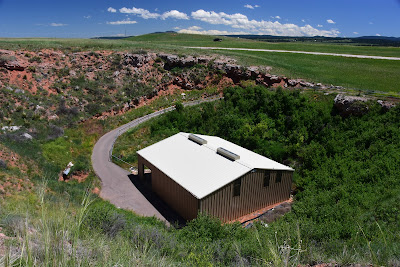
Many years ago the gypsum had come into contact with sufficient enough water to cause a section a couple of hundred feet in diameter to collapse and form what we describe today as a sinkhole. Presto! The Indians had a ready-made cliff face over which they could drive the buffalo. Over the centuries thousands of buffalo were killed in this fashion, and the animals were butchered right on the site.

Well, the story sounded terrific, and we only lacked a guide to get started on our tour of discovery to the bottom of the sinkhole and a world that we had never explored before. Stepping into this roll was a young high school graduate who was but a couple of weeks on the job. Bright, intelligent, and extremely friendly, Shelby took us under her wing and escorted us first to the information "tipi," then to the actual dig at the bottom of the sinkhole. We were prepared to be thrilled, and we definitely were NOT disappointed.

Shelby explained in depth each and every salient fact about the archeological dig, while I tried to capture as much of the surrounding visual aids as I could photograph in the rather poor light of the tipi. Still, I think we got the gist of what she was trying to tells us. Once she had given us the background, we headed down the corkscrew path toward the floor of the sinkhole.

The hole had been discovered by the Wyoming Highway Department when they were planning the route for Interstate 90 back in 1971. The Vore family had been using the "big hole" for their personal dump site for many years at that point, and had added about four feet of rubbish in the bottom of the hole. The Highway Department decided that they needed to know how stable the sinkhole would be should it end up in the highway right-of-way. But when they took a core sample they came up with not only the Vore Family garbage, but pieces of ancient buffalo bones as well.

Of course at this point the archaeologists were called in, the highway right-of-way was permanently moved 150 feet to the south, and a bulldozer went to work removing the top layer of refuse. After that, archeologists went to work on what has been described as "One of the most important archaeological sites of the Late-Prehistoric Plains Indians."

It turned out that the site had been in use from about 1550 to about 1800. Hernan Cortez brought a little over a dozen horses to America in 1519, and later explorers brought more. By the seventeenth century there were large horse herds in the Americans. Still, these particular Indians seem to have been still afoot when they tricked their quarry into running over the cliff. The evidence for this is the existence of rock formations called cairns that were put in place by the natives in an inverted V-formation to help guide the beasts to the cliff edge.

Shelby told us that these animals were not the smartest and had poor eyesight. So, the animals at the "front" of the herd had to be gently persuaded to head in the correct direction by Indians in animal skins in order not to alarm the herd. Once the lead animals were nearing the edge, other Indians would suddenly create a disturbance at the rear of the herd, which caused the panicked trailing animals to push forward in the direction the herd had already been moving. Once this happened, the animals in front were literally pushed over the edge and into the trap by the animals in the rear. According to Shelby, without the help of the trailing animals, the whole scheme would fall apart.

And there you have it. When the archeologists finished their exploratory trenches in 1972, they had reached a depth of fifteen feet below the surface of the sinkhole. The estimate of how many animals lay in the sinkhole runs around 20,000. According to Wikipedia: "In 1982 the site was transferred to the University by the Vore family with the stipulation that it be developed as a public-education center within twelve years. Funding limitations prevented development, so the site was again transferred to the Vore Buffalo Jump Foundation, which has built a small interpretive center and provides interpretive services. The Vore site is located in a narrow strip of land between I-90 and old US 14. The site was placed on the National Register of Historic Places in 1973."

Concetta and I were especially impressed with our history-loving guide, Shelby. Her enthusiasm definitely enhanced our experience, perhaps because she reminded us so much of our own enthusiasm for history. Considering that she had only been on the job for two and a half weeks, she knew her material cold and she could answer all of our questions without hesitation. After the tour was over, she told us that even though she loves history and geology more than anything, she has decided to be conservative. When she attends college in the fall, she will be pursing a degree in the field of Business Administration. She hopes to make enough money in that field to pursue her first loves of history and geology in her free time.

And that's it for today's adventures. Tomorrow we'll be headed west again with eye toward later dropping south toward Thermopolis, Wyoming in a few days. Until then, we wish you exciting destinations and memorable travels from the Davises, the Happy Wanderers.

Monday, June 11, 2018

Day 32 - Buffalo to Devils Tower, Wyoming - 130 Miles

We didn't have much on our plate today as we broke camp in Buffalo, Wyoming, and traveled the few blocks to the Interstate 90 on-ramp going east. Last night we had discussed taking Interstate 90 to Gillette, but we hadn't really decided on something to see there. But when we had driven the 50 odd miles to Gillete and saw a sign on the interstate for something called the, "Rockpile Museum," just the cleverness of the name captured our attention. I said to Concetta, "let's just pull in at the museum, and then consult the map and brochures to see if we want to see anything else here in Gillete."

Concetta agreed, so that's what we did. The parking lot was a tad small for a 32-foot RV, but we pulled in next to the building so we wouldn't block the entrance. Then we made sure that there was plenty of room to back up into the adjacent front yard of the nearby museum annex. Since there were no marked parking spaces in front of the annex, we figured that cars would not end up behind us and block our exit. Later, when the lot had filled and even two more RVs (smaller) had come in as well, we were still able to get out.

For a few minutes we sat at the RV banquette and poured over our literature and maps looking to see what might be interesting for us to track down in Gillete. But in the end, we decided to go with the bird in the hand, and we locked up the rig and made for the museum's front door.

Once inside, we were immediately greeted by a super friendly museum docent who explained the house protocols, the location of the various types of exhibits, and told us what we could expect to find in the annex. To my question about an entrance fee, the nice lady announced that there would be no charge as they operated solely on donations. I dropped a ten-spot in the donation box, and then Concetta and I plunged into the exhibits using the docent's proffered maps as a guide.

If you spend any time at all in museum settings you know that you encounter all levels of exhibit quality. Sometimes a museum will try to put everything they own on display, though the actual descriptions of what you are seeing may be absent or of dubious value. Sometimes there are just too many item descriptions and you grow weary of reading everything and can't retain it all anyway. At the Rockpile Museum they had hit upon a wonderful plan to have numerous small alcoves devoted to one subject and one subject only. Whether it was quilting, WWII photography, handmade saddles, or women's millinery items, there was an alcove for each one. Even more delightful, the museum staff had left plenty of floor space between the alcoves. This last is important because it allows you to rest your eyes before tackling another subject.

Something else I discovered about the Rock Pile Museum's techniques is enhanced selectivity. Since all of the alcoves were like islands in a stream, you could easily sail right on by an alcove that discussed, for instance, well-known local restaurants, past Presidents of the Lions Club, or other subjects which would interest local residents, but not you.

This technique allowed me (I had lost Concetta by then) to move through the museum more quickly by skipping things for which I had no particular interest. This technique allowed me twice as much time to focus on the things that I did find interesting. My areas of study tend to center on transportation subjects, so this morning I could be found photographing the undercarriage of a freight wagon, walking through a Burlington Northern caboose, or doing closeups of farm implements.

Concetta and I did tour some parts of the museum together. We were both fascinated by the sheepherder's wagon. Though we had seen such early camp outfits in the past, today was the first time ever we've been able to look inside such living quarters and photograph what we saw there.

We also toured the museum annex together as the interior was a reconstruction of a city street. Lining both sides of the street was a blacksmith's shop, a printing shop, a saloon, a miner's cabin, and an automobile garage. In addition, there was a beautiful Model TT truck on the street along with more examples of sheephearder abodes. All of the displays were nicely done, and we enjoyed our experience in the annex.

I should point out that the Rockpile Museum has made quite extensive use of the new museum technique of inviting patrons to "touch" or "experience" certain exhibits. As Concetta and I travel around the country, we've begun to see greater incidence of this technique as museums everywhere try to combat declining attendance. This may ultimately prove the best way to entice younger generations through the door.

With our museum experience over for the morning, we sat down to a nice lunch right there in the museum parking lot. After that, we followed the signs back to the Interstate 90 on-ramp and sailed right back onto the freeway headed still further east toward Moorcroft. At Moorcroft we hoped to gas up the rig, then head north on Route 14 until we discovered the location of the famous (or infamous) Devil's Tower.

You may remember Devil's Tower for its prominent appearance in Steven Spielberg's 1977 movie with Richard Dreyfus and Teri Garr, "Close Encounters of the Third Kind." Yes, that same huge hunk of black rock, more properly referred to as the solidified inner core of a long-extinct volcano. Over the eons of time, the surrounding country rock, into which the volcanic magma once intruded, has eroded away leaving only the much tougher core still standing.

Personally, I only watched "Close Encounters of the Third Kind" one time and I was never all that impressed with the whole extraterrestrials concept, nor did I ever think that a specific sojourn to this spot on the map was worth my time. But now that I'm here, my enthusiasm is mounting. I have already scored the obligatory t-shirt depicting Devil's Tower and the impossibly small of stature gray aliens. I have shot the tower from several angles today and will shoot a few more in the morning when the sun is from the east and more effectively lighting the monolith. And I've even kicked around the idea of hiking up to the base of said monolith. The latter I may have to forgo because of my knee which has been acting up for the past few days. Perhaps the knee knew about this impulse visit before I did.

However, if we can get out of camp early enough tomorrow, we might be able to drive into the National Monument, up to the tower, and return before the hoards of tourists descend on the place. I was told in confidence this happens around 11:00 a.m. Otherwise, I may have to be satisfied with my colorful t-shirt, and a handful of long-distance photographs.

But the KOA camp here just outside the National Monument gate is pretty darn nice, though somewhat expensive at over sixty dollars. I guess the tourist season must be short here in Wyoming, so those profits must be made quickly. Still, the place has lots of room between campsites, level spots, tons of tenting space, a wildlife "hay ride," acres of grass, a swimming pool, and they show "Close Encounters of the Third Kind" each and every night for those who were far too young to see it when it came out.

Though I would probably shrink from advising you to drive all the way to northern Wyoming to visit this black monolith, I WOULD advise you to come for the scenery. Concetta and I have been in awe of the beauty of the green rolling meadows between the craggy hills, the plethora of wildflowers, and the relatively vacant highways up here. So, if you have the $62.00 bucks to stay overnight, I'd certainly say go ahead and make the trip. AND, as I personally experienced, the ice cream at the trading post across the street from the KOA is pretty darn good, though refrigerated so thoroughly that the plastic spoon was hard pressed to dig into it. I persevered, however, and so should you.

And if you do make the trek to see where space aliens will someday return to indulge in more close encounters, we wish you exciting destinations and memorable travels from the Davises, the Happy Wanderers.

Sunday, June 10, 2018

Day 31 - Ranchester to Buffalo, Wyoming - 51 Miles

Well, we didn't get to Gillette this afternoon, and it's because history got in the way yet again. All we had to do was stay on the surprisingly lightly-traveled Interstate 90 East from Ranchester and we would have ended up with about twice as many miles on the ol' odometer. Though I knew we would be cruising by a couple of historic sites, I had decided to hold our course and make Gillette by cocktail hour.

But then came one of those ubiquitous brown signs announcing that the turnoff to the Fort Kearny historic site was coming up soon, and the site itself was a mere 3 miles off the Interstate. I gritted my teeth but said nothing. There is little in this world that interests me more than a frontier army post, especially this particular frontier army post that I first read about and studied back when I was about 15 years old.

It has always been my intention to see the site someday (the actual fort was destroyed by Indians more than a century ago), but I never quite landed in this neck of the woods until now. Still, Concetta and I had whiled away the entire morning touring the "End of the Trail" historic home in Sheridan, Wyoming, and I fully intended to use the afternoon to make at least a hundred miles or so.

I could see the exit for Fort Kearny in the distance and it was getting closer. I was thinking about all the pros and cons of taking the exit and filling up the rest of the day with history stuff, when Concetta said, "Why don't we go to Fort Kearny. You've been talking about it for a couple of days, and you probably need to go see it."

There it was, the tacit approval. And yet I tried to explain why we probably needed to try and make Gillette before 3:00 p.m. since we hadn't made hardly any miles today. But Concetta persistented. "I think we should go," she said. "There's the turnoff now."

And so off we went in search of still more adventure amidst the verdant, rolling pastures of northern Wyoming where once upon a time millions of buffalo roamed. We did have a bit of trouble at first, if you can call missing a turnoff sign and ending up seven miles further away than we should have gone. No matter, once we had reversed our direction, we saw the sign the second time around, and rolled up the dirt access road and into history.

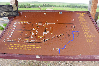
The history, as it is explained in the Fort's brochure, goes like this: "[The Fort] was named for a popular Union general Kearny killed in the Civil War. Fort Phil Kearny was established at the forks of Big and Little Piney Creeks by Col. Henry B. Carrington, of the 18th U.S. Infantry, in July, 1866."

"The mission of the Fort and two other posts along the Bozeman Trail, Forts Reno and C. F. Smith, was three-fold: to protect travelers on the trail; to prevent intertribal warfare between Native Americans in the area; and to draw the attention of Indian forces opposed to Euro-American westward expansion away from the transcontinental railroad under construction in southern Wyoming."

"All three Bozeman Trail forts were stockade fortifications, with Fort Phil Kearney being the largest. Enclosing 17 acres, the fort wall was 8 feet high, 1,496 feet in length, and tapered in width from 600 feet on the north to 240 feet on the south. More than 4,000 logs were used to erect the stockade. Over 606,000 feet of lumber and 130,000 bricks were produced in 1867 alone for the extensive construction of Fort buildings."

"During its two-year existence, Fort Phil Kearney was the focal point of a violent war between the U. S. Army and the Sioux, Cheyenne, and Arapaho Indians opposed to intrusions into the last great hunting grounds on the Northern Plains."

"By 1868, the Union Pacific Railroad had reached a point to the west where travelers could bypass the Bozeman Trail forts' expensive liabilities. In the treaty of 1868, the United States agreed to close the forts and the trail. Fort Phil Kearny was abandoned by the Army in early August 1868, and burned soon afterwards by the Cheyenne."

So, you ask, if the Fort was only around for a two-year period, what makes it so special? The reason the vanished fort, the new interpretive site, as well as the surrounding landscape and hills are so important is because of one momentous event that took place in 1866. Here are the facts as related by an informational sign in the interpretive center:

"The Battle of 100 Hands (otherwise known as the Fetterman massacre) climaxed a classic Indian ruse. On December 21st, 1866, Captain Fetterman led 81 infantry and cavalrymen to repel an attack on the Fort's wood-cutting detail. Taunted by a few mounted warriors, Fetterman allegedly disobeyed orders and chased the Indians over Lodge Trail Ridge -- directly into the weapons of 2,000 Sioux, Cheyenne, and Arapahoes. The trap snapped shut on the scattered troops, and forty minutes later all the soldiers were dead."

This massacre is an important milestone in the history of plains warfare between the Native Americans and the U.S. Army because it marks the first time that Indians used the technique of presenting an inferior force to the army in hopes of luring them into a trap. This particular defeat was regarded as the biggest loss of life for western army troops to that date. Not until General Custer rode into a similar trap just under a decade later, would the loss of life be surpassed.

I knew this story from having read about it in my teens. Still, I was interested in seeing the site, even though I knew that nothing remains of the original fort structures. But aside from my curiosity about the actual look and feel of the location and its proximity to the ridge line over which the ill-fated Fetterman troopers rode into the trap and died, I had yet another motive for deciding to follow Concetta's advice and see the interpretive center.

Ever since I discovered that my two-times great grandfather had been a teamster, both before coming west to Utah in 1853 to be with his Mormon relatives, and later when he arrived in what would be his home in Springville, Utah, I wanted to learn more about teamsters in the old west. This, it turns out, is an extremely difficult subject on which to find any material at all. So, if I can find no hugely compelling reason for visiting a museum or interpretive center, the potential for the site's having a book collection is sufficient to motivate me.

Alas, most of the Fort Kearny Interpretive site's book collection revolved around Indians and soldiers, as I might have guessed. I did purchase the book, "Hardtack & Coffee," by Billings, to bone up a bit more on my knowledge about life in the frontier army. But my quest for books on freighting and teamsters was in vain.

But serendipity being what it is in my life, I was intrigued to see that the Interpretive Center had a Springfield armory Civil War rifle on display. The rifle was no longer a muzzle-loader. It had been altered into a "trapdoor" model that was intended to accept breach-loading cartridges. My interest was immediately peaked when I learned that the rifle was being raffled off, the drawing to take place in my birth month of December. How could I turn down such an opportunity? Well, I couldn't. I bought five tickets.

So, it would appear that fate meant for me to come to the Fort Kearny site today for a number of reasons, all of which I enjoyed immensely. I got to see the fort's location, as well as the fateful ridge over which Captain Fetterman took his last ride. I got to walk the fort's grounds (in the rain it would turn out) and try to visualize how it had been situated. And I got to buy raffle tickets for a weapon I'd just truly love to own. I'm thinking we made the right decision.

Now, I haven't even ventured into the story of our morning activity, which was a visit to the "End of Trail" house and grounds in Sheridan, Wyoming. Usually, Concetta and I quickly grow tired of visiting historic houses for their tendency to be pretty repetitive. But today, the two of us were just bowled over with the experience. The house was magnificent, inside and out. The rooms were meticulously decorated with original family furniture and possessions. And the unique nature of many of the rooms compelled us to read virtually all the explanatory cards, view all the portraits and photographs, and take pictures of nearly everything.

From their house pamphlet we learned that: "Construction began on "End of Trail" in 1908. After it was finished in 1913, the family had only a short time to enjoy their new home. John Kendrick was elected Governor of Wyoming in 1914 and the family moved to Cheyenne. Two years later, he was chosen to serve in the United States Senate. Until his death in 1933, Trail End was used primarily as a summer home."

"From 1933 to 1961, Eula Kendrick (the wife) lived at "End of Trail" with Manville (the son) and his family. After Eula's death, the other family members moved out, and the house stood empty for seven years. In 1968, when it was about to be torn down, the Sheridan County Historical Society purchased the house and grounds. They opened the home to the pubic as a community museum. Ownership was transferred to the State of Wyoming in 1982."

When I think that this absolutely gorgeous house might have been torn down it nearly makes me physically ill. Architecturally, artistically, and physically, the house is a masterpiece. And the interior woodwork, furniture, and accessories are treasures beyond description.

Further, back in 1913, when a normal house cost about $4,000 to build, "End of Trail" cost $164,000. The house contains limestone from Indiana, roofing tile from Missouri, brick from Kansas, granite from Montana, woodwork from Michigan, window screens from Maine, stained glass from New York, and marble from Vermont. The architect was Glenn Charles McAlister of Billings, Montana.

In short, the house is a fantastic place to visit, and the entrance cost is minuscule. I urge everyone who comes to Wyoming to visit and help support this lovely house and its upkeep by paying your entrance fee and taking the tour.

Now, if you're still reading, one final word about how "End of Trail" got its name, which I learned from the museum's brochure: "John B. Kendrick (1857-1933), former Governor of Wyoming and United States Senator, was born in Texas. He was unfortunately orphaned at an early age and raised by relatives until he went out on his own at age fifteen. He came to Wyoming Territory for the first time in 1879 as a trail rider on a cattle drive. Kendrick took the money he earned and invested it in land, an investment that would grow and later become the OW Ranch in southwestern Montana."

"Kendrick would marry in 1891, and later raise a son and daughter on the ranch. The ranch was the start of what would become the Kendrick Cattle Company, a 210,000-acre collection of cattle ranches in northern Wyoming and southern Montana. Not until 1989 would the ranch lands be sold by the family." Kendrick's story is, as you can see, one of true rags to riches.

And that dear reader is our adventures for the day. Since we didn't get to Gillette this afternoon, we are at present enjoying a very nice camp in the town of Buffalo, where no less than THREE camps are to be found. But this one was recommended by Damion, the State Parks guy who sold me the Springfield Rifle raffle tickets. They tell me that an ice cream social is being held here tonight so we obviously came to the right place.

And if YOU are getting ready to hit the road and tour the many fascinating backroads to our country's hundreds of wonderful historic sites, we wish you exciting destinations and memorable travels from the Davises, the Happy Wanderers.