Saturday, April 30, 2016

Day 23 -- Taking a day of rest in Onawa, Iowa -- 0 Miles

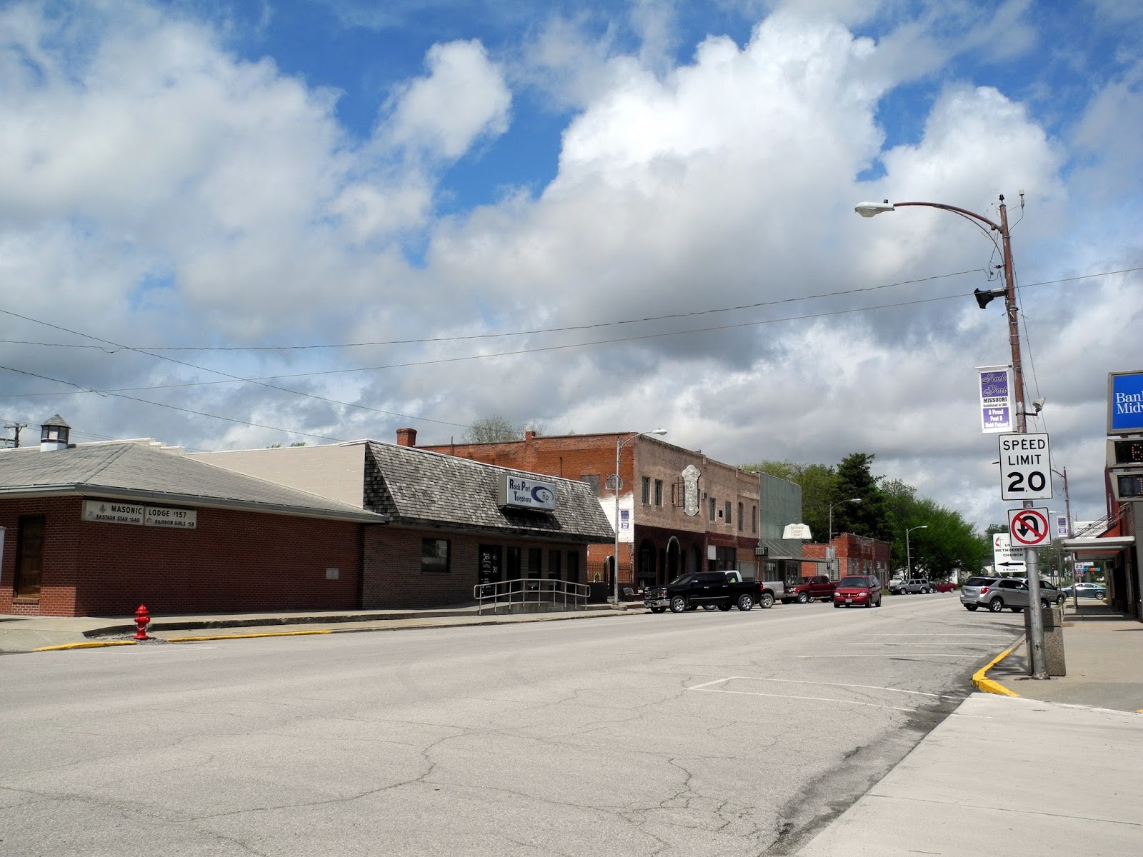
Today we didn't go anywhere, mostly because it was raining so ferociously when we woke up, that we came to the conclusion that maybe it would be good day for some reading and writing and studying. Personally, I am glad we took the day off because I made a major discovery in my research on my 2-times great grandfather, John Daley. After several hours of searching the web I discovered where his wife had posted a letter to her brother from St. Joseph, Missouri, in 1852. So, it would appear that they had moved the seventy miles south from Atchison County, Missouri, after 1850 and taken up residence in the thriving city of St. Joe.

Anyway, genealogy aside, I don't have any exciting destinations to write about today so I thought I'd look back over the photos I've taken so far to see if an interesting subject would present itself, and I think one has. What I've decided to do is select a few of my photos and perhaps acquaint you with what I know (or can find out) about the history connected with that object.

In the photo left we have a glass insulator, commonly used to firmly hold electrical wiring to telephone pole cross-arms high above us, mostly to keep us from being electrocuted, but also to keep the electricity from losing some of its charge by discharging into the poles and cross-arms. For more information on this once ubiquitous fixture atop nearly every neighborhood pole, I found the following site: http://www.glassbottlemarks.com/glass-insulator-manufacturers/

"As time went on, networks of “open wire” telegraph lines, and later, telephone lines, were developed and built throughout the country, and these lines required the installation of insulators. Insulators were necessary by serving as a medium for attaching the wires to the poles, but much more importantly, they were required to help prevent electric current loss during transmission. The material, glass, is itself an insulator (not a “conductor” or “transformer” as insulators are often incorrectly labeled in antique malls and flea markets)."

"Both glass and porcelain insulators have been used since the early days of the telegraph, but glass insulators were generally less expensive than porcelain, and were normally used for lower-voltage applications. The oldest glass insulators date from about 1846."

The period from 1875 to 1930 might generally be thought of as the “heyday” of the glass insulator. Hundreds of millions of these glass “bells” were produced during this time by many glasshouses, located primarily in the East and Midwest with a few plants in California and Colorado. Many of the glasshouses that made insulators also produced bottles and other glassware."

"Most insulators are found in some shade of blue-green/aqua-colored glass (typical cheap “bottle glass” or “green glass”) but many, many other color shades are found. Clear glass was used (with some exceptions) primarily after about 1935. Hundreds of different styles were developed, and insulators are found with a wide variety of embossed names, patent dates, and other markings. Many earlier insulators have bubbles, streaking, “snow”, surface creases and other marks of crudeness which was common for this type of glass because quality standards were not usually set as high as tableware. As long as the insulator performed it’s duty adequately, the color and minor imperfections in the glass were of little concern. These “marks of crudeness and age” now add to their value and charm, to collectors of antique insulators."

Like every other history nut who loves antique anything, I have a few of these "treasures" myself. I especially like the ones with bubbles as they just look older. Though you don't see them much anymore, once in a while you'll be off in the woods and run across an abandoned line of poles, and up there just out of reach you'll see an insulator, just waiting for you to be clever enough to get it down.

The next historic subject I want to explore has long ago been forgotten, but once upon a time it was a crucial piece of rural Americana. It was called the "Spring House." I found the following on Wiki:

A spring house, or springhouse, is a small building, usually of a single room, constructed over a spring. While the original purpose of a springhouse was to keep the spring water clean by excluding fallen leaves, animals, etc., the enclosing structure was also used for refrigeration before the advent of ice delivery and, later, electric refrigeration.

The water of the spring maintains a constant cool temperature inside the spring house throughout the year. Food that would otherwise spoil, such as meat, fruit, or dairy products, could be kept there, safe from animal depredations as well.

In settings where no natural spring is available, another source of natural running water, such as a small creek or diverted portion of a larger creek, might be used.

In the accompanying photograph we see a spring house that was actually fed via a well, with a windmill serving as the motive power to pull water from the ground and cycle it through the stone basin you see here. Though I don't know for sure, I suspect that the overflow exit that you see was then channeled to a vegetable garden or similar use. This allowed the farmer or homesteader to utilize the coldest water for "refrigeration" of his perishable foods and then somewhat warmer water would cycle out and onto the garden plants.

As you can see the stone basin actually has to separate compartments, one for the larger milk cans and one for smaller items such as a quart of something that needed to be kept cold.

Unfortunately, I didn't get a photograph of the outside of the Spring House (in this case more properly a "Well House,"), but it was simply a ten foot by 12 foot stone building that would do a good job maintaining a constant cool temperature throughout the summer.

The next item I want to discuss is that most famous of fixtures on an old west cattle drive, the chuckwagon. One source I found said that "The invention of the American chuckwagon is credited to cattleman Charles Goodnight. In 1866, Charles needed a way to keep his drovers fed as they trailed cattle from Texas to the North. A true product of "necessity breeds creativity", Goodnight bolted a wooden box to the back of an Army Studebaker wagon and added compartments to store utensils, bedding, food, and more. The rest, they say, is history.

The term "chuck" is from 17th Century England used by meat merchants who referred to their lower priced goods. By the 18th Century, "chuck" was colloquial for good, heart-warming food. So it is no surprise that Goodnight's invention became known as a "chuckwagon". His simple creativity revolutionized the cattle industry and is now celebrated as the official vehicle of Texas."

As I was putting this piece together it got me to wondering just how many TV westerns and movies showed the cattle stampede, the mad dash of the out-of-control chuckwagon, and the resultant strewing of cooking gear, food, and other necessities all over the prairie floor -- usually in the middle of the night. If I'm not mistaken one of my favorite movies, "City Slickers," did just that.

Here's some more info on the chuck wagon: "Chuckwagon food was comprised of black-eyed peas, beans, corn and cabbage. Of course, there was lots of beef and bison steaks and stews spiced with chilies, garlic, and onion or the occasional catfish or shrimp caught from the rivers, lakes or coastal waters. Sourdough breads (sourdough bullets), quick biscuits, skillet corn bread and cowboy coffee were served with the meals."

Wait a minute! There had to be bacon, didn't there? There's always bacon! Anyway, we read on.....

"The chuckwagon was drawn by oxen or mules. The wagon usually carried food, eating utensils, a water barrel, as well as tools and bed rolls, all tucked away in drawers and shelves and covered by a canvas covering. A hinged counter that folded out was used for chopping and preparing the food."

"The inventor of the chuckwagon, Charles Goodnight was born with the Texas Revolution, came to the state from Missouri the year Texas entered statehood, and, later, with a handful of men, invented the American ranching industry AND the chuckwagon."

Here's something else we have encountered on our travels, a Regina pneumatic, hand-operated vacuum cleaner circa 1910. Here's what I learned about the invention of the vacuum cleaner while sitting "home" on this rainy day:

"In 1860 a carpet sweeper was invented by Daniel Hess of West Union, Iowa that gathered dust with a rotating brush and a bellows for generating suction. Another early model (1869) was the "Whirlwind", invented in Chicago in 1868 by Ives W. McGaffey. The bulky device worked with a belt driven fan cranked by hand that made it awkward to operate, although it was commercially marketed with mixed success. A similar model was constructed by Melville R. Bissell of Grand Rapids, Michigan in 1876. The company later added portable vacuum cleaners to its line of cleaning tools."

"The next improvement came in 1898, when John S. Thurman of St. Louis, Missouri, submitted a patent (US No. 634,042) for a "pneumatic carpet renovator." This was a gasoline powered cleaner although the dust was blown into a receptacle rather than being sucked in, as in the machine now used. In a newspaper advertisement from the St. Louis Dispatch, Thurman offered his invention of the horse-drawn (which went door to door) motorized cleaning system in St. Louis. He offered cleaning services at $4 per visit. By 1906 Thurman was offering built-in central cleaning systems that used compressed air, yet featured no dust collection. In later patent litigation, Judge Augustus Hand ruled that Thurman "does not appear to have attempted to design a vacuum cleaner, or to have understood the process of vacuum cleaning."

"The motorized vacuum cleaner was invented by Hubert Cecil Booth of England in 1901. And The first vacuum-cleaning device to be portable and marketed at the domestic market was built in 1905 by Walter Griffiths, a manufacturer in Birmingham, England. His Griffith's Improved Vacuum Apparatus for Removing Dust from Carpets resembled modern-day cleaners – it was portable, easy to store, and powered by "any one person (such as the ordinary domestic servant)", who would have the task of compressing a bellows-like contraption to suck up dust through a removable, flexible pipe, to which a variety of shaped nozzles could be attached."

There was James B. Kirby who developed his first of many vacuums called the "Domestic Cyclone" in 1906. There was department store janitor, James Murray Spangler, of Canton, Ohio who invented the first portable electric vacuum cleaner in 1907. Spangler sold his patent to William Henry Hoover, which is a name I'm sure you'll all recognize. The list of inventors of machines and components is very long.

The Regina company who made the hand-operated vacuum pictured here started out in the music box business. When Tom Edison's invention of the photograph cut too drastically into their profits, the company began making vacuums. Just for fun I've included an Regina ad from around the same time as our example machine.

Naturally, there's a great deal more to this story then I can comfortably tell here. Innovations continue to be made to the old "dirt-sucking" gadget all the way up to modern times. If you've got a ancient vacuum in your attic, better drag it out and look at the date. You might have a real treasure.

Friday, April 29, 2016

Day 22 -- Pappillion, Nebraska to Onawa, Iowa -- 75 Miles

To quote a guidebook that we picked up today, "In 1839, Joseph Smith and his faithful fled Missouri, whose governor had ordered the Mormons to leave or be exterminated. They [subsequently] found refuge in Illinois, where an advance group of Latter-day Saints had prepared a new town site. There, in a horseshoe bend of the Mississippi River, they built the settlement of Nauvoo, meaning 'The Beautiful Place,' and began work on a stately limestone temple."

By then my three-times great grandfather, Moses Daley, had been a Mormon for the past eight years and had risen high enough in the church to have been appointed a Branch President while the church was centered in Ohio. He was also entrusted with the job of purchasing property for the church.

On March 31, 1836, Moses was ordained a high priest. Then, in 1838, Moses and his family moved to Missouri and settled at Adam-ondi-Ahman, Daviess County. It was there that the Prophet Joseph Smith and [his brother] Hyrum Smith, among others, stayed at Moses’ home at least once while laboring for the Church and surveying the property there [in Missouri].

Then, with the 1839 expulsion from Missouri, Moses with his wife, Almira, and several children began what turns out to be nearly two decades of privation and constant moving until the family finally settles in San Bernardino, California, where the Mormons had established a colony in 1851.

The task for me has been to figure out just where Moses and the various family members were located in space and time between their settling in Nauvoo, Illinois, in the early 1840s, until their trek down the Old Spanish Trail (northern branch) from Salt Lake City to San Bernardino in the mid to later 1850s. The tale involves everything from plural marriage to murder, and from conspiracy to mysterious vanishings and death. This branch of the Davis family tree is not boring, but it is hard to fathom, that's for sure.

The Mormon stay in Illinois lasts just long enough for them to craft beautiful farms and houses for themselves, as well as a huge and impressive limestone temple, when the old rancor between the Church and the surrounding non-Mormons to once again lead to trouble in 1844. But this time the trouble leads to the deaths of Church head, Joseph Smith, and his brother Hyrum. Things quiet down for a time, but in 1845 trouble flares again and outsiders succeed in burning 100 Mormon homes and several farms.

At this point the Mormons know the end of any hope of a peaceful existence is once again upon them. Throughout the winter of 1845/1846 they struggle to complete their masterpiece temple even tough they know they will not be around to enjoy or make use of it. In the interim they work quietly at constructing sturdy wagons and organizing themselves into wagon train companies.

Unfortunately, before the winter months of early 1846 had had a chance to slide gently into spring so that the companies could depart Nauvoo in good traveling weather, rumors of a potential attack on the new head of the Church, Brigham Young, forced the Mormons to move up their departure date plans. Many were not nearly ready, but the first wagon train of westward-bound immigrants left Nauvoo on February 4, 1846. The weather was so cold that February that the Mississippi River froze hard enough for wagons to drive across instead of having to be ferried. Some 500 wagons escaped Nauvoo, and, along with Church head, Brigham Young, began their trek westward on March 1, 1846.

Of course, there were still as many as 17,000 Mormons left behind in Nauvoo. Those remaining church members planned to leave in waves throughout the spring and summer assuming that the surrounding non-Mormon population would leave them alone that long.

But what of my 3-times great grandfather, Moses Daley? Where does he figure into all of this? Well, the record states that "he resettled in Big Neck Prairie, Adams County, Illinois, about 49 miles south of Nauvoo." after being kicked out of Missouri. Unfortunately, I don't find any evidence of Moses in the 1840 census for that area of Illinois. Also in the record is this reference from The story of the John Daley Jr. family, westward pioneers by James D. Martin: "Moses and his wife, Almira, both received their Endowments in the Nauvoo Temple on February 3, 1846 before they left to cross Iowa with the 15,000 Mormons who began leaving on February 13th." So it would appear that they had left Big Neck Prairie by 1846 to take part in the Mormon migration out of Illinois.

And I found this in the record: "Moses and Almira [Daley], and their children who came with them, stayed at Winter Quarters from 1847 to 1849. In the 3 December 1847 entry of the “Journal History of the Church” we find: “A brother Daley was living at Block House Branch, 9 miles up the river from Winter Quarters on the Iowa side of the river." So we know that they made it all the way across Iowa and were temporarily resettled, not at Winter Quarters, but just across the river in Iowa.

One might question whether the "brother Daley" mentioned in the above paragraph was actually my 3-times great grandfather, but then the record further states that "On 10 July 1849, Moses (about 53 years old), Almira, their son Edward, son Moses Jr., and daughter Samantha Ann left to go to Salt Lake in the Silas Richards Company." Well, that's my Moses alright. Can't be anybody else.

So now we encounter a new mystery. At the time that Moses supposedly moved from Nauvoo, and out across the Iowa plains, his two eldest sons "stayed behind." The younger of the two brothers who stayed behind, Stephen Daley, took the opportunity to marry Favoretta Marie Clark in Hancock County, Illinois, on 8 January, 1846, just prior to when the first wagon train was due to leave from the west bank of the Mississippi near Nauvoo. Nauvoo, of course, is located in Hancock County. There is no mention in the record of the newly-married Daley couple actually leaving with the first wagon train bound for Nebraska, which you would expect since he supposedly "stayed behind."

Now comes a really weird part. The record states that Stephen Daley dies on August 15th, 1847, just a year and a half after he married Favoretta. Okay, maybe he and Favoretta actually DID go along with the wagon train and he died on the trail. And for awhile I entertained this possibility. But then some lucky searching in the census record for 1850 in, of all places, Atchison County, Missouri, turned up Favoretta living with Stephen's older brother, John -- my 2-times great grandfather -- and John's wife Eliza (Fisher) Daley.

To me that would indicate that Stephen and Favoretta could not have gone west with the wagon trains, but for some reason left Nauvoo and traveled west toward a Missouri River town about a day's travel below Nebraska City, Nebraska. Can we think anything but that the brothers had probably withdrawn from the Mormon church, at least temporarily, and decided to try and make a living more or less where they were? John Daley lists his occupation as "freighter" on the census document, one of nine in the whole of Atchison County. In 1850 there was a tremendous amount of freighting potential based on the California goldrush and the westward expansion. The brothers would have had no trouble finding work, especially if they had their own wagon(s) and team(s).

But how did Stephen die so young? He was only 26! But after diligent searching I have found no mention of the cause of Stephen Daley's death, nor exactly where he died and was buried.

In 1852, Moses would travel back across the prairies from Utah to St Joseph, Missouri and talk John Daley and his wife Eliza into coming west with him again. Favoretta stayed in Missouri, and in 1853 married a man named Philip Henry Fisher. We know that John and Eliza were living in st. Joseph by then because Eliza writes a letter to her brother, Willard from there in March of 1852.

So, the mission for Concetta and I today was to see if my 2-times great grandfather's deceased brother, Stephen Daley, could possibly be buried in Winter Quarters, Nebraska, even though it was an extreme long shot. My personal belief is that the two brothers were working together as teamsters 80 miles south of Winter Quarters and had no intention initially of going west, so finding him in Winter Quarters would be a huge surprise.

Winter Quarters became the town of Florence once the last Mormons left for Salt Lake City and the promised land. But the cemetery is still there, carefully tended by a current crop of the Mormon faithful. They have a nice two-page list to hand out that displays the names of all the folks who never traveled any further west then the top of the hill beside the Florence museum. As you might guess, Stephen's name was not listed.

However, we spent a thoroughly fascinating two hours with a couple of young Mormon teenagers who insisted on shepherding us around the museum from exhibit to exhibit. They regaled us with the story of Winter Quarters and were perfectly charming the whole time. The day might have been gray and foreboding outside, but inside we four had quite a camaraderie going.

This joviality lasted only until Concetta and I got back to the motor home and discovered that the sewer tank was full to overflowing, and though I thought I had completely emptied it, I obviously had not. Now it was imperative that we find a camp with a nice, easily-accessible sewer connection so that I could perform whatever surgery I needed to perform to make sure things were evacuating properly.

So, even though we hadn't put many miles on the rig today, we found a KOA camp that lay just a short 50 miles or so up Iowa Route 29 and headed there as quickly as our V-10 motor could manage it. My fear was that if we whiled away the afternoon sight-seeing or visiting more historic sites that we'd arrive in camp at such a late hour that I might be working on the sewer problem in the cold and dark.

We got another surprise when we arrived at the KOA, I suppose just to keep us on our toes. We found NO ONE in the office. When I tried the knob it was locked. Heeding the advice of the "night registration" instructions posted on the door, I opened the big yellow box meant for late arrivals, and discovered that the reason no one was in the office was that there were almost no spaces left to be rented anyway. There was just one for a rig like ours. There was just one for tent enthusiasts. And beyond that, everything else was pre-registered and merely awaiting the campers' arrival. In other words, if we hadn't arrived at such an early hour -- I think it was 2:15 p.m. -- there would have been NO spaces left to rent to us, and we would have been compelled to start over in selecting and driving to a new camp. Yes, the Davis luck was in full bloom today. AND, once we had arrived, the sewer problem seemed to have miraculously cured itself as we drove, because everything worked just fine when I flushed the system. Just a bit more nice luck to finish the day.

So tomorrow we start our trek towards the great state of Kentucky, though I have no idea what route we might choose to accomplish that task. My search for the Daleys has, for now, come to a close, though there's lots more to tell you about. You see my 2-times great grandfather eventually got himself into a peck of trouble out there in the promised land of Utah. He was accused in 1857 of being a murderer along with several other Mormons. AND, it's entirely possible that he was murdered himself in 1861. He took a second wife without permission, and had a baby with the second wife in the mid 1850s. And somewhere along the way, he got excommunicated by the Mormon church for reasons they're not willing to share with me. So, there's lots more to learn about good ol' John Daley, and someday we'll talk about him and his family some more. Until then, we wish you Happy Traveling.

Thursday, April 28, 2016

Day 21 -- Nebraska City to Papillion, Nebraska -- 50 Miles

No rain last night, but it sure was cold and gloomy when we woke up this morning. The weather really has been a challenge on this trip as it's been almost continually gloomy and overcast. Since I'm a person who gauges the success of a sojourn like this on the photographs that I'm able to capture of important and exciting landmarks, the lack of sunny skies has definitely had a negative effect on my photography.

Okay, now that's off my chest, I'll tell you about today. Our first port of call this morning after leaving camp was the beautiful new Lewis and Clark National Historic Trail Museum located just a quarter mile down the road from our camp in Nebraska City. It was so close, that had warmer temperatures prevailed, we had planned on walking the distance after breakfast and walking back to pick up the rig. As it was, we drove over there and parked in the empty parking lot, confident that the facility opened at 9:00 a.m. Turned out it begins opening at 9:00 a.m. this coming weekend. We were just a couple of days early. But no matter, we just spent the time pouring over maps in an effort to decide on our next objective.

Once inside the museum we were immediately lost in the world of Meriwether Lewis and William Clark as they pursued their assignment to explore America's newly-acquired 800,000 acres of land President Thomas Jefferson had purchased from Napoleon of France. The new territory, known now as the Louisiana Purchase, would double the size of the existing United States.

Initially the co-captains recruited over fifty men to accompany them on what turned out to be a scientific as well as fact-finding expedition, and christened the group the Corps of Discovery. In 1803 they set out with one large keel boat and two smaller, canoe-style boats called parogues to ascend the rushing current of the Missouri River to its headwaters. The three boats used sail power whenever feasible, but when no wind was present the voyagers were compelled to row, pole, or pull the boats with ropes as groups of men, rope in hand, walked along the shore.

The Corps of Discovery spent the winter of 1804/1805 with the Mandan Tribe located in what is now North Dakota. They built shelters within a Fort structure to aid in their survival in the cold temperatures. In April, when warmth had returned to the upper reaches of the Missouri, they sent the large keel boat back since its draft was too deep for the further progress upstream. Aboard was all the scientific specimens, maps, and written descriptions of what the Corps had encountered to that point.

It was at Fort Mandan that the Corps added two new crew members to the group, one who would forever be renowned as the only female member of the expedition. Sacagawea, a Shoshone Indian, was married to Toussaint Charbonneau, a part French, part Native American, and both accompanied the Corps along with their brand new baby, Jean Batiste. The inclusion of the Charbonneau family was a stroke of luck for the explorers as the Shoshones would later welcome the Corps into their midst and provide them with horses once it was no longer feasible for them to travel by boat.

By November of 1804 the explorers had traveled all the way from Fort Mandan to the shores of the Pacific. And other then the one crew member who had died early in the adventure, perhaps from appendicitis, no Corps of Discovery members had died, though at one point while traveling through the Rocky Mountains in deep snow they had been reduced to eating their young horses and even candle wax.

The trip back from the Pacific Ocean to St. Louis, Missouri was accomplished in much less time. Though they had to build boats when they had once again reached the upper headwaters of the Missouri, the voyage home was without incident. The explorers returned home to great acclaim in September of 1806.

This account is vastly oversimplified, of course, but there are literally hundreds of books on this subject, one of which you should watch for on Ebay and read. Lewis and Clark accomplished through hard work, intelligence, attention to detail, and perseverance a nearly impossible task, that of opening up the west for the future expansion of a new and growing country. The co-captains had taken 31 men all the way to the Pacific and back, and all lived to tell about it (a number of men had returned with the keel boat from Fort Mandan and the Charbonneaus stayed with Sacagawea's people, the Shonshone).

All the displays at the Lewis and Clark Trail Museum were just excellently done. Three floors of exhibits kept our attention for almost two hours. They had some fantastic taxidermy, including a grizzly bear, a buffalo, and a number of smaller animals. They had an extensive display on the fish encountered by the Corps of Discovery, as well as Meriwether Lewis' notes and drawings as each was discovered. They also had an extensive set of displays on life-sized and miniature replicas of the Corps' various boats, fifty-five in all, that started the voyage or were crafted along the way.

One of my favorite displays was a full-sized keel boat replica that sported an integrated, interactive computer screen (photo above) that showed your progress on the Missouri as you steered between a group of snags and picked up some supplies. All you had to do was grasp the tiller and steer. I didn't do too well as I kept hitting the snag.

My favorite "find" of the morning was a book entitled, "Feasting and Fasting with Lewis & Clark," "A Food and Social History of the Early 1800s." Everything from food preservation to shopping in St. Louis in 1803 caught my eye as I paged through. Looks like it's going to be a great read and future reference.

I also had a lucky break while at the museum. I noticed a brochure for the "Freighters' Museum" that was located in Nebraska City. That really got my attention since the reason we're in this part of the country at all is so I can research my second great grandfather who was a freighter in 1850 in the northern-most tip of Missouri. I hurried to ask the Lewis and Clark Museum's desk clerk about the Freighters' Museum.

"Well," he said. "I can show you where it is, but it doesn't open for the season until this weekend."

I'm sure my smile faded at that point.

"Wait a minute," the clerk said, after seeing my disappointment, "sometimes the docent there will let you make an appointment and will meet you there even though the museum is not officially open. I'll make a call and find out for you."

"Outstanding," I said, and mentally crossed my fingers.

The clerk immediately got the Freighters' Museum docent on the phone and after some back and forth the docent agreed to meet us at the museum at 1:00 p.m., a comfortable time that would allow us to navigate to the place and then have lunch in the parking lot before showing up for our tour.

And that's exactly how it turned out. Using the map from the Lewis and Clark Museum, we easily found our way to the Freighters' Museum, located a nice level church basketball court on which to park the rig, had lunch, and were able to present ourselves at the front door precisely on time. A neatly-dressed man in his mid eighties met us at the door, and then for the next two hours conducted us on a guided tour of the museum's two floors.

The house in which the Freighters' Museum is located was originally owned by the U.S. Army, but later was purchased by the famous freighting firm of Russell, Majors, and Waddell. You might remember those names from that grand experiment in mail delivery called the Pony Express. Well, those entrepreneurial gentlemen were also heavily involved with overland freighting for many years, and ran groups of wagons from the Missouri River out to military forts along the overland trail, even as far away as the Mormon settlement of Salt Lake City.

I was really hoping that the Freighters' Museum would provide an opportunity to pick up some great information, maybe a book or two on the subject of early freighting. But when we toured the office where the books were kept, only one book was available on the subject. Unfortunately, I already have that one book, actually two copies since I need one to remain in pristine condition and I need one to mark up. The book is entitled: "From the Missouri to the Great Salt Lake : An Account of Overland Freighting". This book has a wealth of information on the subject, and indeed the docent told us he considered the book his "Bible" on freighting topics.

So I came away disappointed that I had not encountered additional information on freighting in the 19th century, but the two hours that we spent with Air Force vet, Sociology/Anthropology professor, ordained minister, and docent extraordinaire, Larry Falk, turned out to be the highlight of our day. His enthusiasm was infectious as he read to us, guided us, informed us, educated us, and brightened our day even as the gloomy skies hovered overhead. Well done, Larry. We loved it.

And so here we are, gone from Nebraska City, back over the bridge to Iowa Route 29, up I29 to the vicinity of Omaha, and then over a convenient bridge to Pappillion, Nebraska. Here we found a somewhat level spot in a state campground that is meager in cost, but light on amenities. We have no water or sewer connection, though the electricity seems to be flowing adequately enough. We do have a nice asphalt parking space, a congenial park host, and our little campsite is tucked in among rolling hills and beautiful trees. Tomorrow we're headed just a bit north from here to explore the last place in the then United States where the Mormon tribes lived before immigrating to the Salt Lake Valley. My three times great grandfather and much of his family lived there after leaving Nauvoo, Illinois in 1846, and before moving west in 1849. Not sure what we're going to find, but we've heard reports that the Mormons in Winter Quarters, Nebraska really know how to do a museum right. So until then, we wish you the best of Happy Travels.

Wednesday, April 27, 2016

Day 20 -- Big Lake, Missouri to Nebraska City, Nebraska -- 57 Miles

The goal today was research, and we spent the morning hours doing exactly that. My current research project involves trying to find out where my two times great grandfather was living in 1850 when he was recorded by the census as living in Atchison County, Missouri, which lies at the most northern and western tip of the state.

At the time my ancestor lived in Atchison County there were 1641 white free men and women, 7 black free men and women, and 30 slaves who showed up on the census document. Statistically, the breakdown of white free men and women was 887 Males, 754 females, four free black males, 3 free black females living in a total of 291 homes in this portion of the state. Whether the slaves were male or female was not recorded and I can't tell if the housing number represents slave housing or not.

The perplexing thing about this census document is that the census taker did not record any towns. And even though there seems to have been at least a half dozen "settlements" in the county, the census taker didn't feel compelled to record that information. So, even though there are 37 pages of names for 1850 in Atchison County, it's impossible to tell where exactly anyone lived. What could be worse? It's just one big conglomerate of people in 550 square miles of territory.

Why is this bad? Well, if you want to find a town cemetery where your ancestor lived, it really narrows things down if you know what town that might be. Finding the right cemetery might help you stumble upon other family members you weren't even looking for.

Anyway, so the census guy was either lazy, or maybe in 1850 there were no "real towns" as defined by the federal government. And in truth, most if not all the towns in Atchison County, Missouri didn't come into official being until after 1850. Still, the perplexing thing is that many had been around since the late 1830s. It's not like the informal villages didn't have names yet.

All this noodling I had actually done long ago from the comfort of my home easy chair. Nowadays it is not necessary to trek thousands of miles across the country to work on your genealogy. Ancestry.com or FamilySearch.org brings it right to your computer screen. However, what I hoped to accomplish today by coming to Atchison County was to perhaps stumble on a local library that had composited local history for so long that there might be reference materials located there that might not be on the web just yet.

Our primary goal today was to reach Rock Port, Missouri, the county seat of Atchison County. Of course when we decided on the county seat as our destination, I immediately envisioned a prosperous, bustling little community with an old but vibrant downtown, a modern library, and great places to explore and photograph. I wasn't even deterred when Concetta read the population figure at the southern edge of town as we approached: 1266. But as we rolled into town it was immediately obvious that Rock Port was going to turn out to be just another rural, middle American town that time and economic development had forgotten.

We cruised slowly from one end of town to the other, eyeing the collapsing storefronts, the boarded up windows, and the fading exteriors. "Oh, man," I thought. "This just isn't going to work out."

But we spied the library at the north end of town so we circled the adjacent block and parked across two or three spaces next to the only modern building we had seen so far, the local bank. "The sun is out," I told Concetta. "We might as well do some walking."

After visiting the post office to mail a letter and finding that they take two hours for lunch and were not in attendance for our visit, we set our course for the library just down the block. The front was painted a sort of dismal green, and the color sort of echoed my scant hope of finding any useful information in such a woebegone setting.

But surprise, surprise! The moment we entered the door we found ourselves once again in the most welcoming environment that one could ever hope for.

I could see immediately that an older lady, who was probably the head librarian, was busily involved in conversation with another patron. But the assistant librarian, who was seated behind a computer to the rear of the front desk, spoke right up and asked if she could help me.

Then, for the next several minutes I explained my quest and what I knew of their local history. She was sympathetic with my task, but it was obvious she was not going to be able to answer my questions. "But," she said. "Darlene will know the answers."

Hearing her name, Darlene immediately ended her conversation and came over. When I had explained my research project to her she asked me to come with her, and she lead me to another room at the rear of the library that contained shelf after shelf of compiled local history. "Most of this concentrates on time periods later then 1850," she said. "But this," she dragged a huge book off a nearby shelf and laid it on the center table, "has a lot of the early stuff even though it was published in the 1880s."

"Great," I said.

Darlene went on to explain that she had taken apart the old book when it began to fall apart on its own from extended use, and put the pages in plastic sleeves so she could copy sections for genealogists without further harming the original pages. The pages then went into two giant binders. "You just go ahead and look through these binders," Darlene said, taking a second book off the shelf. "And I'll photocopy anything you want for ten cents a page."

I nodded. "Sounds great," I said, and I sat down and for a next couple of hours I just looked at all the early history of Atchison County that might be appropriate. Unfortunately, my ancestor did not show up in the index of the old book, but I really hadn't expected him to play any huge roll in local history as his stay in the area was probably short. My ancestor was a teamster, according to the census, and there were a total of nine teamsters in the county. There were also a half dozen blacksmiths, an equal number of wagon builders, several doctors, several school teachers, and a very large number of farmers.

At the end of my study time I had not found any references to teamsters or any hint to what a teamster might be doing in the county, except that by 1850 steamboats were navigating the Missouri on a regular basis and steamboats needed wood for the boilers. Somebody would have had to cut and haul wood to the pickup locations along the banks of the river where the steamers could pull in and load up. Also, since things were bustling in the 1850s, lots of building materials would have been required, farmers would have needed products freighted to bigger cities, and perhaps the big cities would have needed products delivered to rural areas.

At one point the assistant librarian walked through the genealogy room and stopped to talk to me. "You know," she said,"the first few towns were down by the Missouri River originally, but over time they were mostly all washed away by movements of the river as it changed course."

Cemeteries, too?" I asked.

She nodded. "Everything's gone now, but that's where most of the economic activity would have been centered in the earliest times.

"How far from the river are we here in Rock Port?" I asked.

"Six miles or so," the assistant said.

At that point Darlene showed up and asked how I was doing.

I told her that I had found the various stories in her 1880s book valuable for getting a feeling of the environment of Atchison County, but I found nothing that will help me in my quest for John Stephen Daley, a man who had come and gone, perhaps even in Darlene's own community, and not left a trace. I would, I told her, watch on Ebay for a copy of the Atchison County book, but in reality it was only of minimal help.

At that point the clock had traced its way around to 1:00 p.m. and Concetta and I decided to go back to the RV and have some lunch. After lunch we wandered the main street until it began to rain, then we saddled up and rolled out of town. We hadn't been successful (well, Concetta had found a new exciting reading book at the library), but we had met some extremely nice folks who made every extra effort to help us in our goals. My opinion of small-town America, though often looking a little down-at-the-heels in today's fast-paced world, continues to soar. People in small towns are just the nicest you'll ever want to meet. And if they can help you in ANY way they will rush to do so.

As you can see, we didn't drive very far today. Our driving conditions in the states of Missouri, Iowa, and Nebraska went from lovely and sunny to dark and stormy. Most incredible, we came upon a wall of brake lights on I29 ahead of us after leaving Rock Port, and found that everyone in both northbound lanes had pulled over and stopped until a severe hail storm had passed. Fortunately for us, we didn't rrive until the hail storm was over, though we did crunch over the marble-sized ice for the next mile or so.

Tomorrow? Well we're parked here at the "Victorian RV Park" in Nebraska City, Nebraska. Just down the road is a Lewis and Clark Trail center that we want to explore first thing after breakfast. After that, we're headed for the Mormon settlement of "Winter Quarters" up near Omaha. Winter Quarters was the last place in the settled United States that the Mormons lived before moving west to the Utah territory. My 3-times great grandfather was there between 1845 and 1847. So the adventure continues, and until we meet again, we wish you Happy Travels as well.

Tuesday, April 26, 2016

Day 19 -- Lawrence, Kansas, to Big Lake, Missouri -- 122 Miles

"I'm wandering down to the banks of the great big muddy, where the shotgun houses stand" -- the words are Mary Chapin Carpenter's, one of my very favorite singers and song writers. I used them here because we spent most of the day cruising the east bank of the "Great Big Muddy," otherwise known as the Missouri, just watching the beautiful green hills and dales roll by. We're closing in on Atchison County, Missouri, where my 2 times great grandfather, John Daley, was living in 1850, a fact that had somehow escaped everyone else who claims him in Ancestry.com for their personal trees, but one that I miraculously came up with last month.

The weird thing is, in the 1850 census for Atchison County the spelling of John's last name is "Dailey," which is why everyone else missed him. What gave it away was John had two women living with him, his wife Eliza, and his deceased brother's wife, Favoretta. John would later go on to name one of his daughters Favoretta.

But there's another perplexing problem with the 1850 Atchison County, Missouri, census -- there's no town or township listed. This makes it very, very hard to determine where in the county they were living. From my research I know that there were hardly any towns in the whole county in this time period, so my goal is to find the two or three oldest towns and maybe visit the town museums or libraries and try and narrow down my choices. I'd also like to wander through a few cemeteries if any exist.

Anyway, that's what we're doing here in Missouri. Last night we spent the evening with my long, lost buddy from my Naval Air Corp days, Thom C. He and I were roommates for a couple of years before we both mustered out in the summer of 1972. I've been sending Thom and his family Christmas letters virtually all the time we've been apart, but this is the first time we've been together in 44 years. It was just great! It was even nicer since Concetta and Thom's wife, Sally, hit it off right away and the four of us did a night on the town in Lawrence, Kansas.

Thom and Sally invited us to stay at their place but we begged off and asked if they minded if we stayed in the rig in the nearby state park. It was only a ten minute drive from their place and it allowed us to sleep in our own bed and not have to gather up things to move into their guest room, which almost always means we make endless trips, back and forth to the rig to get something we forgot. Then, when we leave we almost always forget a couple of items.

Anyway, our hosts were cool with us staying in the nearby park and they drove over after we'd had our showers and picked us up for dinner. After an extensive tour, both driving and walking, of their lovely college town of Lawrence, they took us to one of their favorite restaurants, which had a very eclectic menu. I had ravioli with a cauliflower filling and a light cream asparagus sauce, and Concetta had the Bison Burger and a side of asparagus.

After dinner we retreated to their very lovely house east of Lawrence and were offered a selection of Scotch. By the time 11:00 p.m. was approaching we were all very jovial and talkative. We even touched on politics, though with a great deal of caution. I scolded myself for forgetting to take my camera along, but such is life. We all had a simply wonderful evening.

This morning we set off for northwestern Missouri, but not before stopping on the Kansas side of the Big Muddy to tour the Amelia Earhart birthplace in the wonderful old town of Atchison. The house was built in 1860 and was actually the home of Amelia's grandparents. At the point in time when Amelia's mother, Amy was pregnant, the grandparents insisted that she come live with them until the baby (Amelia) arrived. The year was 1897.

The museum was a bit of a challenge since it sits atop a bluff overlooking the Missouri and the vintage brick street on which it fronts is about 14 feet wide. Parking (of very small cars) is allowed on only one side of the street, the side away from the bluff. Fortunately, I was able to squeeze the rig into an empty stretch of curb just to the north of the house and hoped that no large trucks would need to squeeze through. Then, when it was time to leave, I had to back up into the tiny street in front of the Earhart house, between the curb and the small cars, so that I could turn and go back down the hill the way I had come. There was no retreating in any other direction.

Let me just say, if you're ever in Atchison, Kansas, north of Kansas City, you should try and visit the Earhart Museum. The house is just simply wonderful, it's packed so full of Ameila memorabilia. Everything from newspaper clippings and photographs, to baby clothes and family furniture are wonderfully displayed there. AND, the docents don't seem to feel the need to nervously follow you around to make sure you don't touch anything. I even put one newspaper page (suitably encased in plastic, of course) on the carpeted floor so I could shoot it better.

The other attraction that I saw in Atchison -- and unfortunately I didn't try do any photographs -- was all the magnificent old mansions that we saw in the the original, very opulent part of town. Many, many of the grand old houses on the bluff near the Earhart house (see photo left) were in wonderful shape, sat beneath spreading century-old trees, and were just begging to be appreciated. Unfortunately, we would have had to find a level place to park the rig and then walk for the rest of the afternoon. It took us a full 15 minutes just to find a level place to eat lunch, and that turned out to be the parking lot for the Catholic Church. Still, I'd like to come back someday and spend an entire day just photographing those terrific Grand Dames.

After leaving Atchison, we crossed the River on Route 59 (photo right), and then headed up the east bank of the Missouri. We weren't sure just exactly how far we would get, but we were finding a complete dearth of campground choices anywhere short of Rock Port. Nothing in the KOA booket, and the Good Sam booklet had only one, which with some difficulty we were able to find at the end of a complicated series of roads amidst the rain-soaked fields just south of Mound City, Missouri.

Yes, it was some trouble to find the place, called "Big Lake Camp," but oh wow! When we finally did roll in, we discovered that there was only ONE other camper in the entire complex, and he had gone off somewhere in his pickup truck and left his fifth wheel behind. Of course there is a camp host here, a disabled veteran and his wife in a motor home about twice the size of ours. We had a nice chat with them when they rolled up in their golf cart to collect the $21.00 fee. I must warn you that only electric is available in the sites, which means no water and convenient sewer. We'll have to use the dump station when we leave. Still, we can't believe the peace and quite here. I think you could easily hear ice cubes clinking into cocktail glasses from five camps away.

After Concetta and I had paid our fee, we locked up the RV and set off to get a few steps on the ol' pedometer. We walked clear from one end of the camp to the other and the only living creatures we saw were a couple of woodpeckers. However, as we passed the camp hosts' rig the Vet hastened over to show me his IPhone. There on the tiny screen he pointed to a graphic representation of an incoming storm. "Great," we thought. "Just what we need, more rain!"

We did manage to get back to the rig before the sky opened up and dumped what would be a year's supply of rain for Nevada in a single, two-hour deluge. No matter, the pelting made nice company for our dinner. Now the rain has let up, the camp looks like the miniature lakes all around us may sink in or run off by morning, and we should be able move out to Rock Port, our intended destination tomorrow, and maybe for a day after that. AND, if we can't find a good camp tomorrow night, we'll just come on back here. I know there will be spaces.

So, until we have more adventures to write about, we wish you Happy Travels!

Day 18 -- Hutchinson to Lawrence, Kansas -- 194 Miles

Today, all we did was drive. We promised my Navy buddy, Thom, that we'd be in Lawrence, Kansas by afternoon-ish and we knew that he and his wife would certainly be expecting to join us for dinner and a nice comfortable session of getting re-acquainted. For the most part we chose the rural routes, trying as hard as we could to avoid the interstates, and especially the toll roads. However, as luck would have it, we encountered both and just had to deal with them the best we could. The bulk of the day was spent in listening to our CD book on Lincoln and the Civil War, so except for our lunchtime stop, we didn't take any other photo ops.

We we arrived at Thom and Sally's house in a very upscale section of west Lawrence, Kansas, we parked just above his house on a somewhat level spot, and walked down the hill to meet them. They had seen us drive by and were already out in front waiting for us. Then for the next hour or so we sat and talked, we toured the house and grounds, and then we toured THEIR motor home that was sitting in the driveway. Coincidentally, they intended to hit the road just a couple of days after our visit as they had a whole list of people they needed to visit this spring.

We asked Thom to recommend a nearby camp that would be close enough to their house so they could come and pick us up for dinner in Lawrence. As it turned out, there was a terrific state park just down the road, less then 10 minutes away, and we rolled over there and got a nice spot for the night. The cost was minimal, the scenery was fantastic, and the camp was so conveniently located that when we were ready to leave it was just a simple couple of turns and we were on the interstate out of town.

Our only stop for the day was in a tiny hamlet called "Strong City." Like so many middle America towns of such size and fading glory, it was heartbreaking to see the once stately and finely-crafted buildings falling into ruin. We did get to see a once proud filling station with fitting compliment of vintage automobiles in front. The property has largely gone to rack and ruin, but it was neat to photograph anyway. Concetta and I walked around town, we had a nice lunch, and we got to see a few trains go by on the track adjacent to our lunch spot. All too soon we were back on the highway, no doubt never to return to Strong City.

So until next time, we wish you Happy Travels!

Sunday, April 24, 2016

Day 17 -- McPherson to Hutchinson, Kansas -- 29 Miles

Today we traveled the fewest miles so far on this trip, perhaps the fewest on any trip anywhere in any time frame. Still, we had an extremely good time. Our goal today was the Carey Salt Mine tour in Hutchinson, Kansas. We had been headed straight for Kansas City, but my shipmate, with whom we intend to visit when we DO reach Kansas City, suggested that we shouldn't miss the salt mine tour under any circumstances. He also suggested we not miss the Science Museum, but that one will have to wait for another visit as we ran out of time.

We had meant to reach Hutchinson last night, but the write-up on the city fairgrounds RV camp failed to impress us. So we ended up in McPherson's Mustang RV resort, which should never be anyone's first choice. If you ask Concetta it shouldn't be your second, third, or fourth choice either. Me, I thought it was just fine. It had all the physical amenities, even though it lacked the ambiance we usually seek, but it had easy back-in spots and everything but the cable TV worked great.

Turns out that the Hutchinson Fairgrounds has a perfectly marvelous camp, as we found out today once our mine tour had ended and we programmed the magic brain to deliver us here. The site is sunny and open and sporting all the physical hookups. Of course at the moment there's a tornado warning out and the wind is rocking the rig like it doesn't weigh any more than a VW bug. But the sun is shining and RVs are pulling into the park in unceasing numbers, so I guess we we'll have company if we end up taking an unexpected flight somewhere.

Being tornado novices, Concetta and I did take a tour around the fairgrounds on foot to scout out the various buildings should we need to seek shelter in one of them at some point. All are locked as far as we could see, but I'll surely take my hammer with us to gain entry if we need to.

Speaking of tools, I have to relate a funny incident since we're both sitting here anyway. When we dropped by Walmart yesterday you may remember that I had the tire shop employee check the air in the spare tire on this rig. You wouldn't believe the spare, I had trouble believing it when I first took off the heavy duty tire cover and checked it out for the first time. Underneath the tire cover, so suitably festooned with the American flag, the whole spare tire is "swaddled" in some sort of plastic membrane to protect it from, well, I don't exactly know what, unless it's just Nevada's dryness.

But while pulling back the tire's plastic protector I immediately saw that there was a small padlock on the mounting bracket for the tire. It wasn't a particularly beefy padlock, so anyone who really, really wanted to steal the tire, and perhaps had his own crowbar, probably would be able to make short work of it. But the presence of the padlock was decidedly unnerving. I am not carrying anything that could easily be used to break into a padlock, no matter what size, in a small, confined space. If we were to have a flat and a tow truck driver responded, he would not be happy with us if he didn't carry a bolt cutter, either.

I looked at the tire store kid and said, "I don't suppose you have a bolt cutter?" I asked him that because the previous owner had not only failed to mention the padlock, but definitely didn't give me a key to it. In fact, I would be willing to bet the previous owner didn't even know it was there since it was concealed beneath the tire cover and undisturbed plastic wrapping.

The kid scratched his head and said, "No, I don't think we do. Sorry!"

I told him not to worry, I'd check inside the Walmart store. And that's what I did when I joined Concetta inside when the tire guy was done. But they had no bolt cutters that I could find. I made a mental note to visit Home Depot as soon as possible, knowing full well that if I ignored the fact that my spare was unusable until the padlock was removed, I was courting disaster.

And so that brings us to today's events. The first thing we did today was seek out the Laundromat that we had accidentally stumbled over yesterday while searching for the Mustang RV Resort. Though we weren't exactly out of clothes or anything, Concetta thought it time to do the bedding and towels and such. And, since we had only to drive thirty miles or less to reach our intended stop for the night in Hutchinson, we opted to use our time doing laundry and getting things shipshape.

Some of you may know that Concetta and I met in a Laundromat back in that portentous year of 1976. After that earth-shattering experience, I have harbored a certain fondness for rooms full of washers and dryers, even though most laundry-oriented business are NOT the most inviting places to spend your time.

But the launderette that we had caught a glimpse of yesterday, even from the street at forty miles an hour, appeared somehow different than what one might expect. The building looked clean and well cared for, and the interior, what we saw of it, looked the same. Once in camp last night, we took a vote and decided to visit the laundry place this morning. The plan was to do the laundry, then drive to Hutchinson by lunch. Then we could buy our tickets when the office opened at 12:45, which would get us on the first tour of the day.

Let me just tell you that if all the Laundromats in America were put on a scale of 1 to 10 (10 being best), this morning's facility would not only get a 10, but would probably get a 15 since it was so clean it bordered on unbelievable. We were so astounded that I had to retreat to the RV and grab my camera. Yes, the facility was only 18 months old, but it actually looked like it opened that morning. All the machines were hospital clean, and every single one appeared to be in working order. We encounter so many scuzzy washing machines and dryers on our rambles that a lot of the time we pass on doing laundry because we're so disgusted by the machines, not to mention the facilities themselves.

So, around 10:00 A.M. we had all the clothes folded and put away and were headed out of town toward Hutchinson. Using a mixture of intuition and luck, I managed to pick the right road in the middle of town and off we went. As I mentioned, Hutchinson was only a little less than 30 miles away, so we had time to locate the underground mine tour location, then retreat to a Lowe's store we had passed a short time before. There I intended to seek out a heavy-duty bolt cutter and other related items. Once the bolt cutter, a new padlock, and, for good measure, a hacksaw were located and purchased, we drove back to the salt mine location and enjoyed lunch in the parking lot.

One perk I enjoyed today was a chance to do some photography in a railroad yard. I've always been fascinated by the interplay of colors when the weathered, rusted metal of rail cars are seen against a dissimilar background. The other thing I've been wanting to do is photograph some of the incredible graffiti that has become rather ubiquitous on rail cars. Unfortunately, I found no good graffiti today, but the weathered, rusty cars were there in abundance.

Around 12:30 I presented myself at the door to the tour office since I'd seen car after car of young girls arriving in the parking lot. Concetta and I had read that only 28 humans are allowed in the first group and we really wanted to take the tour as soon as we could so we could get into camp at a reasonable hour. So when the door swung open, I was there to be first at the ticket window. However, it turned out that the girls -- they all belonged to a sorority -- had reservations and they got hustled through ahead of us. Still, we got the 1:20 p.m. tour which was still great.

Neither Concetta nor I have ever been in a salt mine before. We did a coal mine in Wales, and we've done a couple of gold mines, but so far no salt. So this was going to be something entirely new. Once you are issued your hard hat, they usher you into about 40 square feet of elevator space and close the iron door. Then it's drop, drop, drop -- straight down for 650 feet. When you emerge it's into a world that existed some 275 million years ago. At that time Kansas, and a territory stretching both north and south for hundreds of miles, was an inland sea which came and went, came and went. Each successive departure caused more layers of salt and mud to be deposited.

When we emerged from the elevator the guide gave us a brief set of instructions, then told us to go have a good time and try not to stay so long that we got locked in there for the night. From the elevator to where the rolling tours began, you could just wander along and read the many explanatory displays and, often, touch actual salt specimens. They provided the hands-on stuff so visitors wouldn't be compelled to touch the walls, which made them nervous for some reason.

So Concetta and I spent the next two hours underground, reading all the informational texts, touching whatever we could touch, and generally enjoying the heck out of ourselves. Up on the Kansas prairie there were tornado warnings and the wind was making a big nuisance of itself, but down in the bowels of the salt mine it was 68 degrees and the living was easy. We rode the tiny train that plied the tunnels on 18" rails, we took the "Dark Tour" which winds its way back and fourth, here and there, amidst the salt pillars while you sit comfortably on sort of golf cart trailers, and we walked a lot. By the way, the mine into which we had been lowered does not produce common table salt. Their specialty is road salt and salts used in animal feed. Table salt requires more extensive and more careful processing. I was surprised to hear which state ordered the most road salt. Why don't you guess and I'll give you the answer tomorrow.

Yes, it turned out to be just a lovely day and I wouldn't want to change a single thing. The Science Museum that my Navy buddy told us about will have to wait until our next trip. Tomorrow morning we're headed for Kansas City, Kansas City here we come. My buddy Thom is expecting us and I wouldn't want to miss him and his lovely wife, Sarah. If we go out to dinner with them the blog may be a tad late going to press tomorrow, but you know I'll catch you up. Until then, we wish you Happy Travels!