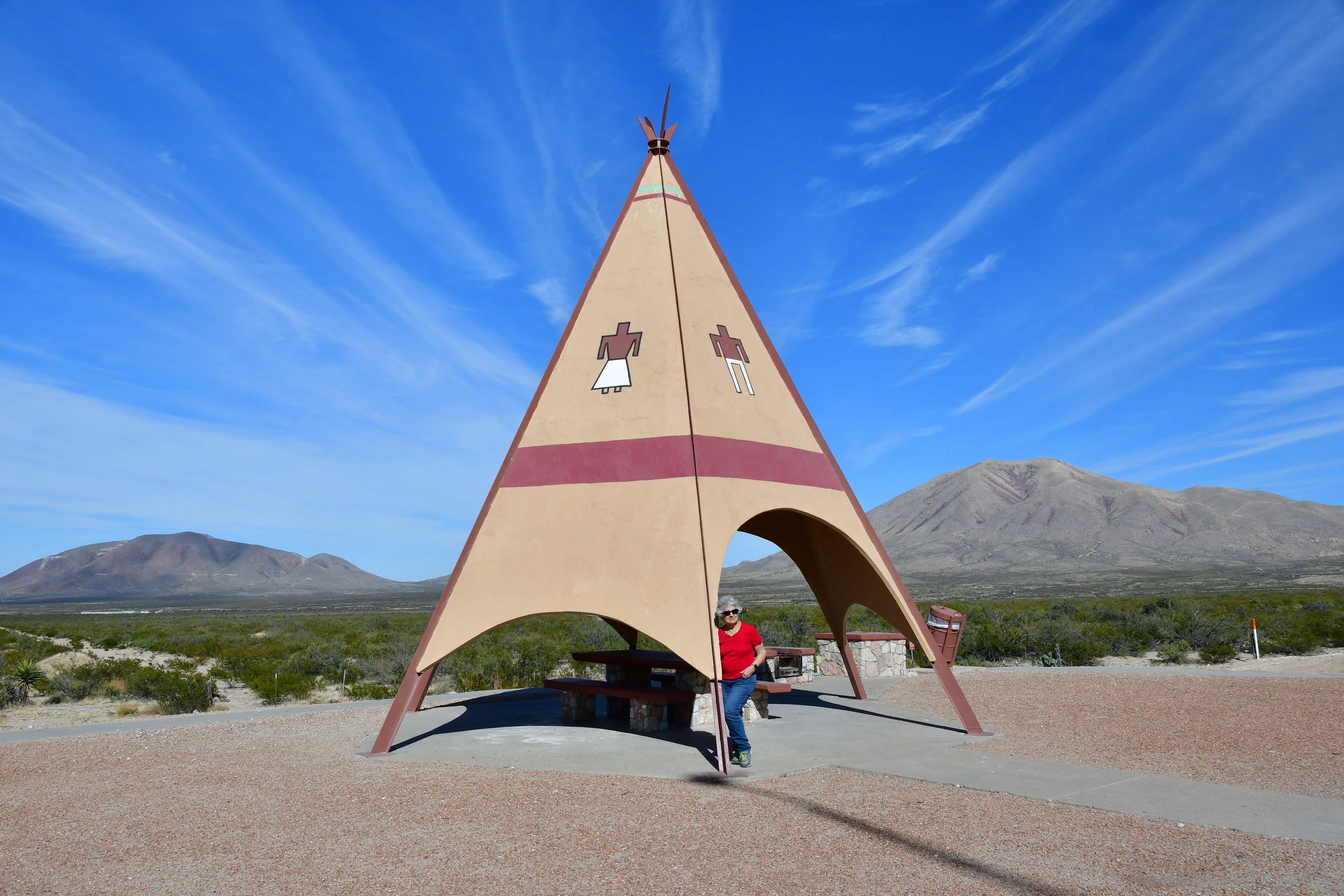
Nothing to report today since all we did is drive. But I did take the photos below when we stopped to stretch our legs on the run between Tuscon and Kingman, Arizona:


Nothing to report today since all we did is drive. But I did take the photos below when we stopped to stretch our legs on the run between Tuscon and Kingman, Arizona:
Since the push is on to get home as expeditiously as possible, we stopped today only to grocery shop, top up the gas, and eat lunch. Consequently, we didn't visit any interesting attractions, and I never even got the camera out. Our target destination today was the city of Tuscon, and we handily made it by 4:30 p.m. after starting our 320-mile run in El Paso, Texas, at 8:05 a.m.
At lunch today in the city of Lordsburg, New Mexico, we made our evening camp reservations by phone, but we had no idea what the camp would be like since we'd never stayed there before. Little did we realize that the camp had been set up specifically to cater to the famous "snowbirds" who come to Arizona from the very coldest and snowiest states in the union to escape winter's worst.
It soon became obvious when the KOA counter person issued us camp spot number 1639 that we would be keeping company with more RVers than we have in the last ten camps combined. And that's not all. The camp has its own restaurant, fitness room, game room, fireplace sites, and miniature golf course.
And even that is not all to be seen at this Shangri-la of RV parks. Over many of the longterm campsites, perhaps those which cater specifically to snowbirds, the camp owners have erected sun-filtering, steel slatted roofs to ward off the winter sunshine presumably! I guess it's also possible that some of these long-termers simply stay here year-round and would need the slats in the 120-degree summer months.
Anyway, since I did drag out the camera and take photos of this camp before the sun went down, I thought you might like to see what "fancy" looks like in the way of RV camps. Enjoy!


As you know, if you've been reading our blog for any length of time, we usually try to keep mileage to about 150 miles a day. Sometimes if we can't quite find a camp where we need it to be, we'll push it up to 200 miles. Beyond that distance, it's just too tedious.
However, the distance from McKinney, Texas, where we visited with family, to the Texas/New Mexico border totalled just under 700 miles, a mind-numbing figure for our tolerance for long days. Still, towns in between seemed to be few, and we couldn't really find many camps advertised.
So yesterday when we left Mckinney we ended up driving 315 miles, and today we wracked up another 344 Miles to reach El Paso. Tomorrow we will probably have to do another 340 miles to reach Tuscon. It's not something I'm looking forward to, but if we get an early start it is doable.
Still, even though we didn't get to visit any fascinating points of interest, we did get to witness one of the most fascinating cities we've ever seen, albeit from our RV seats, as we passed through the Midland/Odessa metropolitan area of Texas.
If you're unfamiliar with the Midland/Odessa area, you probably have not been paying attention to what insiders are calling the Permian Basin oil deposit. For a discussion of the Permian basin, I turned to Wikipedia: "The Permian Basin is a large sedimentary basin in the southwestern part of the United States. The basin contains the Mid-Continent Oil Field province. This sedimentary basin is located in western Texas and southeastern New Mexico. It reaches from just south of Lubbock, past Midland and Odessa, south nearly to the Rio Grande River in southern West Central Texas, and extending westward into the southeastern part of New Mexico."

"The Permian Basin lends its name to a large oil and natural gas producing area, part of the Mid-Continent Oil Producing Area. Total production for that region up to the beginning of 1993 was over 14.9 billion barrels (2.37×10⁹ m3). The Texas cities of Midland, Odessa and San Angelo serve as the headquarters for oil production activities in the basin."
Personally, I've been pertty worried about the anti-oil attitude of our present government. It seemed to me that they were on an accelerated path to destroy our oil industry. But after riding through Midland/Odessa, Texas today, I'm feeling more confident that our oil industry is NOT down for the count and is going to outlast our shortsighted government leaders.

For instance, there appeared to be litterally thousands of work trucks of all descriptions, from pickups to large flatbed mainenance trucks dashing hither and yon on the frontage roads. And lining those roads were the dealers to sell them. There were dealers providing the tractor component of tractor-trailer rigs. There were other dealers selling the trailers or vans that could be pulled by those tractors. We even saw about three dozen brand new oil tanker trailers sitting in just one spot on the south side of the Interstate.
On the construction side, there were all manner of businesses providing the materials needed to build all the new buildings that housed the burgeoning number of small businesses. Businesses offering electricians, sheetmetal work, boiler and HVC work, plumbing related, hydraulics related, and, well, you name it and it was there.

Naturally, getting through Midland/Odessa was a bit hairy because of the crush of traffic and all the work trucks merging onto the Interstate. But we didn't really mind as we were getting to see an American economy going gangbusters that was simply too good to miss. All too often on our travels we see countless towns where the economic viability vanished years ago. Seeing Midland/Odessa was a very welcome change.
By the way, the photos of Midland/Odessa were not shot by me, but were captured on the web in order to provide some visual backup for my narrative.

Tennessee, the Carolinas, Georgia, Florida, Alabama, Louisiana, and most of Texas are like one giant sponge. Sometimes it rains in these states like pouring water out of a boot. But most of the time the water is just hanging around like the invisible man. We suspect that you could slice a cubic yard of air in any of these states, wring it out into a basin, and survive for a good week in the driest of deserts.
Unbeknownst to us when we picked out Big Springs as our probable stop for the night, and called in a reservation, we didn't realize that the camp would prove to be a climatic heaven on earth. The camp is pretty rustic and the Internet sucks, but we don't really care. The desert air is so wonderful we may just decide to stay here until spring.

Here's what really happened: we trusted Concetta's iPhone to guide us, and the attention-demanding lass in that tiny machine decided that the easy way was just boring. So for the next hour she stair-stepped us down every rutted country lane that claimed any proximity to McKinney, Texas.
We had rutted pavement and potholes. We had steep roadside dropoffs. we had all four cardinal directions fed to us making us think we were actually going in circles. We even had a collection of roads where repaving crews were limiting traffic to one direction at a time. Finally we had had enough, and we dug out the tried-and-true super duper GPS with a screen half the size of a loaf of bread and put that lady to work.

Now that all the fun and games were behind us, we certainly thought that our troubles were over and we could navigate our way out of the insanity of metropolitan Dallas without further adieu. But that was not to be. All too soon we came upon more constuction work going on and unfortunatley right in the middle of where we had to catch Route 35 south.
Still, we made it finally to the onramp and the GPS set our course south -- and right into a super collossal remodel of the entire west Dallas freeway system. Immediatley all the lanes became as narrow as they could make them, and it wasn't long before we just knew we were in for it.
By the time we got out of the west end of Dallas we had missed at least three turnoffs, narrowly avoided construction debris scattered in our lane by some fool in a beatup pickup truck, and had to reverse direction at least twice. All I wanted to do was pull over somewhere and have a good cry. But there was nowhere to pull over.

Finally we managed to bumble our way to Interstate 30/20 west, and I glanced at my watch to confirm that, yes, it had taken us over two hours to drive perhaps 40 miles just trying to LEAVE THE CITY!
Thankfully, the rest of the day passed uneventfully. Because we had a little trouble finding a camp on the Internet or in our Good Sam book, we decided to try and get half way to El Paso, if possible. That decision brought us to Big Spring, Texas, about 315 miles from last night's camp. Our day turned out to be long, but we did find a fairly nice place for lunch just off the Interstate where I took the photos herein.
And that's it for now. Concetta and I wish you many exciting adventures of your own on the highways and byways of our beautiful country.

Yesterday got started with an all too customary trip to the tire store. Fortunately, I found a Firestone dealer who told me he had just the tires I wanted. Only problem was he couldn't work on the rig until 11:00 a.m. since he was booked up with appointments until then. So, having no real choice but to take the offered appointment, we cleaned up our camp, left some money in the RV camp office box, and motored over to the dealer to hang out in their parking lot.
If this sounds like Deja vu all over again, it is. On this trip we purchased two new tires in Dandridge, Tennessee, two new tires in Statesville, North Carolina, and now two new tires in Monroe, Louisiana.
And it looked like the Monroe Firestone shop was ready to do the tire installation around 9:30, which would have been wonderful. But the puney hydraulic jack the store had on hand didn't have a hope of lifting the rig off the ground. So we purchased the tires, then headed off down the road to a discount tire store which purportedly had a decent jack. So now we're waiting again.

Though I wasn't at first pleased with the look of the discount tire store, nor the cadre of very young employees, as it turned out the store and the employees were fantastic. Great care was taken to make sure we had what we needed and just after 11:00 a.m. we were able to hit the road again quite satisfied with the job that was done for us.
It turned out that though the outer tire of the passenger-side dualie was destroyed, the inner tire was still in great shape. This tire became the new spare as our existing spare was twelve years old and not safe to use, nor serviceable at modern tire shops.
There were a couple of dings in the steel wheel where the ruined outside tire was removed, but the technicians said they weren't significant and could be banged back into place. Before long both the new tires were mounted and balanced and replaced on the rig. The jack was removed and we were ready to go.

At the end of the day we found an incredibly nice camp in the Texas town of Longview, though we checked out a couple of really unsuitable camps before we found Fernbrook. The first one we rolled into was so dingy and rundown that I immediately turned around and left before anyone noticed us. The second would have been okay, but it was completely full with long-time tenants. Permanent tenants has become commonplace in most camps.
Fernbrook, on the other hand, tops the list as one of the most modern and pristine we've seen on this trip. All the sites have widely spaced and level concrete pads. The streets are all paved and not the dirt or gravel we see so often. The laundry facility was large and modern. Seeing that the laundry was basically empty, we lost no time in gathering up things in need of washing and dashing over there once our camp was set up.
And that's it for yesterday's events. Since we got such a late start back in Monroe, we didn't try to stop at any historic sites. Fortunately we didn't really see anything to drew our interest.

Our plans for the morning were to travel Route 20 to Vicksburg, Mississippi, then leave the Interstate to spend a couple of hours at one or more of the museums to be found there. Stopping just a half dozen miles outside the city, we did some Internet searches and decided that the museum we'd like to visit was the one that displayed the Union gunboat, Cairo, from the time of the Civil War.

To quote the pamplet, 'Armed Ready for Action,' by Helen Schwartz, "USS Cairo was one of seven vessels of the same design built specifically to cruise the Mississippi river and its tributaries. Those seven warships were designated city-class gunboats. Cairo, Carondulet, Cincinnati, St. Louis (Baron de Kalb), Louisville, Mound City, and Pittsburg, were named for cities and towns along the upper Mississippi and Ohio Rivers."
,
"The city-class gunboats were state-of-the-art warships in 1861. Cairo and her six sister ships combined several features that enabled them to change the strategy and tactics of naval warfare on the western waters and impact the duration and outcome of the Civil War. Steam propulsion, iron armor, rifled artillery, a dual rudder system along with a recessed paddlewheel, and the physical characteristics of a riverboat were combined to bring increased protection, maneuverability and firepower as well as give more consistent mobility to these gunboats."
"But now the gunboat was on the bottom of the Yazoo River in 36 feet of water. Over the years, the gunboat was forgotten, and her resting place was slowly covered by a shroud of silt and mud. Protected by this protective ‘cocoon,’ Cairo became a time capsule in which her priceless artifacts were preserved in a largely oxygen-free environment. Her whereabouts became a matter of speculation as members of the crew had died and local residents were unsure of the location."

"Starting in the mid 1950s interest began to grow in launching a search for the nearly century old relic. In 1960 one of the Cairo's canons was located and eventually the entire wreck was found. In 1964 efforts were underway to lift the hull with large cables, but this effort succeeded only in damaging the fragile timbers. Finally, the wreck was lifted from the river in three separated sections and taken to Vicksburg."
"In 1972, the United States Congress enacted legislation authorizing the National Park Service to accept title to the Cairo and reassemble the remnants for display and preservation in Vicksburg National Military Park. Delays in funding halted progress until June of 1977, when the Cairo was returned to the park and partially reconstructed on a concrete foundation near the Vicksburg National Cemetery."

Today Concetta and I had the pleasure of visiting the reconstructed wreck at the Vicksburg National Cemetery Museum grounds. The massiveness of the ironclad is what strikes you first. To quote Helen Schwartz again, "Cairo weighed 888 tons fully loaded, which is 1,776,000 pounds. Her iron armor contributed 122 tons of that weight while her load [canons, stores, coal, and crew] provided 376 tons. Yet Cairo drew only six feet of water, which enabled her to navigate the shallow watercourses of the Mississippi and its tributaries."
We were not only able to photograph the immense vessel, we were actually allowed to go aboard in some places. When onboard you can more clearly view the canons, boilers, and the mechanics of the paddle wheel. We were also able to walk completely around the vessel as it sits in a sort of craddle beneath a giant tent that protects it from the elements.

Inside the small museum we were able to view the myriad of archeological finds from the boat. Everything from weapons of all sorts, to everyday living essentials were skillfully displayed. The Museum devoted to the fascinating boat certainly proved to be well worth a visit
By the time we retreated to the RV it was lunchtime. Little did we know at the time that while we sat enjoying our noonday meal fate was busy plotting quite a different kind of afternoon for us. It actually all began before we arrived at the museum when Concetta programmed her iPhone to choose a route to the Vicksburg National Military Park where the Cairo was on display.

At first I ignored the directions when we were approaching the area as I actually SAW the Visitor Center and pulled into the parking lot. Unfortunately, not only was the iPhone not happy with our choice, but once at the Visitor Center, I could not see a path that would take us to the boat. I did see what I thought was the correct road, but there was a chain baring access.
So, I backed the rig around, and headed back to the entrance. From there we let the iPhone take us to where it thought we needed to go. Unfortunately, after turning this way and that way on a series of tiny residential roads, we ended up facing a weed-grown wooden bridge across a creek.
The bridge clearly said "NO TRUCKS" and stipulated a weight limit of 10,000 pounds. Concetta and I looked at each other, then looked at the bridge. "What do you think?" I asked her.

Concetta just shook her head.
So, with a sigh, I put the truck in gear and sped quickly across the old bridge. We didn't hear any sounds of splitting timbers, so we continued up a steep hill and around several more twists and turns, and finally we arrived at the museum site just in time to see two tour buses descending a hill in front of us, obviously having taken the correct route.
So, after lunch, we decided to not leave via the road on which we had come, but to leave the way the tour buses had come. In retrospect, we would have been better off taking the tiny, winding road with the ancient bridge, for as we ascended to what we thought was the way out all we did is get completely lost in the rolling hills of the Vicksburg Civil War battlefield.

At one point we thought we where headed the right way because the iPhone insisted that we were. But at the end of the road we reached a dead end complete with a gigantic tree that looked as though it might thwart any attempts to manuever around it. Happily I was able get turned around and we retraced our steps to try another route.
But there was a bigger problem brewing. While navigating the route to the giant tree on the tiny park road, I moved aside to let a car pass and accidently clipped the edge of a culvert with the passenger side rear tire. As we continued searching for the route to the entance gate, the tire lost all its air and we were running on only the inside tire of the pair.
When we finally found our way through the park maze to the front gate, we were so happy to be out, that I neglected to check the condition of the tire that had clipped the culvert before proceding. This oversight came back to haunt us before we'd gone very far.
Since the Military Park lay quite close to Interstate 20, we were soon zooming west toward the Mississippi River bridge. But because I have become quite sensitive to the rig's behaviour at speed, I suspected that we had a problem. By the time we passed over that mightiest of American Rivers, I had begun to look for a place to pull over.
Fortunately, we only had to travel a very few miles and the Welcome Center and rest stop for Louisiana came into view. I pulled in, parked, and got out to view what I knew was not going to make me happy. Sure enough, the sidewall of the brand new tire purchased in Tennessee had a shredded sidewall and we had instantly become stranded.
Our current highway rescue service is the same as our auto insurance, and so we picked up the phone and called the Allstate Emergency Roadside Services. Within seconds a nice chap with an East Indian accent took all my information, located our rest stop on his map, and had called a local Vicksburg tow service to come rescue us.
In a little over an hour the tow truck operator had arrived, assessed the problem, and exchanged our shredded tire for the spare. The spare was a little low on air, so once we were on the road again we set our course for the nearest truck repair business where a great guy named Jake filled the low tire and sent us on our way.
But Fate was not done with us yet. It was around this time that I noticed that the running lights that I had just repaired the day before were again not working. Yesteray I thought it was a cracked reflector that was letting in water when it rained. I replaced that reflector, replaced the fuse again, and all the lights worked fine. But that didn't keep the fuse from blowing today.
I told Concetta that we needed to find a camp pronto so we wouldn't be out on the highway after dark with no taillights. So Concetta asked the iPhone for camps in the vicinity and it came up with one called "Sand Lick RV" located just ahead.
Here Fate was about to have great fun with us. The iPhone said that we needed to go to the town of Rayville and get off the Interstate, so we did that. Then it said we needed to go north just 11 miles on Route 425 so we did that. Then it said turn right and go four miles west on Route 134 so we did that. Then it said turn right and go four miles up Route 138 so we did that, too.
At this point, all we could see in every direction was farm land. There were no people, hardly any cars, and the whole expanse around us felt pretty lonely. So when we had done the 4 miles on Route 138 we began to get a bit skeptical. The iPhone then said that we needed to turn right and drive toward the tiny village of Collinston which came complete with a "Speed Trap Ahead" sign in some farmer's field.
When we got to Colliston, the main street was sort of stair-stepped, which made it hard to keep up with the iPhones commands. But we soldiered on. But when our electronic navigator told us to turn left down this dusty track into the woods just outside of Colliston, we called it quits and turned around. The device had just sent us on a twenty mile wild goose chase.
Naturally by this time I was in a cold sweat that we would not be able to find a camp before dark. Hastily we retraced all of our steps until we got to Route 134, then we turned west in the direction of the town of Monroe whose name I had seen on a highway roadsign.
When we got to Monroe, I pulled in for gas at a tiny convenience store and while pumping I asked the customer next to me if he knew of any RV camps nearby. He sort of scratched his head and finally told me no. But when I got back in the cab, Concetta had located a camp in Monroe that proclaimed it didn't have anyone in the office on Sundays, but that we might be able to find a place there.
It was getting toward dusk by then, and we hurriedly headed to Concetta's find before night fell. Naturally, Fate was NOT going to give up on the game quite yet. Just a couple of blocks from the camp, she threw a mile-long freight train in our path just to test how high my blood pressure might rise.
But somehow, when the train had passed, we managed to pull into the "Ouachita RV Park" just before the streetlights came on in the neighborhood. Quickly we found a vacant site, got set up, and breathed a long-awaited sigh of relief. Tomorrow we'll have to find a good tire dealer since I didn't want to drive too long on the spare or be without a spare to use in emergencies.
