Saturday, June 23, 2018

Day 43 - Prairie City to Redmond, Oregon - 148 Miles

When we set out today, we had one goal in mind for sure and one goal in the back of our minds. First, we wanted to stop at the John Day Fossil Beds National Monument as we drove west on Route 26 from our camp in Prairie City, Oregon. Second, we wanted to continue traveling west from the John Day site until we came to a nice camp in whatever time we had available after doing item one.

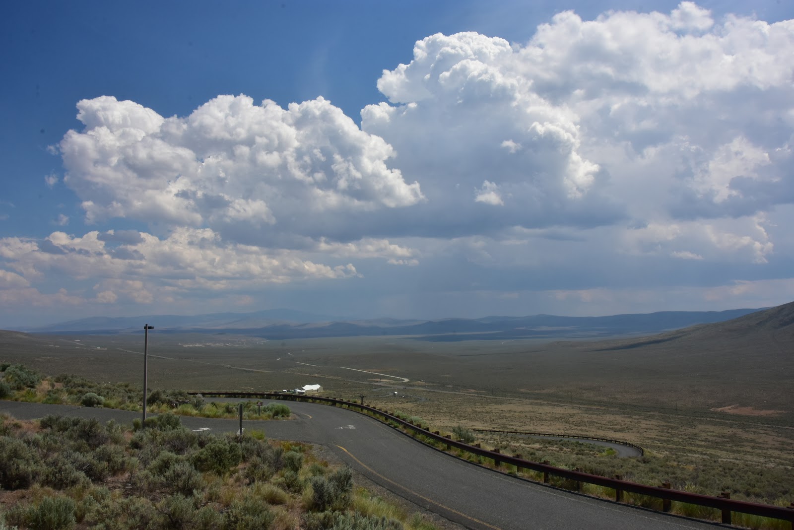
The first item came off admirably. Though we had to travel about an hour from Prairie City to the turnoff for Route 119 and the National Monument, we were able to spend a least two uninterrupted hours there just totally enthralled with the museum, with the wealth of information available, and with the friendly, helpful nature of the staff.

Probably more than one person would like to know how and why we got so interested in Geology. The answer is simple: the geology of this planet is everywhere we go! It's in the towering cliffs where the rock strata is pushed up in odd angles from the tremendous forces from within the earth. It's in the extinct volcano cores that dot the landscape like the smokestacks on old steam locomotives. It's in the roadcuts that we constantly pass that reveal just what the surrounding landscape, now covered with grasses and trees, looked like at one time. It's in the lofty peaks that strain the RV's engine as we slowly climb to the top, but which dazzle our senses as we realize that our conquered peak had once been thousands of feet under water as evidenced by the ocean fossils that can be found there now.

Geology is the key to understanding everything about our planet, and, if you travel long enough, it's the one thing that helps tie all of your continental AND regional knowledge together into one neat package. Want to know where gold mines are prevalent? Consult your geology handbook. Want to know why there are certain soils in certain states and not others? Consult your geology handbook. Want to know why some mesas composed largely of sandy sediments don't seem to erode? Well, you get the picture. If you travel in an RV, you might want to bring along a book or two to help you understand what you're seeing as you drive.

Our two hours at the John Day Fossil Beds National Monument had us staring open-mouthed at dozens of biological and geological revelations, most of which we had never heard of or seen in the past. The particular area of Oregon in which we were located was a wild and wonderful place over the past fifty million years. Weird plants, weird animals, and huge fluctuations in climatic conditions sometimes brought on by vulcanization, as well as other, unknown, factors.

One geological phenomena that Concetta and I had never heard of in the past is something called a "basaltic flow," which is simply lava bursting to the surface and flowing out over the land without benefit of an actual volcano. I found it to be a pretty sobering concept to think about, since I doubt that the local fauna had much warning that they were about to be enveloped in lava. Here's some more history from Wikipedia:

"The John Day basin remained largely unexplored by non-natives until the mid-19th century. Lewis and Clark noted but did not explore the John Day River while traveling along the Columbia River in 1805. John Day, for whom the river is named, apparently visited only its confluence with the Columbia in 1812. In 1829, Peter Skene Ogden, working for the Hudson's Bay Company (HBC), led a company of explorers and fur trappers along the river through what would later become the Sheep Rock Unit. John Work, also of the HBC, visited this part of the river in 1831."

"In the 1840s, thousands of settlers, attracted in part by the lure of free land, began emigrating west over the Oregon Trail. Leaving drought, worn-out farms, and economic problems behind, they emigrated from states like Missouri, Illinois, and Iowa in the Midwest to Oregon, especially the Willamette Valley in the western part of the state."

"After passage of the Homestead Act of 1862 and the discovery of gold in the upper John Day basin, a fraction of these newcomers abandoned the Willamette Valley in favor of eastern Oregon. Some established villages and engaged in subsistence farming and ranching near streams. Settlement was made more practical by a supply route from The Dalles on the Columbia River to gold mines at Canyon City in the upper John Day valley. By the late 1860s, the route became formalized as The Dalles Military Road, which passed along Bridge Creek and south of Sheep Rock. Clashes between natives and non-natives and the desire of the U.S. Government to populate the region with Euro-Americans led to the gradual removal of native residents to reservations, including three in north-central Oregon: Warm Springs, Burns Paiute, and Umatilla."

"In 1864, a company of soldiers sent to protect mining camps from raids by Northern Paiutes discovered fossils in the Crooked River region, south of the John Day basin. One of their leaders, Captain John M. Drake, collected some of these fossils for Thomas Condon, a missionary pastor and amateur geologist who lived in The Dalles. Recognizing the scientific importance of the fossils, Condon accompanied soldiers traveling through the region. He discovered rich fossil beds along Bridge Creek and near Sheep Rock in 1865."

"Condon's trips to the area and his public lectures and reports about his finds led to wide interest in the fossil beds among scientists such as Edward Drinker Cope of the Academy of Natural Sciences. One of them, paleontologist Othneil C. Marsh of Yale, accompanied Condon on a trip to the region in 1871. Condon's work led to his appointment in 1872 as Oregon's first state geologist and to international fame for the fossil beds. Specimens from the beds were sent to the Smithsonian Institution and other museums worldwide, and by 1900 more than 100 articles and books had been published about the John Day Fossil Beds. During the first half of the 20th century, scientists such as John C. Merriam, Ralph Chaney, Frank H. Knowlton, and Alonzo W. Hancock continued work in the fossil beds, including those discovered near Clarno in about 1890."

"The monument consists of three geographically separate units: Sheep Rock, Painted Hills, and Clarno. The units cover a total of 13,944 acres (5,643 ha) of semi-desert shrublands, riparian zones, and colorful badlands. About 210,000 people frequented the park in 2016 to engage in outdoor recreation or to visit the Thomas Condon Paleontology Center or the James Cant Ranch Historic District."

"The John Day Fossil Beds National Monument lies within the Blue Mountains physiographic province, which originated during the late Jurassic and early Cretaceous, about 118 to 93 million years ago.[34] Northeastern Oregon was assembled in large blocks (exotic terranes) of Permian, Triassic, and Jurassic rock shifted by tectonic forces and accreted to what was then the western edge of the North American continent, near the Idaho border.[35] By the beginning of the Cenozoic era, 66 million years ago, the Blue Mountains province was uplifting (that is, was being pushed higher by tectonic forces), and the Pacific Ocean shoreline, formerly near Idaho, had shifted to the west."

"Volcanic eruptions about 44 million years ago during the Eocene deposited lavas accompanied by debris flows (lahars) atop the older rocks in the western part of the province. Containing fragments of shale, siltstone, conglomerates, and breccias, the debris flows entombed plants and animals caught in their paths; the remnants of these ancient flows comprise the rock formations exposed in the Clarno Unit."

"Preserved in the Clarno Nut Beds are fossils of tropical and subtropical nuts, fruits, roots, branches, and seeds.[40] The Clarno Formation also contains bones, palm leaves longer than 24 inches (61 cm), avocado trees, and other subtropical plants from 50 million years ago, when the climate was warmer and wetter than it is in the 21st century."

"Large mammals that inhabited this region between 50 and 35 million years ago included browsers such as brontotheres and amynodonts, scavengers like the hyaenodonts, as well as Patriofelis and other predators. Eroded remnants of the Clarno stratovolcanoes, once the size of Mount Hood, are still visible near the monument, for example Black Butte, White Butte, and other buttes near Mitchell."

"After the Clarno volcanoes had subsided, they were replaced about 36 million years ago by eruptions from volcanoes to the west, in the general vicinity of what would become the Cascade Range. The John Day volcanoes, as they are called, emitted large volumes of ash and dust, much of which settled in the John Day basin. As with the earlier Clarno debris flows, the rapid deposition of ash preserved the remains of plants and animals living in the region."

"Because ash and other debris fell during varied climatic and volcanic conditions and accumulated from many further eruptions extending into the early Miocene (about 20 million years ago), the sediment layers in the fossil beds vary in their chemical composition and color."

"Laid down on top of the Clarno Strata, the younger John Day Strata consist of several distinct groups of layers. The lowermost contains red ash such as that exposed in the Painted Hills Unit. The layer above it is mainly pea-green clay. On top of the pea-green layer are buff-colored layers."

"Fossils found in the John Day Strata include a wide variety of plants and more than 100 species of mammals, including dogs, cats, oreodonts, saber-toothed tigers, horses, camels, and rodents. The Blue Basin and the Sheep Rock unit contain many of these same fossils, as well as turtles, opossums, and large pigs.[48] More than 60 plant species are fossilized in these strata, such as hydrangea, peas, hawthorn, and mulberry, as well as pines and many deciduous trees.[49] One of the notable plant fossils is the Metasequoia (dawn redwood), a genus thought to have gone extinct worldwide until it was discovered alive in China in the early 20th century."

"After another period of erosion, a series of lava eruptions from fissures across northeastern Oregon, southeastern Washington, and western Idaho inundated much of the Blue Mountain province with liquid basalt. Extruded in the middle Miocene between 17 and 12 million years ago, more than 40 separate flows contributing to the Columbia River Basalt Group have been identified, the largest of which involved up to 400 cubic miles (1,700 km3) of lava. The most prominent of these formations within the monument is the Picture Gorge Basalt, which rests above the John Day Strata."

"Subsequent ashfall from eruptions in the Cascade Range in the late Miocene contributed to the Mascall Formation, layers of stream-deposited volcanic tuffs laid atop the Picture Gorge Basalt.[52] Preserved in the Mascall are fossils of animals such as horses, camels, rhinoceroses, bears, pronghorn, deer, weasels, raccoons, cats, dogs, and sloths. These fauna thrived in the monument's open woodland and savannah between 15 and 12 million years ago. The fossils of oak, sycamore, maple, ginkgo, and elm trees reflect the area's cool climate during this time period."

"The last major eruption occurred in the late Miocene, about 7 million years ago. The resulting stratum, the Rattlesnake Formation, lies on top of the Mascall and contains an ignimbrite. The Rattlesnake stratum has fossils of mastodons, camels, rhinoceroses, the ancestors of dogs, lions, bears, and horses, and others that grazed on the grasslands of the time. Two fossilized teeth found recently in the Rattlesnake stratum near Dayville are the earliest record of beaver, Castor californicus, in North America. The beaver teeth, which are about 7 million years old, have been scheduled for display at the Condon Center."

"The monument contains extensive deposits of well-preserved fossils from various periods spanning more than 40 million years. Taken as a whole, the fossils present an unusually detailed view of plants and animals since the late Eocene. In addition, analysis of the John Day fossils has contributed to paleoclimatology (the study of Earth's past climates) and the study of evolution."

"Paleontologists at the monument find, describe the location of, and collect fossil-bearing rocks from more than 700 sites. They take them to the paleontology laboratory at the visitor center, where the fossils are stabilized, separated from their rock matrix, and cleaned. The fossil specimens are then catalogued, indexed, stored in climate-controlled cabinets, and made available for research. In addition to preparing fossils, the paleontologists coordinate the monument's basic research in paleobotany and other scientific areas and manage the fossil museum in the visitor center."

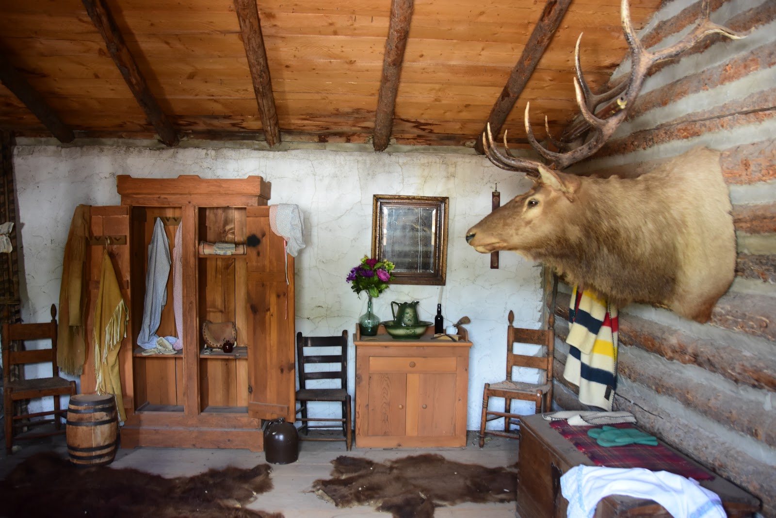
And there you have it. I know that you're not going to get the geology "bug" by reading my excerpts from Wikipedia, but believe me, you'll find the John Day Fossil center is well worth visiting and learning about these millions of years earth's history.

Once we were out of the museum, we had our lunch in the parking lot, then hit the road around 1:00 p.m. With just two hours to travel we didn't plan on getting much beyond Prineville, but as fate would have it, we trusted Ms. GPS yet again, and yet again she mislead us. Where we had programmed her for the Prineville area, she had other ideas. Before we were done pursuing another wild goose chase, we had driven all the way to Redmond, Oregon, a distance for the day of 148 miles.

Oh, well, it did allow us to do some shopping in Prineville, grab some gas, and now we're in good shape for supplies. But that's definitely the last time we're turning the conniving female on until this trip is over. Tomorrow, we're headed a short distance down Route 97 to Bend, Oregon, where we hope to finish what we started at the High Desert Museum. You may remember the High Desert Museum from the blog a month ago or more. It was there that I thought I'd get a great photo if I climbed to the top of a large pillar. I subsequently fell off and got some very painful and long-lasting "contusions," as the ER doctor in Oregon City put it. Fortunately, a month later I'm feeling much better.

At the time we could only do a part of the museum, and now we're going back for the rest. We'll probably camp in Bend so we don't have to worry about making miles tomorrow now that we're pretty close to home. Perhaps we'll even have time to do some hiking or walking since we didn't get very many steps today.

Tonight's camp here in Redmond is very nice, though we didn't expect it to be so. When we discovered that Ms. GPS intended for us to drive even further this afternoon, we turned her off and sought out this camp run by the county. We've stayed in good and bad county parks over the years, but this one turned out to be nearly flawless in it's expertly run, 105-space design. It had a fairly decent laundry room, though too few machines Concetta tells me. But all the pads are level concrete, and we were able to get full hookups.

And there you have it. The day is done, our brains are loaded down with all sorts of new information, and the sun is finally setting which will soon cool off the camp. If you someday take to the highways and byways of America, for God's sake get yourself a good GPS. Don't get a cheap one, and don't rely on your IPhone as in many parts of the country there is no cell service. But the thing is to go, even if you have to navigate by the always reliable paper maps. Try it! You'll have loads of fun, and while you're doing it, we wish you exciting destinations and memorable travels from the Davises, the Happy Wanderers.

Friday, June 22, 2018

Day 42 - Huntington to Prairie City, Oregon - 110 Miles

Anyone who has been reading this account of the travels of the "Happy Wanderers" and their adventures in the Northwest have probably noted that our GPS hasn't always been the most reliable of navigation tools. Most times we keep her turned off as more and more she seems to intentionally mislead us. Perhaps you've never had ANY trouble with your handheld or onboard GPS when you're traveling. Glad to hear it. But let me relate the latest adventures of our nemesis, Ms. GPS and your intrepid adventurers.

It started this morning when we set out to find the Baker City Oregon Trail Interpretive Center. As we approached Baker City about 10:00 a.m., I told Concetta that we'd just get off at the first opportunity and cruise through town on the business loop bypass of Interstate 84. I figured that we'd almost certainly see the always helpful brown point-of-interest signs somewhere downtown that would help us navigate to the Interpretive Center.

But when we had reached the old part of the city and had not encountered even one brown sign, we pulled over and consulted a "things to see" booklet that we had collected somewhere in our travels. We soon found the address, and in short order Concetta had succeeded in programming the ever-cantankerous Ms. GPS to take us to our destination.

So far so good, and all seemed to be going well. Ms. GPS directed us right back to Interstate 84 and told us to take the on-ramp headed west. This order seemed to be contrary to what my intuition was quietly telling me, but as usual I decided to just sit back, relax, and let Ms. GPS do her thing.

After traveling just a mile or two in a northwestern direction, Ms. GPS instructed us to get off the Interstate, and get on the frontage road. Concetta and I looked at each other because we had long since left the city proper behind and nothing but farm and pasture lands greeted our inquiring eyes in any direction we looked.

At this point we think that Ms. GPS really began to feel her power. Since Concetta and I had dutifully followed her directions to this point, she obviously wanted to see how much she could get away with. Or maybe she just wanted to punish us for ignoring most of her directions in the past, and leaving her deactivated most of the time.

What followed for the next half hour was nothing short of insubordination, if not outright insurrection. Once we had left the Interstate, Ms. GPS began to send us in a stair-step fashion across hundreds of acres of farmland in one-mile segments at a time. She'd say, "turn right at the next corner, then proceed for one mile until your get to some other Street." When we got to that Street, she'd say, "Now proceed down the present street for one mile and turn left on the next Street." When we got to that street, she'd say, "Now go down one mile......" You get the picture.

The land that we were traversing was flat, featureless pasture. We encountered almost no houses at all. When Ms. GPS had sent us on no less than ten of the one-mile stair-stepping segments, we finally got to "Sunnyslope Road." When we drove to the end of Sunnyslope Road we encountered the DIRECT ROUTE from Baker City to the Oregon Trail Interpretive Center. We knew this to be true because when we looked left we could see the Center way up on a hill above us. When we looked right, we could see the Interstate and beyond that the city. It was obvious that our obnoxious GPS lady had harpooned us big time and wasted no less than a half hour of our time by adding a needless thirty-minute meander to what should have been a five-minute drive from Baker City.

All I can say is that Ms. GPS is hugely lucky that she isn't spending the rest of eternity somewhere in a cow pasture adjacent to Sunnyslope Road. We've discussed all sort of punishments, including sending her back to the factory, but we may give her one more chance to redeem herself once we update her software. Perhaps she's just become misguided and simply needs some tough love.

So once we actually found the road to the Interpretive Center we arrived there in a heartbeat. At first we couldn't quite understand the reason for locating the Center so far from town and at the top of a mountain peak no less. But once inside, we understood. The building has been cleverly positioned to overlook the "tracks of the pioneers" as they coursed through the valley below. The center even provides binoculars for folks who would love to hike down to see the wheel ruts in person, but can't for some reason.

To accommodate those who Do want to hike, the Center has paved the mile down to the wheel-rut area. And the paved path doesn't just charge straight down the mountain. It meanders artistically down to the valley floor, so you can meander yourself and take note of the flora along the way. If the signage in the parking area is any indication, the Center may have even labeled plants on the paved path, too. I could see using the binoculars that a single covered wagon had been located at the bottom of the hill where it's 19th century equivalents had once passed.

You may remember that Concetta and I wanted to finish up our cruise along the Oregon Trail by actually visiting an Oregon Trail Interpretive Center in the state of Oregon. It seemed to be a fitting way to top off what has turned out to be a major portion of our vacation experience.

The museum, we thought, was pretty good, and some of the "mock-up" displays of emigrants and their wagons are truly excellent. We also thought that the whole story of the trail experience was pretty thoroughly done. Still, the museum is somewhat small overall, and probably rates a good, but no spectacular grade. The trail center that we found truly memorable from our RV vacation in 2016 was the one in Casper, Wyoming. That Museum rates an outstanding.

While we were enjoying the museum "walk-through," we were invited to attend an hour with a couple of performers who promised to acquaint the audience with the overland trail experience through instrumental music and old-fashioned song. Our morning's performers were Buffalo Bill Boycott and his sidekick, Doctor Jo. They advertised their program as: "A music extravaganza of songs and stories in celebration of the 175 anniversary of America's historic migration of 1843. The duo would be accompanied by a multi-media presentation of historical paintings and photographs, stories in Native American Indian sign language, information on the Oregon/California Trail, Mormon Trail, The Donner Party, Gold Rush and more. Buffalo Bill and Dr. Jo would be performing on the Fiddle, Banjo, Mandolin, Guitar with vocal harmonies.

Some of the music was a bit folksy, but the overall effect was pleasing and the audience seemed to get into the spirit of the thing by singing along, clapping when requested, and doing their best to help the performers pull off an entertaining show.

Once the show was done, we stopped briefly in the gift shop where Concetta scoped out a cool T-shirt for my "Shirts-around-the-U.S." collection. We also tried to locate a book on Concetta's latest research topic on emigrants and their descendants and how they contributed to Oregon society. Not seeing any such narrative, nor my favorite topic of freighting in the old west, we made our escape and headed to the RV for lunch.

We didn't get far before I realized that I needed to photograph the circle of wagons on the bluff near the Interpretive Center. I had resisted photographing the wagons when we first arrived since the sun was behind clouds at that hour. But at high noon the conditions were prefect. After fifteen minutes, and perhaps two dozen shots, I was satisfied that I had covered the topic and we again made for the RV.

Once lunch was over, it was our intention to find Route 26 and head for Bend, Oregon. Trouble was, I had misread the map and what I really needed was Route 7 which runs into Route 26. This took us just a bit of time to sort out as we headed northwest on Route 84 looking for Route 26, when we should have headed southeast looking for Route 7. Embarrassing as that was, I was not about to trust Ms. GPS to tell us anything. We did turn her on briefly, and Concetta put in an address in Bend, but Ms. GPS immediately insisted that she was taking us to Yakima, Washington, no ifs, ands, or buts.

With a sigh we turned her off, consulted the map, found Route 30 on the northwest side of Baker City, which ran into Route 7, which ran into Route 26, and we were off and running. We wasted perhaps ten or fifteen minutes, but on the positive side the dalliance brought to my attention the need for gasoline, which I had forgotten about. Cruising Route 7 until we found Route 26 allowed us to happen upon a filling station, so all was well in the end.

I know I've recommended a lot of different routes, but anyone who wants to cruise the eastern part of Oregon would do well to schedule a drive along Route 26. It's absolutely beautiful and very lightly traveled.

We had an added benefit as we ran across the old Sumpter Valley narrow gauge railroad a few miles before we got to our evening campsite in Prairie City, Oregon. All the narrow-gauge equipment seemed to be completely unattended, and I just gleefully wandered the grounds, camera in hand, shooting anything and everything. The sun cooperated. The sky was a brilliant blue with copious fluffy clouds on high, and a great time was had by yours truly.

Not since the days of my membership in the Carson City Railroad Association have I enjoyed shooting rail equipment as much. It wasn't until I ventured far enough into the rail yard to hear ethereal voices from somewhere I couldn't see, that I retreated back to the rig. I suppose that I could have just wandered into the engine house and met the fellows who were probably working on an old narrow-gauge locomotive today. But it was already late, and we truly wanted to find a camp by day's end. If they let me watch, well, I might be there still.

Someday I'd really like to come back and ride the Sumpter Valley Railroad. The attraction is reasonably close to Carson City and would make a splendid short RV trip for late summer. Steam railroads are always fascinating. And, if you decide to go in search of vintage covered wagons, or wonderful survivors of the steam era, we wish you exciting destinations and memorable travels from the Davises, the Happy Wanderers.

Thursday, June 21, 2018

Day 41 - Moutain Home, Idaho to Huntington, Oregon - 124 Miles

Life on the road is seldom predictable. It often rains when you have outdoor tours in which to participate. Camps are full when you'd rather not drive one more mile. Laundry facilities are so dirty that you wouldn't wash your dog blanket in them. And mechanical difficulties can leave you sitting beside the road waiting for a long overdue rescue.

That unpredictable nature can also translate into positive things. It can rain on when you planned to attend museums all day, anyway. Gas at the next station you pull into can cost much less than you've been seeing all day. Camps that look full can have one more space left just for you (read last night's blog to see an example of this). And you can stumble over a special attraction that you didn't know was there, and it can turn out to be the best thing you've done in weeks.

The latter of the above items happened to us today. We had been planning on visiting the mining and geology museum in Boise, Idaho, but when we arrived we discovered that right next door was a fabulous botanical garden the likes of which we have seldom seen. Literally every type of garden setting, from lush shade gardens, to xeriscape and native plant gardens were fully represented. We just couldn't believe our wonderful luck.

From the Club directory of Boise I learned that: "the Idaho Botanical Garden, one of the first and oldest botanical gardens in Idaho, is a lush 15-acre tapestry of dappled shade and vibrant splashes of color. Nestled in the Boise Foothills, it is a sanctuary in the heart of the Old Penitentiary Historic District. The Garden promotes horticulture in the Treasure Valley using native and domestic plants adapted to the intermountain region."

"Today the Idaho Botanical Garden has blossomed into fourteen specialty gardens, each with a unique focus. Included are a contemporary English Garden, a Meditation Garden, a Children’s Garden, and an Heirloom Rose Garden. The Jane Falk Oppenheimer Heirloom Rose Garden, planted in 1989, consists of over 300 roses in 107 varieties, primarily varieties that have been under cultivation for more than a century."

The Idaho Botanical Garden is a nonprofit effort located at 2355 North Old Penitentiary Road, Boise, Idaho. Until 1973 the site served as the Old Idaho State Penitentiary's farm and nursery. After the penitentiary was closed, the land lay dormant for more than a decade, and in 1984 the gardens were first created. The facility is operated by a private, non-profit 501c corporation.

Concetta and I were so overjoyed with our good luck in finding this absolute gem that we whiled away the second half of the morning without a thought. I was personally so invigorated with all the beautiful plants and garden settings, that I took just under 200 photos and would have taken more if we had stayed the afternoon.

Many of the plants and trees are labeled on small placards near the base of the plant. We love this because when we come across a plant we really like, and could see having in our own yard, we photograph both the plant and the placard to help us when we go shopping at our local nursery.

Another aspect of the garden was the tremendous number of scrap steel sculptures that we encountered. We were just enthralled by the artist's clever combinations of "found" materials into stunning garden art. I found this on the web about the artist, whose name is Amber Conger: "...she has always been drawn to metals and sees unlimited possibilities in steel. She gathers her sculpture parts from local salvage yards, auctions, garage sales, and surplus centers. To her, the gears, bearings and mechanical objects are engineering marvels and she likes using these small parts that make the world go round."

Though I didn't always like Amber's sculptures, I did find them to be artistically clever and eye grabbing. In contrast with the softness of most of the flowers and plants in the garden, Amber's sculptures are hard, angular, rusty, and amazingly illogical and unexpected in form. But they make you stare for many minutes as you try to figure out what made Amber combine that particular truckload of discarded iron into that particular form.

Concetta and I have been talking for quite some time about fabricating a rock garden in our front yard. After today, and with the help of the photographs we gathered, I think we can get started this summer. We'll need some large rocks to be sure, but once those are acquired, we should be able to get all the plants we need from our local nursery. In addition, while we were in southern Wyoming, I collected some yucca seeds from plants that I encountered at two different museums, and I'm hopeful that I will be able to get them to germinate.

Once our visit to the Botanical Gardens was finished, we retreated back to the RV for our lunch. We had no intention of leaving the area, as the original reason for our visit, the "Mining and Geology Museum" was still to be visited. We knew we could spend all afternoon, but we hoped to spend an hour communing with some great rocks and minerals.

So after lunch we trekked once again up the path toward the Botanical Garden, but at the last minute veered to the west and continued on into the oldest section of the property that had once been the Idaho State Prison grounds. Concetta and I weren't interested in touring the penitentiary itself, but here's some information from the Idaho Historical Society should you decide to visit:

"The Old Idaho Penitentiary opened its doors in 1872 to some of the West’s most desperate criminals. Today, visitors can experience over 100 years of Idaho’s unique prison history with a visit to Solitary Confinement, cell blocks, and the gallows."

"The Old Idaho Penitentiary State Historic Site was a functional prison from 1872 to 1973 in the western United States, east of Boise, Idaho. The first building, also known as the Territorial Prison, was constructed in the Territory of Idaho in 1870. The territory was seven years old when the prison was built, a full two decades before statehood."

"From its beginnings as a single-cell house, the penitentiary grew to a complex of several distinctive buildings surrounded by a 17-foot-high sandstone wall. The stone was quarried from the nearby ridges by the resident convicts, who also assisted in later constructions."

"The Old Idaho Penitentiary is operated now by the Idaho State Historical Society. Over its 101 years of operation, the penitentiary received more than 13,000 inmates, with a maximum population of a little over 600. Two hundred and fifteen of the inmates were women. Two famous inmates were Harry Orchard and Lyda Southard. Orchard assassinated former Governor Frank Steunenberg in 1905 and Southard was known as Idaho's Lady Bluebeard for killing several of her husbands to collect upon their life insurance."

"Serious riots occurred in May 24, 1952, August 10, 1971, and March 7 and 8, 1973 over living conditions in the prison. The 416 resident inmates were moved to the new Idaho State Correctional Institution south of Boise and the Old Idaho Penitentiary was closed on December 3, 1973."

"In 1992, the Idaho State Historical Society recorded oral history interviews with fifteen former prison guards. These tapes and transcripts cover prison operations and remembrances from the 1950s to the closing of the prison. The collection is open for research at the society."

So there you have it. One day, if we come back this way again, we'll probably want to visit the Botanical Gardens again. When we do, I'm sure we'll want to complete our tour by visiting the prison museum. What we did come to visit was the Mining and Geology Museum which is housed in the "Trusty Dormitory" on the old Penitentiary grounds. I learned the following from the Museum's web site at https://www.idahomuseum.org/history/:

"The Idaho Museum of Mining and Geology (IMMG) is over 25 years old. The plan to open an Idaho museum that focused on the history of mining and geology in Idaho was sparked in 1988. The man behind this idea was Fred Shute, a geologist and a Boise jeweler. Fred was assisted early on by a dedicated and influential group of Idahoans. This small but enthusiastic band of engineers, businessmen, and geologists worked tirelessly for almost 5 years to bring their dream of a museum to fruition."

"Those first years were filled with both satisfaction and frustration. The museum board got off to a strong start and on January 26, 1989, the Idaho Museum of Mining and Geology became incorporated as a Foundation. The board leased 450 square feet of office space in Boise at 106 N. 6th as they worked on plans for a permanent museum site at elsewhere in the city."

"By 1992 there was still no sign of a permanent museum site. At this point, IMMG was renting the auditorium at the Old Penitentiary in east Boise for its annual membership meeting. By now there were 100 members of IMMG. The board was beginning to offer field trips to historic mining towns in southern Idaho. The IMMG began talks with the Idaho State Historical Society (ISHS) and Parks and Recreation to renovate a storage building in Julia Davis Park to use as a museum. This was another great idea that never panned out."

"Then in May of 1992, the IMMG learned the Trusty Dorm at the Old Penitentiary was available. With new-found vigor, the board took the steps needed to rent the old, fixer-upper, 2,300-square foot building for $100 a month. What Fred Shute had envisioned was now unfolding before him, but not without approximately 1 1/2 years of clean-up and setting up displays before the Idaho Museum of Mining and Geology opened."

Of course there is a lot more history than I have included here, but if this is something that really interests you, please pull up the museum's web site and take a look. Suffice it to say that Concetta and I were totally enthralled by our tour of the museum. They had just oodles of rock specimens, both rough and polished.

They included in their teachings short features on the top ten asteroid hits on planet earth and they effects they've had on the rock structure at the impact sites, and another on the composition of meteorites. Both were fascinating, as was another video that we watched that showed the large continent known as Pangea breaking up to form the separate landmasses of North America, South American, Europe, and Africa 250 million years ago.

After the breakup, were were especially intrigued to see how many millions of years went by and huge portions of North America, especially the west coast, were under water.

Of course I liked the displays of vintage mining equipment, which included a miners dwelling, a couple of ore cars, sluice equipment, a hydraulic "water blaster" used to increase the flow of ore to placer miners, and a recreated deep mine hoist.

The museum is small, so it's not hard to see it all in an hour. There is no fee for entrance, but I left a donation as well as making a small purchase. I was hoping to buy the Oregon copy of the "Roadside Geology" series, but they were fresh out.

And that was our day. We didn't get back to the RV until just after 2:00 p.m., and we still wanted to put some miles on the rig before camping for the night. So we fed Ms. GPS with an address for a camp in Huntington, Oregon, and set out to run the border before dinnertime. As fate would have it, Ms. GPS unerringly guided us out of the congested city of Boise and onto Interstate 94. From there it was an easy trek across the border to Oregon.

We got to "Catfish Junction" RV park about 4:00 p.m. and, though the park wasn't anything to write home about, the cost was cheap at $26.00, and the manager gave us a premier site in the shade of some leafy trees. Tomorrow we're headed for Baker City, Oregon, where we plan to do our last Oregon Trail museum, one that's actually IN Oregon. With that bit of important business out of the way, we'll be turning the old RV toward Nevada.

I hate to see this sojourn around the wonderful Northwest come to a close. The weather has been pretty darn terrific. Everyone we've met has gone out of their way to greet us warmly and to help us. And, most important, we have added to our knowledge in everything from history and geology, to horticulture and geography. We just loved it. We hope YOU take the bait, and do your own tour around this great country of ours, and when you do, we wish you exciting destinations and memorable travels from the Davises, the Happy Wanderers.

Wednesday, June 20, 2018

Day 40 - Heyburn to Moutain Home, Idaho - 119 Miles

Interesting day today. We spent a rather large part of our travel day plying Interstate 84 since it was basically the only route headed up to Boise, the direction we wanted to go. Now we don't like traveling the Interstates much, but we did manage to salvage a potentially "four-lane" day by taking a couple of "holidays" from divided-highway travel. This morning we decided to get off the blue highway and seek out Hagerman, Idaho, which purportedly had a nice fossil museum. According to our information brochures, fossils abound in the Hagerman area, and the museum there had a fossil horse for us to see.

But once we got to Hagerman, we discovered that the fossil museum hadn't heard we were coming and didn't bother to open today. I took a photo of the building just so I could remember how rude they had been, and, while I was at it, a photo of a cool '56 chevy four-door that was for sale on the main street opposite the museum. I winced at the owner's asking price of $28,000, since the lovely two-tone, albeit nicely-restored classic had two too many doors.

Then, since it was getting close to lunchtime, and not wanting to waste a perfectly good rural setting, we pulled over in the tiny town of "Bliss" just down the road from Hagerman and had lunch beneath a spreading willow tree. We were all set with a nice park setting out our dining room window that came complete with a couple of horseshoe pits. Boy, if I had had a couple of horseshoes in the rig I would have been right out there to shoot a few.

After leaving bliss, we sailed on down the rural Route 30 just to see how far we could get before we'd be forced to get back on the Interstate. Unfortunately it was only a mile or two before we had to hit the Interstate on-ramp. Still, it's always nice to travel the two-lanes if you can find them.

Since we really didn't want to be traveling on Interstate 84, we both kept an eye out for any point-of-interest sign that might lead us to a neat adventure. So we were fortunate when we saw the sign for "Three Island Crossing" State Park and the Oregon Trail Interpretive Center. Before long we were pulling up to the gate, where a wonderfully friendly gate attendant loaded us down with literature, gave us directions on how to tour the nearby camp site and Interpretive Center, and finished by charging us the rather paltry sum of $5.00 to enter.

The camping area looked nice. Were it later in the day, we definitely would have been tempted to remain after our tour of the Interpretive Center. Yes, it lacked sewer connections, and we would have to use a dump station, but the setting beneath the trees and adjacent to the Snake River was just outstanding.

If anyone were to ask me, I'd say that I just never get tired of touring emigrant trail museums. But Concetta said that the subject was starting to get slightly repetitive. Still, I think both of us found a great deal to appreciate and ponder in the Three Island Crossing Interpretive Center. Naturally, I photographed just about everything that was displayed in case I needed it for the blog, which usually means I miss actually reading some things that it would be nice to know to appreciate the museum experience more fully.

The one thing that I got to see that I had not appreciated before, was a display of Native American Camas bulbs on which they based a good portion of their diet in many of the high desert locations that we have visited recently. They had a couple of large bowls of them to look at and learn about.

I did some research to see what exactly a Camas was and why the Indians found it so valuable. I found this discussion on the web at http://nativeamericannetroots.net/diary/828:

"The Plateau Culture Area is the region which extends east from the Cascade Mountains in Washington to the Rocky Mountains in Montana. It extends from the Fraser River in British Columbia to the Blue Mountains in Oregon. The Indian tribes which inhabited this area have historic and cultural ties with the tribes on the Pacific Coast as well as with the tribes on the Northern Plains."

"The Plateau tribes gathered and used over 130 different wild plants. It is estimated that from 40% to 60% of their calories came from the plant foods which they gathered. One of the most important root crops for the Plateau tribes was camas, which provided a major source of carbohydrates for their diet."

"Camas is a lily-like plant whose bulb can be fire-baked to make a sweet and nutritious staple. In some places in the Northwest, camas was so common that non-Indian travelers would mistake the plant’s blue flowers for distant lakes.

"Camas is very high in protein: 5.4 ounces of protein per pound of roots. In comparison, steelhead trout (Salmo gairdneri) has 3.4 ounces of protein per pound.""

"The proper time to gather camas is when the lower half of the flowers begins to fade. Indian people generally gathered camas in June, but this varied according to altitude and seasonal weather conditions. Some of the tribes, such as the Flathead, designated June as Camas Moon."

"The camas was often dug up using digging sticks made from elk antlers. A woman could dig up about a bushel of roots in a day from a site that was about half an acre in size."

"At the camas digging camps, the camas was usually cooked in earth ovens before eating it or storing it. Since the same camps were used each season, the pit ovens used for roasting the camas were also reused."

"Although the men gathered the wood for the ovens, men were not allowed near the roasting pits for fear that the camas would not be roasted properly."

"The oven (a roasting pit dug into the ground) was preheated by building a fire in it and placing small rocks (about 5″ in diameter) in with the wood. In addition to the small rocks, some pits had large flat stones on the bottom which were also heated by the fire. When the rocks were hot, they were covered with wet vegetation such as slough grass, alder branches, willow, and/or skunk cabbage leaves. Then the camas bulbs were placed on top of the vegetation."

"Sometimes Douglas onions (Allium douglasii) were placed in with the camas. The camas was then covered with bark and earth and a fire was built on top of the oven. Cooking usually took between 12 and 70 hours, depending on the number of camas bulbs in the oven."

"The camas which was intended for storage was then dried for about a week. Dried camas can be preserved for many years. Some American explorers report eating camas that had been prepared 36 years earlier."

"The early Europeans in the area, such as Lewis and Clark, occasionally consumed camas after they were shown how to harvest it and prepare it. One Jesuit missionary fermented camas to make alcohol. Another Jesuit missionary observed that the consumption of camas by those unaccustomed to it is “followed by strong odors accompanied by loud sounds”."

"In order to increase the camas yield, the camas areas, as well as other root gathering areas, were occasionally burned over."

So there you have it. I just learned about a subject I knew nothing about five minutes ago. Now I'm going to be keeping an eye out for Camas plants wherever we roam in the future. I want to see if I can dig up one with my elk antler digging stick. Maybe we can even get some to grow at our house back in northern Nevada.

You're probably wondering why the Three Island Crossing was an important part of the Oregon Trail experience. I was, too. I found this discussion at https://www.nps.gov/oreg/planyourvisit/site9.htm:

"At Three Island Crossing emigrants on the Oregon Trail reached a critical junction. Here they had to decide whether to make the difficult crossing of the Snake River or take a longer alternative route along the south side of the river."

"Some of the hardest things the emigrants had to do was crossing rivers. When you read the diaries there are a lot of incidents of deaths at the river crossings. So when they get to Three Island Crossing they’ve got a decision to make. They could continue on down the south side of the Snake which was known as the dry and the longest route and the more desolate route or they could risk crossing. So it was whether you wanted to risk drowning or take the longer route."

"Three Island Crossing was the most important and difficult river crossing in Idaho. Crossing the Snake River was always dangerous, but when the water was low enough to negotiate, everyone crossed who could, to take advantage of the more favorable northern route to Fort Boise."

On September 11, 1843, William T. Newby wrote ". . . crossed Snake Rive[r]. First we drove over a part of the river one hundred yards wide on to a island, the[n] over a northern branch 75 yards wide on a second island; then we tide a string of wagons together by a chane in the ring of the lead cattles yoak & made fast to the wagon of all a horse & before & him led. We carried as many a[s] fifteen wagons at one time. . . . The water was ten inches up the waggeo[n] beds in the deepe places."

When Concetta and I left the Interpretive Center we drove down as close as possible to the river, then I walked out across the sagelands to the river's edge. Though we were east of the Three Island Crossing at that point, I could just imagine by looking at the width and flow rate of the Snake that crossing it in a wagon would take real guts. Crossing it successfully when the river was high would take a great deal of luck as well as guts.

I couldn't tell how deep the Snake is at that point, but I'm sure that high water kept many a wagon train on the south bank until conditions were more favorable. Losing all your supplies when the current catches your team and wagon and submerges the lot would have been devastating to these emigrants if they even lived through the tragedy.

The park at Three Island is quite nice, and we even thought about staying the night. But since we hadn't made many miles so far we opted to drive a little further. This idea was soon quashed when we approached the off-ramp for Mountain Home and I had spotted the tell-tail blue sign of our favorite shopping location and yours, Walmart!

Since Walmart is basically one-stop-shopping for RVers, we just can't pass one up when we need supplies. Everything from prescriptions to automotive parts, and from fresh fruit to deli items are available in super-sized quantities. Once we had acquired a cart-full of goodies, and then stowed the goodies away in the rig, we headed south from the Interstate to see if we could find the Mountain Home RV Resort.

Finding the resort turned out to be easy enough as it was just down the street from Walmart. But our hopes for getting a spot for the night were almost immediately dashed when a pickup truck and attendant fifth wheel trailer were just leaving the park as we made ready to enter.

"Do you suppose that they just turned those guys away," Concetta asked.

"Doesn't look good," I said. "But let's stop at the office just in case."

But our hopes sank further as we rolled up to the office and saw that someone had posted a large A-frame sign declaring that the park had "NO VACANCIES."

Concetta and I both sat and stared at the sign for a moment. Then, after talking it over, we both decided that I should go inside and make them tell me in person there was no room. I jumped down and headed over to the door. But just as I reached the front entrance, a gentleman came out and point blank told me that the sign was correct. They had no vacancies."

Crestfallen, I retreated to the rig and told Concetta the bad news. Then I climbed into the driver's seat, and we set off into the park to make a circle of the grounds before heading back down the drive.

The park was nothing short of incredible. Ever single site had a concrete slab and a nice picnic table. The whole park was just "crowded with large shady trees." Nearly all the rigs looked well-kept, and the fifth-wheel sites often had new trucks parked in front. We both could tell that we were missing out on a very nice place to spend the night.

As we rolled closer to the front gate again, and before we turned the corner to head out, Concetta couldn't help but voice her disappointment. At that point, in an effort to cheer her up, I said, "Don't worry, by the time we turn this corner coming up, the guy will be out at the front door again to stop us and tell us we can stay."

"Wouldn't that be nice," Concetta said, though I could tell she thought I was dreaming.

Then, just as we actually turned the corner and started for the exit, a woman appeared on the sidewalk and waved to us. I immediately stopped, and she came up to the window. "You can stay," she said. "That guy who just left gave up his spot early. If you still want a space, you can have his."

I made some remark to Concetta about positive thinking, but in truth I was pretty astounded myself for correctly predicting the outcome. I told the woman when I went into register that I had a certain talent for clairvoyance, and perhaps she believed me. But however this came about, we got to stay and the chap who had first told us there was no room, now conducted us to our very own site #82 beneath a bevy of beautiful trees. I have to tell you, it was sweet!

So here we are in the first camp that you could actually describe as paradise this whole vacation, at least in a concrete and swimming pool sort of way. Of course, if you like your camp spots a little more rugged and a little less predictable, you will probably want to stay in the state or federal parks. And if you do decide to hit the road and look for those campsite gems that are hiding out there waiting to be found, we wish you exciting destinations and memorable travels from the Davises, the Happy Wanderers.

Tuesday, June 19, 2018

Day 39 - Lava Hot Springs to Heyburn, Idaho - 112 Miles

For the past couple of days, Concetta and I have been exploring part of America that we've never visited: southern Idaho. Yes, we've been up north to visit the Craters of the Moon National Park. And once we tried to drive still further north to visit Pete Blackmore, an old co-worker of mine from my print-shop days, in his adopted home town of Harrison, Idaho, near Coeur d'Alene. But for some reason we've just never felt the need to visit places like Montopelier, Soda Springs, or Pocatello in Idaho.

Coming to southern Idaho had not initially been a conscious choice. Concetta said she preferred not to drop down into Utah from Rock Springs, Wyoming, because she didn't care for the hot ride across the infamous salt flats. When I studied the map it appeared that if I wanted to avoid Utah, I had to trend in a northwestern direction. This decision meant we either had to go somewhat northwest on Highway 30 to Pocatello, or we had to go radically northwest which would inevitably take us to someplace like Jackson, Wyoming, just south of the Grand Tetons before entering Idaho near the Caribou Targhee National Forest west of Jackson.

I decided that getting anywhere near the southern entrance to Yellowstone Park could mean overly crowded highways, solidly-booked camps, and just too many people everywhere we wanted to visit. Therefore, Route 30 to Pocatello looked like the best and most intelligent route to take. And, as I said, we'd never been over that stretch of highway before. Who knew what we would find?

Well, as I've related in previous blogs, choosing Route 30 turned out to be an incredibly good idea. We hadn't traveled too many miles along the route before we became aware that we were traveling that famous highway of the 19th century, the Oregon/California Trail!

Anyone who has studied western history for as many years as I have knows about the emigrant trails. How many people currently living on the Pacific Coast might have been born in a vastly different place had not some plucky group of their ancestors sold all they had and set out from the Missouri River in a white-topped prairie schooner? My own ancestors, the Daleys, were just one family out of tens of thousands who came west in the 1840s.

Still, since I was born in California I was always more interested in the California Trail then I was with the Oregon Trail. In other words, I knew it was somewhere northwest of southern Wyoming, but I never studied the actual route very closely.

I have found this journey from Rock Springs, Wyoming to Pocatello, Idaho to be a huge learning experience for me. The country is beautiful beyond belief, both naturally and agriculturally. Plus, the roadside geology is fascinating, and includes everything from starkly black volcanic lava flows dozens of feet thick, to multicolored sedimentary deposits that tower above the highway. Today, while hiking down to the Snake River from a nearby roadside rest, we even found a chunk of volcanic ash that we only just learned about during a recent visit to the Fossil Butte National Monument near the Idaho/Wyoming border.

One well-known historic place that I have read about for many years in conjunction with the overland trails system is Fort Hall. I knew from my reading that Fort Hall marked the decision point for many people as it was there that pioneers had to choose between heading for Oregon, or turning southwest toward California.

So yesterday when I looked for points of interest close to Pocatello, Fort Hall is the first name that jumped out at me. Once I researched, I found that the real site of Fort Hall is some 11 miles west of Pocatello on the Blackfoot, Bannock, Shoshone reservation. While this site is not accessible except by prearranged tours, a reconstructed replica of the fort is available for visit right in Pocatello.

Finding the fort turned out to be quite easy and sufficient signage was available on Interstate 15. We were a bit disappointed with the lack of parking available for large RVs, but since we were the only RV present, we just parked in the driveway and left enough room for others to get past us.

It turned out that the replica of Fort Hall exceeded all my expectations. The exterior of the structure was stuccoed adobe and the interior was made up of rough-timbered buildings, roofed with shake shingles. The north side of the Fort contained two-story buildings as well as a corner blockhouse. Low, single-story structures occupied the other three sides, including a blacksmith shop, a farrier, a meat-cutters shop, a leather shop, a carpenter shop, and sutlers store. The two-story section, which originally contained living quarters, was in use largely for museum displays. The museum display on the American Indians was especially nice.

There were dozens of placards explaining the history of the Fort which I dutifully photographed, one by one, in order that I might relate the history on the blog. I only belatedly discovered that the museum sold a small booklet in which they had accumulated all the museum's descriptive texts in one place. So, I bought the booklet for future reference.

But in order to save myself hours of transcribing for the blog, here's a condensed version of the history of the Fort I found at https://www.legendsofamerica.com/id-forthall/:

"The fur trading post of Fort Hall was founded by Nathaniel J. Wyeth, an opportunistic New England businessman who dreamed of exploiting the natural resources of the Oregon country. After an exploratory expedition in 1832-33, he returned the next year. Near the confluence of the Snake and Portneuf Rivers in southeastern Idaho, he built Fort Hall, a stockade of cottonwood logs with two blockhouses. But he found he could not compete with the powerful Hudson’s Bay Company, which the same year built a rival post, Old Fort Boise (Snake Fort), Idaho, 260 miles to the west at the confluence of the Boise and Snake Rivers."

"Around 1837 the Hudson’s Bay Company purchased Fort Hall from Wyeth, reconstructed it with adobe, and enlarged it considerably. It became a center of the Rocky Mountain fur trade and was such a lucrative enterprise that the Hudson’s Bay Company maintained it until approximately 1856, or a decade after the United States acquired full rights to the Oregon country from Great Britain. The post served an acculturative role among the inter-mountain tribes similar to that of Fort Union Trading Post, North Dakota, Fort Laramie, Wyoming, and Bent’s Old Fort, Colorado among the Plains Indians."

"Occupying a prime location only 50 miles northeast of the point where the Oregon-California Trail forked to Oregon and California, Fort Hall in 1842-43 became a major way station and supply point for emigrants and travelers. Dr. Marcus Whitman, Reverend Henry H. Spalding, and Father Pierre Jean De Smet stopped there at various times. So did the explorer John C. Fremont in 1843, while probing the Far West. He recommended establishment of a permanent military post at the spot to supply emigrants and protect them from the Indians. The Army never acted on his proposal, but troops later frequently camped at the fur post site or its vicinity."

In 1849 the Loring Expedition of Mounted Riflemen from Fort Leavenworth, Kansas, establishing posts along the Oregon Trail, founded Cantonment Loring, often incorrectly known as Fort Hall, about three miles up the Snake River from the fur trading post. Loring left two companies to erect a permanent post and proceeded to Fort Vancouver, Washington. A shortage of forage and provisions, however, caused the abandonment of the cantonment the next May."

"A decline in trade and increasing Indian hostilities led the Hudson’s Bay Company to discontinue operations at Fort Hall sometime around 1856. For a few years itinerant traders sometimes lived in the crumbling buildings. In 1859-60 and 1863 Regulars and Oregon Volunteers camped there while patrolling the trail. A flood in the latter year destroyed much of the fort. During the 1860’s and 1870’s overland stage and mail lines used the site, a key road junction, as a base. So, too, did freighters hauling supplies to mining camps in Oregon, Washington, Idaho, and Montana."

"In 1865-66, slightly to the north of the Fort Hall site, Oregon Volunteers protecting the Oregon Trail maintained temporary Camp Lander. For materials, they may have utilized log and adobe scraps from the old fort. Federal troops returned to the area in 1870, but they established a new post, also named Fort Hall, 25 miles to the northeast."

"The fur post site is on the Fort Hall Indian Reservation. A small monument stands about 50 yards from the edge of American Falls Reservoir. The only surface remains are low earth mounds outlining the fort’s walls. Except for the waters of the reservoir, the natural scene is relatively unchanged. The sites of the nearby posts of Cantonment Loring and Camp Lander, often confused with Fort Hall, have not been ascertained."

"The old fort site is located in Bannock County, Idaho, just off an unimproved road, about 11 miles west of the town of Fort Hall. Though there are no remains at the original site of Fort Hall, a replica fort was built in Pocatello, Idaho in the 1960’s. The Fort Hall Replica is a reproduction of the original Hudson’s Bay Fort, based on plans obtained from the Hudson’s Bay Company and extensive research based on early descriptions of the Fort from persons who lived at or visited the Fort."

Concetta and I were enjoying our visit to Fort Hall so much, that the morning completely slipped away, especially since we also visited the Bannock County Historical Museum, which adjoins the Fort on the same piece of property. Before we knew it, the noon hour had arrived and we decided to find a more quiet place to have lunch since earth moving equipment was hard at work right next door.

My intention after lunch was to find Interstate 86, which parallels the old Oregon Trail, and cruise that all the way across Idaho. As fate would have it, we almost immediately stumbled upon Route 86, moved left and took the turnoff, and were soon rolling west toward the far horizon. Before long we had found a nice stretch of farmland, full of potatoes we thought, and we pulled in had a nice quiet lunch. Concetta said that it would have been better if our lunch spot hadn't been right across the Interstate from a large fertilizer factory (bottom photo), but other than that, she had no complaints.

Tomorrow we'll be heading west, watching for the ubiquitous brown signs announcing points of interest for the Oregon Trail, and just generally enjoying the fabulous blue skies, fluffy clouds, and emerald-green fields of potatoes and alfalfa. Whatever we find, we're certain that it will be an exciting discovery. And if you decide that it's time to hit the road and visit places you've always wanted to see, we wish you exciting destinations and memorable travels from the Davises, the Happy Wanderers.