

Coming to southern Idaho had not initially been a conscious choice. Concetta said she preferred not to drop down into Utah from Rock Springs, Wyoming, because she didn't care for the hot ride across the infamous salt flats. When I studied the map it appeared that if I wanted to avoid Utah, I had to trend in a northwestern direction. This decision meant we either had to go somewhat northwest on Highway 30 to Pocatello, or we had to go radically northwest which would inevitably take us to someplace like Jackson, Wyoming, just south of the Grand Tetons before entering Idaho near the Caribou Targhee National Forest west of Jackson.

Well, as I've related in previous blogs, choosing Route 30 turned out to be an incredibly good idea. We hadn't traveled too many miles along the route before we became aware that we were traveling that famous highway of the 19th century, the Oregon/California Trail!
Anyone who has studied western history for as many years as I have knows about the emigrant trails. How many people currently living on the Pacific Coast might have been born in a vastly different place had not some plucky group of their ancestors sold all they had and set out from the Missouri River in a white-topped prairie schooner? My own ancestors, the Daleys, were just one family out of tens of thousands who came west in the 1840s.

I have found this journey from Rock Springs, Wyoming to Pocatello, Idaho to be a huge learning experience for me. The country is beautiful beyond belief, both naturally and agriculturally. Plus, the roadside geology is fascinating, and includes everything from starkly black volcanic lava flows dozens of feet thick, to multicolored sedimentary deposits that tower above the highway. Today, while hiking down to the Snake River from a nearby roadside rest, we even found a chunk of volcanic ash that we only just learned about during a recent visit to the Fossil Butte National Monument near the Idaho/Wyoming border.
One well-known historic place that I have read about for many years in conjunction with the overland trails system is Fort Hall. I knew from my reading that Fort Hall marked the decision point for many people as it was there that pioneers had to choose between heading for Oregon, or turning southwest toward California.

Finding the fort turned out to be quite easy and sufficient signage was available on Interstate 15. We were a bit disappointed with the lack of parking available for large RVs, but since we were the only RV present, we just parked in the driveway and left enough room for others to get past us.
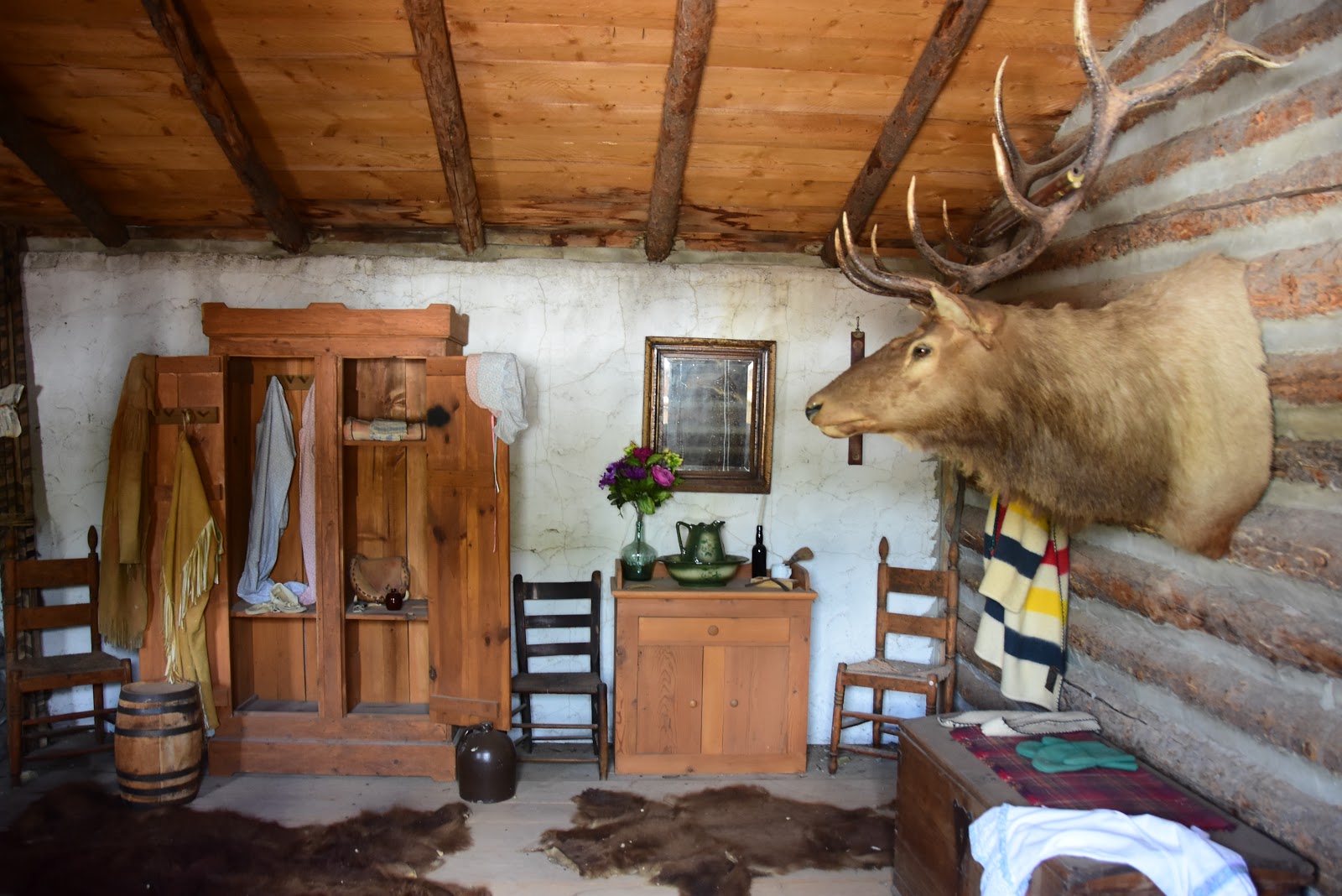
It turned out that the replica of Fort Hall exceeded all my expectations. The exterior of the structure was stuccoed adobe and the interior was made up of rough-timbered buildings, roofed with shake shingles. The north side of the Fort contained two-story buildings as well as a corner blockhouse. Low, single-story structures occupied the other three sides, including a blacksmith shop, a farrier, a meat-cutters shop, a leather shop, a carpenter shop, and sutlers store. The two-story section, which originally contained living quarters, was in use largely for museum displays. The museum display on the American Indians was especially nice.

But in order to save myself hours of transcribing for the blog, here's a condensed version of the history of the Fort I found at https://www.legendsofamerica.com/id-forthall/:
"The fur trading post of Fort Hall was founded by Nathaniel J. Wyeth, an opportunistic New England businessman who dreamed of exploiting the natural resources of the Oregon country. After an exploratory expedition in 1832-33, he returned the next year. Near the confluence of the Snake and Portneuf Rivers in southeastern Idaho, he built Fort Hall, a stockade of cottonwood logs with two blockhouses. But he found he could not compete with the powerful Hudson’s Bay Company, which the same year built a rival post, Old Fort Boise (Snake Fort), Idaho, 260 miles to the west at the confluence of the Boise and Snake Rivers."

"Occupying a prime location only 50 miles northeast of the point where the Oregon-California Trail forked to Oregon and California, Fort Hall in 1842-43 became a major way station and supply point for emigrants and travelers. Dr. Marcus Whitman, Reverend Henry H. Spalding, and Father Pierre Jean De Smet stopped there at various times. So did the explorer John C. Fremont in 1843, while probing the Far West. He recommended establishment of a permanent military post at the spot to supply emigrants and protect them from the Indians. The Army never acted on his proposal, but troops later frequently camped at the fur post site or its vicinity."

"A decline in trade and increasing Indian hostilities led the Hudson’s Bay Company to discontinue operations at Fort Hall sometime around 1856. For a few years itinerant traders sometimes lived in the crumbling buildings. In 1859-60 and 1863 Regulars and Oregon Volunteers camped there while patrolling the trail. A flood in the latter year destroyed much of the fort. During the 1860’s and 1870’s overland stage and mail lines used the site, a key road junction, as a base. So, too, did freighters hauling supplies to mining camps in Oregon, Washington, Idaho, and Montana."
"The fur post site is on the Fort Hall Indian Reservation. A small monument stands about 50 yards from the edge of American Falls Reservoir. The only surface remains are low earth mounds outlining the fort’s walls. Except for the waters of the reservoir, the natural scene is relatively unchanged. The sites of the nearby posts of Cantonment Loring and Camp Lander, often confused with Fort Hall, have not been ascertained."
"The old fort site is located in Bannock County, Idaho, just off an unimproved road, about 11 miles west of the town of Fort Hall. Though there are no remains at the original site of Fort Hall, a replica fort was built in Pocatello, Idaho in the 1960’s. The Fort Hall Replica is a reproduction of the original Hudson’s Bay Fort, based on plans obtained from the Hudson’s Bay Company and extensive research based on early descriptions of the Fort from persons who lived at or visited the Fort."

My intention after lunch was to find Interstate 86, which parallels the old Oregon Trail, and cruise that all the way across Idaho. As fate would have it, we almost immediately stumbled upon Route 86, moved left and took the turnoff, and were soon rolling west toward the far horizon. Before long we had found a nice stretch of farmland, full of potatoes we thought, and we pulled in had a nice quiet lunch. Concetta said that it would have been better if our lunch spot hadn't been right across the Interstate from a large fertilizer factory (bottom photo), but other than that, she had no complaints.
Tomorrow we'll be heading west, watching for the ubiquitous brown signs announcing points of interest for the Oregon Trail, and just generally enjoying the fabulous blue skies, fluffy clouds, and emerald-green fields of potatoes and alfalfa. Whatever we find, we're certain that it will be an exciting discovery. And if you decide that it's time to hit the road and visit places you've always wanted to see, we wish you exciting destinations and memorable travels from the Davises, the Happy Wanderers.

No comments:
Post a Comment