Saturday, September 28, 2019

Day 46 -- Blue Licks to Frankfort, Kentucky -- 103 Miles

Today was Bourbon day. In fact this whole month happens to be Bourbon month in Kentucky. Concetta and I set out from last night's camp in Blue Licks, site of an Indian attack that took the life of Daniel Boone's son, Israel in 1782, and we headed for the Bourbon Trail. Our plan was to visit two or three distilleries, buy some Christmas presents, and then look for a camp for the evening. Well it sounded like a good plan.

Unfortunately, we immediately discovered that we weren't the only ones looking to visit distilleries and stock up on the good stuff in late September. We found this out when we headed first for the Woodfords Distillery near Frankfort, Kentucky. All the tiny feeder roads that form the Bourbon Trail proper, and thereby connect the various bourbon-producing properties, were absolutely thronged with men and women riding bicycles. And these were not just any bike riders. No, these folks, who numbered just under a thousand souls we were told, were decked to the nines in multicolored touring togs and riding mega-dollar bikes.

The bikers were, as a whole, pretty well behaved as they coursed along the tiny Bourbon Trail tracks, but put twenty or thirty of them in any given distillery tasting room or gift shop, and the noise level rose to eardrum-damaging levels. Still, it was something to behold when you saw them in their colorful groups.

You might think that these marathon-riding bikers were all twenty-somethings in the prime of their mating-game years, but this wasn't always the case. We passed numerous riding helmets that covered decidedly gray heads as we navigated the skinny roads. These folks tended to be the most polite as they would signal us when it was safe to pass them.

Some of these roads on the Bourbon Trail could easily rival the ones in England for the International Skinny-Road award. More than once I had to pull the rig onto the almost non-existent grassy shoulder in order to let a car pass in the opposing lane. My mental tape measure told me that several of the roads we traveled this morning were about 1 1/2 times as wide as the rig, which made for some interesting situations when confronting oncoming trucks or tour buses.

Our first visit was to the Woodfords Distillery that Concetta had heard good things about. And in truth we were pretty impressed with the place. There was ample parking for the rig, there were shuttles from the parking lot to the visitor center, and there were tours leaving often enough to keep your wait to a minimum. All the employees were attentive, cheerful, and extremely friendly. And the merchandise was so attractively displayed that you couldn't help but load up your basket.

We didn't opt for the distillery tour since we'd been on production tours before and decided that Woodfords probably wouldn't be much different. After making our purchases, we did opt for eating our lunch in the rig in their parking lot, though we saw that lunch was available on the grounds if we wished.

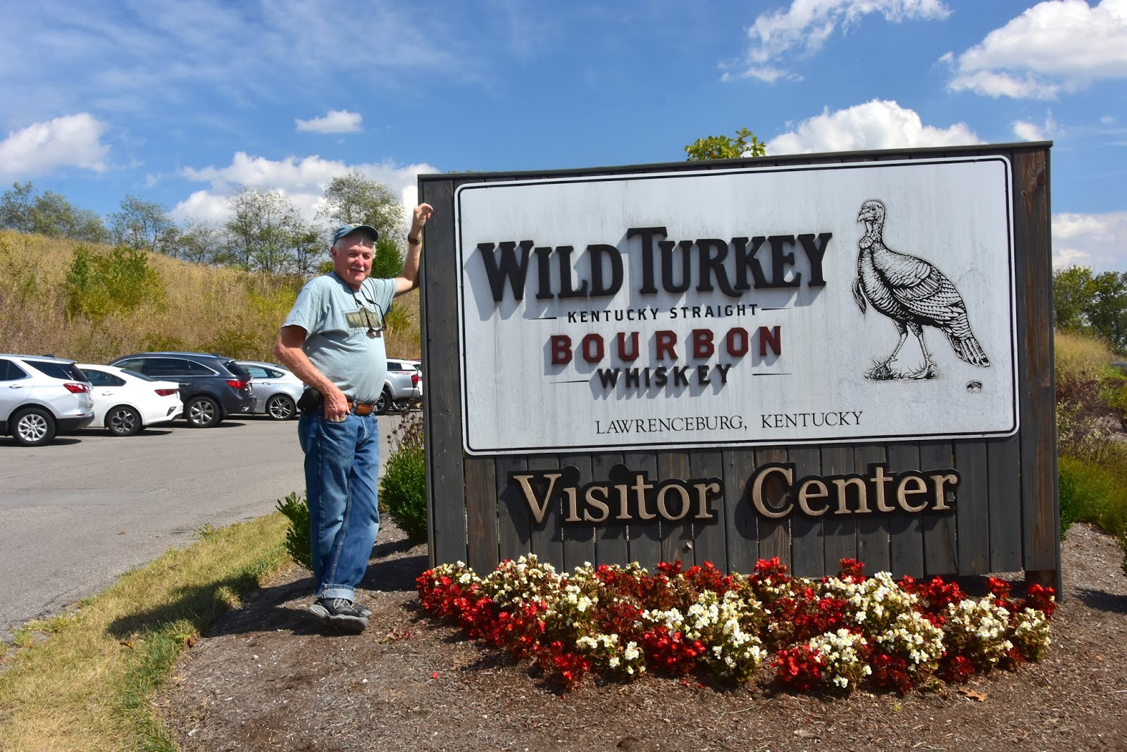
After leaving Woodfords we decided to visit the Wild Turkey Distillery that was located conveniently close by. Though the roads were once again ultra-narrow and were thronged with bikers, we managed to pick our way up the hill to Wild Turkey and found that they had been kind enough to provide us with level RV parking just a short distance away from the visitor center.

Part of the reason that we chose Wild Turkey, other than the proximity, was that Concetta had read that their grounds were wonderfully laid out and gorgeous. This didn't turn out to be the case unless you only got to see the beautiful stuff on the distillery tours. Perhaps it's the ultra hot and dry weather Kentucky has been having, but most of the landscaping appeared to us to be pretty parched and dead.

No matter, we headed inside and made a beeline for the gift shop to see what they were offering. Once we were totally confused by what we saw, we made the wise choice of going down to the tasting bar and asking the bartender to explain the various brands and offerings. This done, we chose two that we wanted to taste and ultimately purchase, and then took our glasses containing the "one finger" of bourbon out onto the patio to enjoy the sun, blue sky, and the loud and lively conversation of the bikers at the next table.

So far I haven't mentioned our efforts to find a camp for the night. The minute we arrived in Kentucky we discovered that the camps are jammed - all of them. Whereas up north the camps are starting to close because of the cold weather, camps here in Kentucky are still doing a brisk business. We thought we had nailed a spot around noon for a camp called the Kentucky River RV Resort, but they called us back a half hour later and said they'd made a mistake. They had no room. The next camp we called said they had no full hookups for the first day, but could give as a full hookup the second day. This deal we took and were glad to get it.

So right now were luxuriating inside with the air conditioner cranked up, and showers put off until tomorrow unless we want to visit the shower room here in the camp center. I took a walk over there and they don't look too bad, though they sure don't give you the space we saw at the Sandy Springs camp where you got a whole bathroom to yourself.

Tomorrow we're headed for the Buffalo Trace Distillery, which will probably be our last one here in Kentucky. By then we will have purchased all the spirits we want or intend to give away and should be ready to visit a historic site or two. I wouldn't mind going back to Boonesborough, especially if I get to throw a tomahawk again. Last time we were there a craftsman was selling a handmade example. It was pricey, but later I wished that I had purchased it.

So when you get out there on the two-lanes, don't forget Kentucky for all the fabulous things you'll find to do there. And when you do, The Happy Wanderers wish you happy travels and exciting destinations.

Friday, September 27, 2019

Day 45 -- Sandy Springs, Ohio to Blue Licks, Kentucky

We had so much excitement yesterday, including smacking the left-rear corner of the RV into a road embankment while exploring for cemeteries and discovering the grave in Rome, Ohio where three times great Grandfather, John Jones reposes, that we decided to take it easy today.

Taking it easy did not mean sitting in lawn chairs resting as one might envision. It meant visiting Walmart to stock up on a week's provisions, doing the laundry (Concetta), and replacing the smashed running light on the RV (Me). In between we needed to put a few miles on the rig before cocktail time so that someday we'd be able to arrive back in Nevada, hopefully before the snow flies.

Our camp last night in Sandy Springs, Ohio was truly outstanding. Though spaces did not come with a sewer connection, we used the dump station this morning, and it was easy to access and very easy to use. They even had a workable flush hose with a usable connection. Located as it is on the north bank of the Ohio, you couldn't find a more idyllic place to hang out for a day or a week or whatever. In fact, owner Anna told us that people often come intending to stay a day and end up staying much longer.

Since the season is largely over, and the weekend had not arrived, Anna told us to just put our rig wherever we saw an empty space. "Really," she told us, "take two spaces if you want." Anna was so nice to talk to that she ended up just visiting with us for quite some time. Her father was Italian, she told us, who came from the area of Naples. So she and Concetta had a lively talk on what we experienced in that part of Italy.

At one point Anna told me that there was yet another cemetery right across the road from her park just up from an old barn (photo right). "Really," I said. "I didn't see it on the way in."

"That's because you have to hike a trail through the forest to reach it," she said. "Come on, jump on the golf cart and I'll give you ride and show you where you start climbing."

I raced to put on my hiking boots, then grabbed the camera and we were off. It was a short ride to the spot across from the park's entrance. I jumped off and was about to cross the road to the trail head when Anna said, "you watch out for snakes now!"

I stopped short and turned around. Anna went on. "Now you need to especially watch out for a funny smell," she said. "Something like oranges or apples or strawberries -- something like that."

"Strawberries?" I said.

Anna seemed to ponder that idea for a bit. "Yeah," she said slowly. "I think it's one of those fruit smells. It means there's a copperhead nearby."

That got my attention and I'm sure my eyes widened a bit. "Copperheads," I repeated.

"Wait," Anna said laughing. "I know what it is. It's cucumbers. You smell cucumbers when copperheads are close."

"Okay," I said, "if I smell cucumbers I'll be careful." I turned to go.

"And you have to watch out for rattlesnakes." she called. "We have those, too."

I turned and waved and told her thanks a lot for the warning, then I headed across the road, past the old barn, and into the trees. I was sort of expecting a leisurely walk along a forest trail in the dappled afternoon sunlight, but almost immediately the trail launched into a solid 30 percent gradient that put my seventy-year-old leg muscles to the supreme test.

Fortunately, before long, I had managed to groan and wheeze my way to the top of a medium-sized hill and emerged into a clearing where the slanted rays of the sun illuminated about fifty grave stones in varying degrees of decay (Photo right).

The entire cemetery was largely dedicated to the McCall Family just as the marker on the trail's entrance predicted. But a few other names appeared as well. I photographed each one that was at all readable, even to the extent of assembling one marker that had cracked and the top half had fallen to the ground (Photo below left).

I'm sure few people feel as I do about these markers, but since I have dedicated a substantial part of my life to the pursuit of genealogical knowledge and understanding, it bothers me very much that the very last remnant of a human being's life often turns out to be an insubstantial marker that simply melts away over time. One hopes that there is somewhere a written record to mark the deceased person's passing, but you're never sure.

Too often the marker is made of marble, which is just a soft sedimentary rock and easily dissolves as the decades pelt it with wind and rain. Granite is a far better stone to use for grave markers, though if the engravings are not deep enough, they too become unreadable when a century or more has passed.

After spending a half hour with my silent friends, I retraced my steps back down to level of the street. This was no small feat since the leaves on the steep path were so darn slippery I nearly lost my footing a couple of times. After ending up sprawled in Stout Creek just an couple of hours before, I was trying really hard to be more careful and not repeat my earlier performance.

But I was telling you about the Sandy Springs camp. All the RV spots are widely separated from the next campsite and all have a variety of mature trees. Predominantly, the spaces appear to be anything but level, fore and aft, OR side to side. But with the usual trial and error system of using my wood block sets, I was able to mostly level us, though the front end was about six inches off the ground to do so.

I found the amenities to be pretty nice. They had enough shower rooms for six or seven people at a time. Each shower room was in effect a separate bathroom with sink, toilet, and shower in each room. In addition, there were ample tables and hooks and shelves to stow whatever gear you brought with you for your shower. Since we had no hookup for sewer, I took my shower in Room #1 and didn't have any difficulties at all.

In addition to the thirty or forty RV spaces of varying lengths, the owners had purchased used travel trailers to rent out to folks who just dropped in to do some hunting for a few days and wanted accommodations provided. Anna said that they had started naming the "Trailers for Rent" group for Goldilocks and the Three Bears, as well as Hansel and Grettel. But unfortunately Baby Bear had proved unsuitable for guests so they were at present minus one member of the Bear Family.

Though I didn't venture there, Anna said that they have a wide variety of groceries available in the main office for those who don't want to drive into town.

Bottom line, the Sand Springs RV Camp is a fine place to hang out for a few days next to one of America's most storied Rivers, the Ohio. In the process, you'll meet Anna and her husband and hear some fine tales of their life as a married couple of 51 years who spent much time driving long-haul trucks. The camp is quiet, the other guests are friendly to a fault, and you're about 100 miles from Cincinnati if you need a big city for some reason. I know we'll be back someday.

And when you venture into the back country along all those picturesque two-lanes, the Happy Wanderers wish you happy travels and exciting destinations.

Thursday, September 26, 2019

Day 44 -- Portsmough to Sandy Springs (and surroundings) -- 76 Miles

Today the search for a cemetery containing the man whom I consider my 3-times great grandfather, John Jones, and associated family members began in earnest. Yesterday's research at the Courthouse in the Adams county seat of West Union seemed to indicate that the various family names I'm looking for -- Jones, Tracy, Stout, and Baird -- were concentrated in the area of Rome, Ohio.

Yesterday, after being forced to detour away from Rome by road repair, we ended up in the town of Portsmouth about 27 miles to the east of our objective on Ohio Route 52. Today, being as how Rome was now on an accessible side of the road closure, we assumed we'd have better success in reaching Rome.

The first thing we did when we reached Rome was to turn north on the Blue Creek road, the route along which my new friend in Brush Creek, Ohio, Jim Richard, had promised me that I would find several early cemeteries. We met Jim yesterday when we pulled into his Brush Creek Ohio River Camp and Marina to have our lunch (photo below right). Once we had stopped, Jim came right over to see if we needed assistance. When we told him we just wanted to find a shady spot to eat our lunch, he welcomed us with a huge smile and open arms.

Naturally, while Concetta whipped up our sandwiches, I got into to a discussion with Jim about where I needed to go to find the cemeteries I hoped would contain the Jones Family. Jim laughed. "There are Joneses everywhere you look," he said. "My grandmother had twelve Joneses right next door."

Well now that didn't sound good. But then I got to thinking about how my great, great-grandfather, John Heath Preston Jones might have moved away, but the rest of his clan had perhaps stayed right in southern Ohio. That might mean perhaps thousands of folks with the Jones surname thereabouts. I told Jim that if that were so, I was probably related to most of them.

At any rate we drove and drove and drove up the Blue Creek Road until we finally decided that there was no way that anyone would be willing to haul bodies so far into the hills from Rome. At a spot where the narrow, twisty road encountered a dirt road from both the east and the west, I turned the rig around and started back toward the last village we passed, that of Squirrel Town. At Squirrel Town we parked in front of the fire station and we called Jim.

Once we had Jim on the phone he assured us that we were doing the right thing and we should just proceed up Blue Creek Road as we had been doing. So, we turned the rig around again and went back up the narrow winding road. But when we passed the two dirt roads, assuming that the "no trespassing" sign clearly meant what it said, we just kept going. When we got all the way to Route 125 on which we had just been driving the day before, we knew we had gone too far. We decided that just in case we'd keep going a bit more and see what turned up in the next few miles.

Nothing turned up, so we reversed direction at a convenient opportunity, and headed back towards Rome. As we once again approached the east/west Route 125, I spotted a crew working on a "submersible" bridge (one designed for water to flow over in times of flood) and I decided to stop. Immediately two of the young workers came over to talk to me. Both confirmed that there was a cemetery back up the way we had just had come.

Doubting that my ancestral relatives would be buried so far away from the Ohio River at Rome, we nevertheless reversed direction once again and soon pulled into the parking area for the Methodist Church at Blue Creek (photo above left). After turning down an invitation to a fried chicken lunch, I wandered among the tombstones and discovered a whole flock of Joneses. That was great, but they just didn't look like my particular branch of the Joneses.

After leaving the Methodist Church, which turned out to be the oldest Methodist Church in Ohio dating to 1787, we pulled into a vacant lot near the junction of Route 125 and the Blue Creek Road, and turned off the engine. It was time for lunch and time to do a bit of thinking about how we were going to achieve our objective.

Almost immediately a pickup truck bounced onto the vacant lot and pulled to a stop. A young driver got out and walked briskly over to our door. Anticipating his arrival, I stepped down and met him. His name was Raymond and he was the owner of the lot. I thought perhaps that he'd object to our presence, but once he found out that we were just stopping for lunch, he was more than happy to welcome us. And when he learned that we were looking for cemeteries, he was even happier to give us some advice.

Incredibly, the dirt roads that we had passed with all the "no trespassing" signs, each had cemeteries along their courses somewhere. Raymond didn't think we should plan on taking the RV out there, at least not all the way, but he thought we might be able to drive some distance in before having to turn around. "Then you'll have to do some walking to reach the graveyards," he said.

As it turned out, Raymond was spot on in his description. We drove the RV on both roads and though we couldn't get far, we did find cemeteries. Unfortunately, not the right cemeteries, though I did do some photos of grave stones I found interesting.

It was when we were driving the second of the dirt roads that we had a stroke of luck. Actually, our luck turned out to be both good and bad. The good was when we stopped to interview a young girl named Haley who was cutting the lawn at a private family cemetery. She told us about another cemetery we could visit just a little further down the road on which we were headed. During the course of that conversation, I told her about a cemetery named "The Point" which I thought was ultimately the one I needed to find. She didn't seem to know of that one, so we told her goodbye and we moved on to the cemetery she had mentioned.

The bad luck caught up with us at the next cemetery. The road was so narrow there that as I tried to turn around and head back, I smashed the driver's side running light on the rear of the coach and mangled a piece of trim when the rear end shoved up against the rocky bank. But after we had photographed the cemetery there, and saw that no ancestors were to be found, we started back down the dirt road toward the junction with Blue Creek Road.

When Haley once more came into view where she had been working, we could see that she seemed to be waiting for us. As we pulled up and stopped she came over to my window. "You know," Haley said, "I've been thinking about that cemetery you mentioned called The Point, and I think I actually know where that is. If you want," she went on, "you can follow me down toward Rome and I'll take you to where you can park. You'll have to walk in from the highway since there isn't a road there."

And that's what we did. We followed Haley's Jeep and her lawn mower trailer down the twisty road until she pulled up in front of a red barn just east of the road and stopped. She walked back to my window and told us we could park in front of the barn since the owner was old and seldom came outside anymore. Then she pointed off to the west toward a stand of trees. "Cross that field, and ford the creek over there. After that, climb the hill and you should see the cemetery up there. You can get there from the West Fork road we passed, but it's kinda steep getting down to the cemetery."

With that she waved and headed back to her jeep and mower. And then she was gone and I drove the RV as far as I could off the highway in front of the farmer's barn, then shut off the engine. Moments later Haley reappeared headed back the way she had come. She whizzed by us with a smile and a wave. I couldn't help but marvel at how she'd helped us.

Shouldering my camera, I headed off through the tall grass in the direction Haley had indicated. This is where a touch more bad luck reemerged. Once I had cleared the small field and reached the creek, I immediately saw that the stream was not deep, perhaps two to three inches of water, but there were darn few stones on which to make a "dry" crossing. With a shrug, I started tiptoeing across the larger rocks until I reached a much bigger rock on which I hoped to launch a jump to the far bank. But as I put my weight on the large rock, my shoe slipped completely on what was probably moss, and I fell flat out into the stream, the camera splashing down beside me.

Fortunately, after a few moments I determined that neither I nor the camera had suffered any noticeable damages, I was soon on my feet and sloshing toward the far bank. I had gotten pretty muddy and wet, but it was a hot day and my clothes soon dried. The camera was dripping, too, but my handkerchief took care of that. Soon I was bushwhacking through more tall grass and eventually came into a huge meadow of mowed grass. Looking around, I saw absolutely nothing but meadow and a ring of surrounding trees in the far distance. The whole space comprised perhaps 30 or 40 acres.

As far as the eye could see there was nature in all it's magnificent glory. There was just one problem: there was NO cemetery. But I firmly believed in Haley, and so I just kept walking. At length I noticed that above me to the north seemed to be some kind of bench or plateau. Assuming that I would find the cemetery there, I moved in that direction. Persistence rewarded me, for as I rounded a stand of trees after climbing to the height of the bench, there was the cemetery, just as Haley had described.

I spent a good quarter hour strolling among the stones before I came upon my three times great grandfather and his wife at the very back of the grounds. John Jones and his "consort" Sabra lay right in the center among other stones for more distant family and I carefully photographed them. Finally, after a full day of searching I had found the cemetery for which I had been looking.

After I got back to the truck, Concetta told me that a couple of different people had stopped and asked if they could help, assuming she'd broken down. One guy even had a tow truck. How amazing. We'd been invited to lunch by the Methodist congregation, we'd been helped on our quest by numerous Ohioans, we'd been led down the hill by a youngster willing to drive out of her way to make sure we arrived at our destination, and we'd been offered help by passing strangers. Ohio is just a marvelous place in America to be right now, we decided.

So tonight we're camped just a short distance from the town of Rome in the tiny hamlet of Sandy Springs. Our hosts are not Ohioans, but North Dakotan transplants. Still the owner went out of her way to make us feel welcome, even to the point of driving me in her golf cart to the entrance of a small trail that coursed up a nearby hill to another family cemetery. We have a tranquil spot beside the Ohio River for our camp, a nearby Kentucky rail line to lull us to sleep tonight with mournful train whistles, and the mighty Ohio River to fire our imaginations as we think of all the places yet to explore.

And when you set out on the two-lanes to find our ancestors or just have fun, The Happy Wanderers wish you happy travels and exciting destinations.

Wednesday, September 25, 2019

Day 43 -- Rocky Fork Lake to Portsmouth, Ohio -- 116 Miles

Our sole purpose today was to travel further south in the state of Ohio until we came to the town of Rome. Rome is situated, at least on old maps, right on the north bank of the mighty Ohio River and was the closest town I could find to where my Jones ancestors might have lived after the War of 1812.

Actually, the Jones family might actually have moved to Ohio slightly sooner than 1812, but since my great, great-grandfather, John Heath Preston Jones, was born in 1811 in Louisville, Kentucky, and not in Ohio, the timing would have been pretty close to the outbreak of the war.

I'm making a few presumptions here as the only concrete piece of data I possess is the birth of John Jones in Louisville. I don't know who he considered his father and mother. I don't know who his siblings were for sure. There just isn't any information that I have been able to turn up that even hazards a guess about these things.

However, using my own deductive reasoning, I decided that the father of John Heath Preston Jones is a man who seems to have lived in the state of Kentucky around the right year, and also seems to have been married around the right year to make the birth of JHP Jones occur in 1811. This man was named Price Jones and may have been the son of one John Jones who also lived in Kentucky for a time.

One of the clues I used to suggest Price as John's father is the standard "naming convention" of the day that decreed that the father's first born son be named after his father. Checking the record, we see that John Heath Preston Jones' first born son was indeed called "Price."

Since census documents before 1850 do not name everyone in the household, I am unable to verify that JHP Jones is living with Price Jones in Ohio after 1811. But Price is certainly living in Green Township, Adams County, Ohio by the time of the 1830 census, and a host of other Jones family members are listed separately there also. I believe all the other Jones family members are brothers of Price. Their names are Noah, Milton, Ephraim, William, and James.

The most telling piece of evidence that I have found is that John Heath Preston Jones is living in the same neighborhood as Price and the other Jones family members in 1840, just after he marries Julia Ann Adams. He's going by the name Preston Jones at the time.

I didn't quite have enough time to pound this out this evening since I spent so much time sitting and enjoying the vista of the Ohio River just a hundred or so feet from our camp. Will add more later.

Tuesday, September 24, 2019

Day 42 -- Delaware to Rocky Fork Lake, Ohio -- 125 Miles

Last night's camp was an extraordinarily well-tended camp with paved access roads, small patios for every rig, and a propane filling station for the seasoned traveler (photo left). It was also one of those camps that has everything a family with kids would love, from a swimming pool, to a miniature golf course. The only thing it didn't have was a low price. We paid $53.00 with the Good Sam discount. It would have been close to sixty without the card.

Tonight we're in a camp called Rocky Fork for it's proximity to Rocky Fork Lake (photo below right). Once again the camp sites are wonderful. The access roads are paved as are all the sites. There is a beautiful lake just 150 feet from our door, a camp store 150 feet in the other direction, and the whole works is surrounded by acres of greenery.

The very best thing I discovered when I checked into our camp site was a full-fledged ice cream parlor just waiting for me to select my favorite salted caramel truffle ice cream. Life is certainly good when that happens.

Today we continued our meander southwest from Akron, Ohio on Route 42. For the most part, we rolled along through field after field of either soy beans or corn. Both these plants are beginning to show signs of frost damage, indicating that the growing season is finally over and fall has arrived.

The very best thing about meandering along the two-lane farm roads in central Ohio is all the tiny towns that you get to see. Some of the town names we saw were: "New California," "Plain City," "London," "South Charleston," "Washington Court House," "Jeffersonville, and "Boston." We even remember passing signs for "Lexington and Concord," though I can find neither on the map this evening. But if you like vintage architecture as we do, you will definitely find some fabulous Victorian houses and commercial buildings on all these rural roads as you pass through these historically-named towns, some of which date to the early 19th century.

People who like vintage commercial buildings often like structures connected with the beginnings of the automobile culture. I found a super example of a Pure Oil Company gas station in the town of South Charleston, Ohio. I looked up the history of the Pure company filling stations. According to Wikipedia: "the Pure Oil Company was an American petroleum company founded in 1914 and sold to what is now Union Oil Company of California in 1965."

Pure Oil Producing Co. was incorporated in 1902. In 1904 a refinery was built on the Delaware River which received 600 barrels per day (95 m3/d) from the United States Pipe Line. This increased to 1,800 barrels per day by 1906."

"Beman Gates Dawes and his brothers, whose Columbus-based Ohio Cities Gas Company had begun in 1914, made an offer of $24.50 a share for the company. Dawes was building an Oklahoma refinery, and Pure Oil had production capabilities there which would benefit his company. The Pennsylvania company accepted the offer and made $22 million in profit on the sale."

"In 1920, Ohio Cities Gas Company's name changed to Pure Oil. In 1926, the headquarters moved to Chicago. Refineries were located in Ohio, West Virginia, Oklahoma, and Texas. A Pure Oil Gas Station, built in 1933 and located at Saratoga Springs, New York, was listed on the National Register of Historic Places in 1978."

It's these 1930ish Pure Oil Company gas stations, constructed to look like small English cottages, that draw the most attention. While I have seen a few of these this summer on our travels, today was the first time that I could conveniently -- and safely -- stop and photograph one.

Fortunately, many old filling stations have gone through some adaptive reuse and have emerged from lying vacant for years to become flower shops, ice cream parlors, real estate offices, and a host of other "cottage" businesses to ultimately survive the bulldozer's blade.

Though the Pure station seen here is vacant and disused, I have high hopes that someone will come along and save this excellent example so that it may serve the public for another few decades.

Tomorrow we plan to continue our southward sojourn towards Adams County on the Ohio River. It has been my contention for a few years that my great, great grandfather, John Heath Preston Jones, lived in Adams County for a time because his father and brothers had settled there. I have no proof that these folks with the name of Jones are related to me. At present it's just a strong hunch. Perhaps when I pay Greene Township, Adams County, Ohio a visit tomorrow or the next day, I will come away with additional information that will help me solve this mystery. After all, I found three generations of the Davis family in Akron's Glendale cemetery. Maybe my luck will hold.

So if you see us out on the two-lanes, be sure and wave cuz The Happy Wanderers are wishing you happy travels and exciting destinations.

Monday, September 23, 2019

Day 41 -- Mogadore to Delaware, Ohio -- 144 Miles

It rained this morning to inaugurate our first travel day in 11 days and promised to do so all day long. But as fate would have it, the rain lasted only long enough to accompany Collin Martin and me to the rental car agency and back. Taking the car back was the final thing we had to do before Concetta and I hit the road. I had already pumped the tanks, put away all the cords and hoses, and stowed all the gear but the drive-up blocks.

Concetta and I had spent the last 11 days pursuing a whirlwind agenda of eating, drinking, visiting, and party-going -- everything that goes with seeing people you only see a couple of times a decade. The first thing we had to do was attend her 60th class reunion, which turned out to be wonderfully great fun. Concetta got to talk to a large number of high school friends whom she seldom sees, and I got to chat with and make friends with quite a few people I'd never met before as I wandered the room taking photos. Later I would post the better part of 125 photos to the reunion Facebook page which made quite a hit.

The other major activity in which we were slated to take part was the wedding of Concetta's sister Phyllis' grandson, Trent, and his fiance, Callie. But this was not to take place until the very end of our stay in the Mogadore, Ohio area.

In between these two events, Concetta spent much of her time with her sister Phyllis baking cookies for the wedding and catching up on family events. This left Yours Truly to find activities to occupy my time.

One of my plans was to meet with a long-time buddy of mine who once lived in Carson City but recently moved to the Cleveland, Ohio area. An equally important plan was to try and locate my great grandfather, George Davis, who was supposed to have died and been buried in Akron. Since I only knew of one cemetery in Akron, I headed downtown to the Eastside Cemetery on Market Street.

When I arrived at the cemetery, I found that no one was in the office so I could not find out where, if anywhere, George and his wife were buried. So, I did the next best thing: I began walking back and forth among the tombstones

After about an hour, and three trips across the grounds north to south, I was about to give up. But something told me to make one more circuit just slightly to the east of my first path. Incredibly enough, about halfway down I stumbled over a tombstone that seemed familiar. It wasn't of great-grandfather George, but was Charles and Bessie Davis. A little voice in my head told me that Charles was my grandfather's brother, and I immediately set about taking photos.

Before I left the cemetery, I happened into a piece of good luck when I met the son of the original managers of the grounds, and he agreed to wade into the horribly antiquated computer system in the office and tell me if George and his wife were present there.

After about twenty minutes of futile searching, the son told me that it appeared they only had two George Davis plots, and neither one appeared to be my great grandfather. But he told me to come back on a Monday, Wednesday, or Friday, and the regular secretary might be able to discern something more from the records. I wasn't totally successful, but I sure wasn't a failure as Charles and Bessie Davis did, in fact, turn out to be my relatives.

The next time I appeared at the Eastside Cemetery the secretary was working. Her name was Wendy, and it was an easy task for her to determine that the man I had met on my previous visit had been correct. No other Davis family members appeared to be buried in Eastside. But before I left, Wendy gave me a very crucial suggestion. She said, "Why don't you go check at the Glendale Cemetery" on West Market Street near Saint Vincent's Church.

Without further ado, I jumped into the rental car and raced right over there. Wendy said they probably wouldn't help me without an appointment, but as it turned out, the young lady in the Glendale office, Jen, was more than eager to assist me. Almost immediately she found George Davis and his wife, Isabella Brown.

But as I eagerly jumped from the car and dashed over to pace back and forth in the area Jen had indicated George and Isabelle were supposedly buried, I couldn't find them. After a few minutes I began to get discouraged. That's when fate stepped in and rescued me. Suddenly there was Isabella right at my feet. The stone was small, easy to walk right by, and the inscription was down near grass level. And then I grew puzzled. I could see Isabella, but George was missing. In his place was someone named Jennie Chapman.

And then I stopped short. Isabella died in 1899 according to the stone, and I had already researched and discovered that George didn't die until 1937. Maybe he was never buried next to Isabella. AND THEN I remembered that George was married again in 1910 to a Louise Bockstedt. I realized then that there was a distinct possibility that George was buried somewhere else, even in a different city or state.

I took a step back and studied the rather poor, makeshift stone for Jennie Chapman. "Jennie," "Jennie," I repeated to myself. Then it came to me. My Grandfather, Thomas Davis, had a sister named Jennie. With a start I realized that not only was George probably not buried next to his first wife, but George and Isabella's daughter Jennie had probably been interred in the spot that had once belonged to George. That would explain why the cemetery record showed both Isabella AND George's names on the plot.

And that's when I made a major discovery. While I was busy taking photographs of the two stones that had initially evaded my search, I suddenly looked up and noticed a huge granite marker with the name "Brown" on it. As I've said, Isabella's maiden name was Brown. Realizing that I had made a significant discovery, I began to explore around the Brown Family plot marker.

Almost immediately I came upon the stones for my great, great grandparents, William and Hannah Brown. Mere minutes before I had no idea if my relatives would prove to be present at the Glendale Cemetery, and NOW I had discovered not one, not two, but THREE generations of my family tree. To say I was completely awestruck and humbled would be a huge understatement.

At this point I knew that George probably wanted to be buried next to his second wife rather than to his first wife. Now all I had to do was find George and his second wife. I dashed back down the hill to the office and burst in to give Jen the news. I was hoping that she would be able to tell me if a George and Louise Davis were located somewhere on the grounds. Unfortunately, she was busy then and was not able to help me answer that question. So, I left Jen my card, and I hope she will do the research when she has the time and let me know. If you're reading this Jen, I can't thank you enough for your kind and considerate assistance. You and grounds-keeper, Raymond, really made my day.

Aside from looking up dead relatives, I spent a lot of time in other pleasurable activities. One of those was getting together with my buddy, Tennessee Don, who had recently moved from Carson City to the wilds of Ohio near Cleveland. Don drove down, and we made a beeline for the tiny town of Hartville where I knew a flea market was in progress and also had a darn fine restaurant for our lunch.

The restaurant was needed because I was overdue buying Tennessee Don his traditional lunch for his birthday. It's become somewhat difficult to pull off now that he lives over two thousand miles away from Nevada.

At any rate, we had a great time prowling the flea market where I scored a new leather belt, a couple of vintage tools, and -- thanks to Don -- a very fine mortising chisel for my collection. Our lunch was great, and we had great time reminiscing. I even had a wonderful piece of coconut-cream pie, though I was unable to coax Don into sampling their birthday cakes.

Later in the week, I got to attend the Hartville flea market again, this time with nephew, Mike Morris. This time the flea market was wonderfully large and crowded, and had all the stuff I love. I ended up with several tools, include two vintage tire irons, and a 1929 Ohio license plate to decorate my garden shed back home.

What with all the mileage we were putting on the rental car, it was proving to be a very essential asset to us. One of the functions we attended was the wedding rehearsal dinner that took place in a cozy room above a supermarket known as the "Mustard Seed." There we got together with all the relatives, as well as as the young members of the wedding party. The food, both hors d' oeuvers and the dinner course, were absolutely excellent. In addition, we discovered a new Cabernet labeled "Katherine" that we just adored and intend to try and find in Nevada.

A few nights later, we attended Trent and Callie's wedding which was fun and took place on a hillside under the spreading trees. Later, we all walked a short distance away for the reception which afforded us another great selection of hors d' oeuvers and main course entrees to please anyone's tastes. Plus, father of the groom, Marc Morris, sprang for a hosted bar that seemed to please everyone. Trent and Callie made a cute couple, and we're sure they're destined for many happy years together.

And that's about it for our stay in Mogadore, Ohio. We got to spend some really quality time with all of our relatives, including one night out to karaoke with Collin, Phyl, John and Pam Montisano, Fred and Izzy Paonessa, and drinks later at John and Pam's house, We also had a night out with Collin and Phyl for fine dining, and a couple of get-togethers at Phyl and Collin's house for football and snacks. Definitely, a great time was always had by all.

In addition to those present for most of our stay, cousins Chuck and Toni and Concetta's sister Paula and husband Rick came for the wedding. Also, we spent much time with nephew Mike and Amy Morris, and nephew Marc and Nancy Morris. It certainly was with a heavy heart that we had to leave all those marvelous people and begin our trip back to Nevada.

But begin we did this morning after Collin Martin delivered me back from the rental car agency, and we broke camp and headed south on Route 43, the road that ran right by our camp called "Countryside." The camp was really marvelous and we have already determined to return as soon as we can.

Our plans today were pretty simple. We wanted to travel south on Route 43 until it intersected the Lincoln Highway. When we had gained the Lincoln Highway, we planned to travel that route all the way to Ohio Route 42 where we would turn south once again. Along the way we hoped to visit the Johnny Appleseed historic site. But when we got there, the gates were locked and it appeared to be closed. I was unable to reach the park by phone. Hopefully next time we'll be more lucky.

Aside from leaving some of our Nevada Lincoln Highway chapter brochures at the Chamber of Commerce office in the Lincoln Highway town of Wooster, we mostly just enjoyed the wonderful scenery along our rural route of travel. The weather was sunny with big fluffy clouds, and we had a fine time just cruising the two-lanes, appreciating all the 19th century architecture, and keeping an eye out for the ubiquitous junk shop full of rusty tools. Much luck on the first two, none on the third. But tomorrow is another day.

And when you head out on the two lanes, the Happy Wanderers wish you happy travels and exciting destinations!

Thursday, September 12, 2019

Day 30 -- Westerville to Mogadore, Ohio -- 126 Miles

Blog entries suspended while we visit with relatives in Ohio.

Wednesday, September 11, 2019

Day 29 -- New Perris to Westerville, Ohio --142 Miles

There's a rather sad fact that Concetta and I have found to be true as we visit scores of camps throughout the United States. Many, and often MOST of the camp spaces are spoken for long before we ever roll through the front gate. These spaces are not spoken for by folks on the road like us. No, the spaces have been placed in perpetual reserved status by the camp owners to accommodate weekend camping warriors who drive out from the city to spend a few hours in their rig that never moves, then return home to do the nine to five once more. The rigs never move and are always available to their owners. The checks come in to the camp owners. And everyone is happy.

Naturally, these aren't the only folks who end up reserving a camp spot for an entire year. In some camps folks down on their luck, who have been forced to live in their RV for economic reasons, can be found in many of the camps. You can tell these camps right away, as they often allow their permanent residents to have all kinds of flotsam and jetsam to be piled around the tenant's rigs. So these campsites will have multiple cars, a group of old propane cylinders, a motorcycle or two, ladders, sheds, container gardens and, well, you name it.

The camps that cater to working class, homeless folks, are not bad if they manage to reserve a few sites for travelers, but sometimes those sites are really in the minority. We were in one camp in Washington state that had only two sites in the whole camp for over-nighters. Normally everyone is very cordial, and we've never had any problems staying in them. We are certainly sympathetic with the homeless, and realize that they have to live somewhere.

No, our major source of irritation are the camps that cater to the folks who simply don't want to be bothered with the uncertainty of driving out to the country to find a camp, doing all the setup when they find one, and then repacking everything when they want to come home two days later. Those folks pay a yearly fee, reserve the nicest spots on the grounds -- usually those with trees -- and don't actually inhabit the RV for more than two dozen nights a year. Good business for the camp owner, but not so nice for those of us on the road who need campsites.

Such a camp provided our accommodations last night. It was quite a big deal for us to find this particular camp, way out as it was amidst the corn fields and soy bean acres. But when we finally found it down a series of tiny farm roads and country lanes northwest of Dayton, Ohio, it turned out to be well worth the trouble. The camp was absolutely immaculate. In fact, it actually looked more like a prototype mock-up of a camp than a real camp; like we had entered the Twilight Zone and had stumbled onto someone's architectural drafting board.

The roads and RV spots were all graveled perfectly, and all campsites camp with a concrete patio. Each camp was separated by well-tended grass, most had steel barbecue rings, small trees, and picnic tables. Each camp space came with not one, not two, but three sewer connections along with the usual water and electric. This would allow one to effortlessly hook up the sewer line wherever it was located on the RV, back, front, or middle.

When we explored the laundry room, it was clean, air conditioned, and the machines didn't need much cleaning themselves. We made full use of these during much of our stay.

The manager was completely accommodating. He helped us get settled, gave us advice on where exactly to park the rig, and even provided two rolls of quarters for our laundry needs.

It was only after we'd been in camp for a few hours that I began to notice something was wrong. There were almost no other campers present. I did see perhaps two people by evening-time. And I saw a couple more this morning. But there was NO hustle. There was NO bustle. There were no sounds of folks having alcohol-induced fun, no one building campfires with noxious smoke to come in our windows, and no boisterous children riding to and fro on their bikes and shouting at each other.

Don't get me wrong, we didn't actually miss most of the aforementioned things. But when they're totally absent it's eerie in the extreme. So I went and asked the manager what percentage of his campsites were occupied by absentee campers. More than ninety-eight percent, he said. That's where the money is. Most people are gone now, he went on, because their kids are back in school. They only come up on the odd weekend and holiday. So that's why we didn't have to fight anyone for the two washing machines. There was just no one else who had desires on them.

So this morning I wandered around with the camera taking photos of the lifeless camp. No noises came from any of the RVs I passed. No one was down at the picnic shelter. No one could be seen sitting on their patio drinking their morning coffee. No one out pumping their black and gray tanks. No one shaking out a rug or two. Just me, my camera, and a whole lot of scenery.

But there is a positive note to this story. They do reserve something like eleven spots for overnight guests. So don't be put off by my description of the place. Just look at the photos and realize that this camp was perhaps in the top five of beautiful camps we've ever seen.

We stayed in camp this morning in a futile attempt to wash a bathroom rug and a bunch of towels that just never dried. Finally, about 11:30 a.m. we gave up and left, with all the offending towels and rug laid out around the coach on whatever flat surfaces we could find. Our hope for the day was to travel east, but not on Interstate 70 which would have been easiest, but on Route 40, better known as the National Road.

From the web I learned that: "the National Road (also known as the Cumberland Road) was the first major improved highway in the United States built by the federal government. Established between 1811 and 1837, the 620-mile road connected the Potomac and Ohio Rivers and was a main transport path to the West for thousands of settlers. When rebuilt in the 1830s, it became the second U.S. road surfaced with the macadam process pioneered by Scotsman John Loudon McAdam."

"Construction began heading west in 1811 at Cumberland, Maryland, on the Potomac River. After the Financial Panic of 1837 and the resulting economic depression, congressional funding ran dry and construction was stopped at Vandalia, Illinois, the then capital of the Illinois, 63 miles northeast of St. Louis across the Mississippi River."

"The road has also been referred to as the Cumberland Turnpike, the Cumberland–Brownsville Turnpike (or Road or Pike), the Cumberland Pike, the National Pike, and the National Turnpike."

"Today, much of the alignment is followed by U.S. Route 40, with various portions bearing the Alternate U.S. Route 40 designation, or various state-road numbers (such as Maryland Route 144 for several sections between Baltimore and Cumberland)."

"In 2002, the full road, including extensions east to Baltimore and west to St. Louis, was designated the Historic National Road, an All-American Road."

I don't think we've ever been on the National Road before and it sure sounded like a wonderful thing to do. It was also easy to find since it parallels Interstate 70 for many miles. In fact, at times you can look over and see the traffic-choked Interstate just a mile north of our travel route. We really enjoyed seeing all the tiny towns and verdant fields that hugged the old road. It was obvious that being bypassed by the Interstate had been a blow to the villages through which we passed, but I'm sure there were some positive effects as well. Economically it was a disaster. But the quality of life must have improved measurably with the lack noisy traffic day and night.

Though I neglected to take a photo of the place, we passed a junk shop in one of the tiny towns on the National Road that appeared to be just what I needed in my quest for the missing part to my blacksmith vise. I pulled in at a church just a few doors past the junk shop, then walked back to find my quarry. There I met ol' Bill Reece, a gentleman perhaps in his early to mid eighties, who obviously loved junk just as much as I do. He had boxes and drawers and shelf units and bins and trays full of tools and hardware. And there was worlds of tools and hardware just lying around loose. I thought for sure that Bill would have my part.

But the more I looked the more I realized that I would have to spend a full day with Bill, maybe even several days to look through all his treasures. To make matters worse, Bill told me that he really didn't know what part I was describing and might never have seen one. So, after twenty minutes of looking, I selected a very nice ball-peen hammer that was so tight and lovingly maintained, I just couldn't leave it there. Bill tried to talk me into buying a larger one that he thought was a better buy, but I insisted on the small one. The one I chose was at least seventy years old, perhaps older, and had never been abused in any way. It just cried out to be added to my collection.

In the end I left my card with Bill since he said he had customers who were blacksmiths, and I hope he contacts me some day. He probably won't. He has no email address on his card, which means he's not computer literate. It was a nice try, but I suspect I'll have to keep looking.

The early part of the day was progressing so pleasantly, that it came as a real shock when we determined that there were no camps in front of us, and the only good camp was one we passed in Springfield, Ohio, about twenty miles behind us. This bit of bad luck resulted in our being immersed into rush hour traffic in Columbus, Ohio. But we had to get to the far northeast side of town to the only camp we could find on our GPS. To make matters worse, the GPS ordered us to leave Interstate 70 and go north on Route 270 at exit number 93B. As we neared exit 93, I could see that exit 93 promised to take us to Route 270. But it wasn't 93B, just 93. So we stupidly sailed right on by Exit 93, which immediately plunged us into the center of Columbus and a true traffic nightmare. We had gone from the most idyllic road conditions imaginable on the National Road, to the worst of the worst conditions in the center of a busy city at 4:00 p.m.

But after doing our penance in bumper-to-bumper traffic for a good hour, we finally emerged from the nightmare and got off the offensive Interstates and onto some beautiful rural roads. We always feel more at home there, and we soon followed our GPS directions right to a very pretty little camp called "Tree Haven." Tree Haven probably has just as many reserved sites as last night's camp, but our next door neighbors are in residence, the manager was a delightful lady, the price was really low, and we have a magnificent view of the surrounding farm fields any time we want it. I enjoyed my cocktail out on the lanai with some cheese an crackers, and not a single mosquito landed on me, though Concetta said she saw one.

Tomorrow we're headed to Akron, Ohio, and what promises to be our camp for the next 10 days or so. We have a class reunion to attend at one end of our stay, and a wedding to attend at the other. Aside from that, I'm not at all sure what we'll be doing to amuse ourselves. Interstate 71 goes practically right to Akron's front door, but we won't be traveling on that one. There is a tiny road called Route 3 that I have my eye one. Hopefully we will be able to meander up that tiny rural avenue, enjoying the surrounding countryside, and won't have a bit of high blood pressure when we arrive tomorrow afternoon.

And when you venture out on the two-lanes, we hope you avoid the Interstates, take advantage of the beautiful rural roads in this country, and savor every meandering mile of your trip. While you're out there, the Happy Wanderers wish you happy travels and exciting destinations.

Tuesday, September 10, 2019

Day 28 -- Big Sandy to New Perris, Ohio -- 187 Miles

You're probably wondering why we go to some of these places like Big Sandy or New Perris, Ohio. "Never heard of those places," you say. The truth would be somewhere between, "we just wanted to explore that particular road and we happened to stumble over a camp there," and "that was the first camp displayed by the GPS." But whatever the reason we stop and camp anywhere has a lot to do with the things we like to see, which is anything historic." If there's a historic site nearby like a Fort, or an archaeological site, or perhaps even just a statue of someone like General Custer, we'll be more likely to choose it as our nightly campsite.

Take last night for instance. Concetta and I were headed south into Ohio from the southern Michigan border when we read that our intended route would take us near the Fallen Timbers battlefield site of 1794. Since we didn't know anything about that particular battle, we decided to take a look. Then, after touring the battlefield, we just looked for the campground nearest our location. The fact that the battlefield site was out in the middle of nowhere didn't enter into the equation.

Too bad we didn't find a better camp to spend our money. Though the rent was fairly cheap, and the park owners wonderfully accommodating, their camp was a tad on the rundown side. The first thing we learned was that there were no full hookups available for single-night patrons. Okay, we said, since it was getting pretty late in the afternoon by then, we'll take it. I checked the showers out and they looked pretty good, so we didn't think we'd be inconvenienced by no sewer connection.

I set up the rig pretty quickly, since the ground was mostly level and no drive-up blocks were needed. I connected the water and the electrical cord and then went off to take my shower. But just after I returned to the rig, another RV showed up and backed in behind us. When they plugged their rig into the same electrical tree as we were using, the circuit went into overload and knocked us off. The readout said, "Missing Ground." Not wanting to make a big deal out of the problem, but not wanting to ruin our electrical system, I just broke out my extra-long electrical extension cable, and we were able to plug into the empty camp next door. Why the newcomers didn't plug in there in the first place we'll never know.

As it was getting dark, I began to worry about our cord stretched forty feet away into the next camp. What if someone shows up late and pulls in there and runs over our cord. So, I went out in the dark and disconnected the cord, packed it all away, and for the rest of the night we had no shore power. I didn't think we'd have any additional problems, but then as I was going to sleep, I realized that without power there would be no coffee for breakfast in the morning. Fortunately, I realized that all I had to do was hook up the 110 volt power in the morning and we'd have coffee without plugging in the 30-amp cable.

Our main reason for heading into southwest Ohio, before doubling back to Akron for the class reunion and wedding we planned to attend, was more Model A Ford parts. Some time ago I had ordered a couple of replacement parts for some severely rusted out parts on the 1929 sedan I'm building. But when the parts arrived, I realized that they weren't correct for my car. When I called the vendor he told me that I should send them back, and he'd send new ones. But when I learned that he was in southwestern Ohio, I hatched a scheme to return the parts in person and pick up the new ones. That way there would be no postage due.

And that's what we did today. First we contacted the seller of the part and he told us he couldn't possibly have the replacement parts until two days hence because he still had to pick up the parts at the manufacturer about twenty miles away. I'm sure my eyes got much wider at that point. But thinking fast I told the seller that I'd be happy to pick up the part at the manufacturer, and then come to his location and make the swap. Fortunately, he agreed to allow me to make the pickup. He agreed to call the manufacturer and ask them to get the parts ready for pickup. This is where the story gets interesting.

After I had hung up with the seller, I began to question in my own mind just why he decided to trust me to pick up a part for which I hadn't paid, and then bring it to his location to give him my incorrect part plus the difference in cash. He'd never met me, but had only corresponded with me by email and phone. Oh, well, wondering if he would soon be on the phone to alter the deal, we set off for our destination, the famous sheetmetal manufacturer of vintage automobile replacement parts, Brookfield.

Once Concetta and the GPS had navigated us to the manufacturer's location, I went inside to find that the seller's contact there, Pete, had not gotten the parts ready for pickup. But no matter, I had a good time looking around the showroom while he disappeared for a moment before returning with the two cowl panel sides that I needed. It was in the process of getting these parts and talking about my project with Pete, that he revealed that he had some leftover parts to a 1929 Model A tudor sedan that he once owned. Among other things, he had the rear seats!

I got really excited as I already had purchased the front seats, and we had picked them up a couple of weeks ago in Minneapolis. Now I was being offered the rear seats for the same model car! "Would you ship them?" I asked Pete, and he said sure. So we struck a deal for a hundred dollars for the two seats and I gave him fifty for shipping with a promise of more money for shipping if it required more.

After we left Brookfield, we scurried right over to the vendor's address and returned the incorrect parts, paid the balance on the new parts that I retrieved at Brookfield, and the two of us parted as friends. The bottom line is this. If I hadn't made a mistake all those months ago and ordered the wrong parts, I wouldn't have been in Brookfield today, and wouldn't have been offered two more parts I need for the restoration of my Model A. Fate sure moves in mysterious ways.

Anyway, once we had the metal parts safely stowed away, we had to find a camp nearby and that's why we're here in Perris, Ohio this evening. Thankfully, this time, the camp is light years ahead of Big Sandy in quality. We have a concrete patio, a gravel pad that's already level, and we have all the utilities right alongside with no substandard hookups to deal with.

In addition, we have no neighbors to compete with us for the two washers and four dryers as there are only three tenants in the whole park at the moment. The manager said that the park is over 98% long-term residents who only come up for holidays and weekends, especially after the kids go back to school.

The only bad part about today was having to travel on Interstate 75 for much of the day. Let me tell you, judging by the hundreds of 18-wheelers that swarmed on all sides of us throughout the day, commerce in this country is going full tilt. Concetta and I agreed that we don't believe we've ever seen more tractor-trailer rigs than we saw in one four-hour period today on Interstate 75.

But tomorrow we'll be headed in an easterly direction, right through Columbus, Ohio and out the other side, and we're going to stick to the two-lane roads whenever and wherever possible. Tomorrow night I expect we'll be about a hundred miles from here and perhaps just south of our ultimate destination, Akron, Ohio. We're hoping that along the way we'll stumble over other interesting and educational things in this great state of Ohio.

And when you head out on the two-lanes to make your travel dreams come true, the Happy Wanderers wish you happy travels and exciting destinations.

Monday, September 9, 2019

Day 27 -- Yipsilani, Michigan to Swanton, Ohio -- 76 Miles

This past weekend, having been a real energy-drainer, we took our time this morning having breakfast, packing up, and getting on the road. Normally we try to get rolling by 9:00 a.m., but today it was every bit of 10:30 before we cranked up the V-10 and eased out of camp.

Our plans contained nothing special. We knew I wanted to head toward Detroit from our camp in Yipsilanti using Interstate 94. Along the way we knew we'd encounter Route 275 south toward Toledo, Ohio. And we knew we wanted to break away from Route 275 (which becomes Interstate 75) and head west to Monroe, Michigan, so we could photograph a larger-than-life statue of George Armstrong Custer, who called Monroe home. We also knew we wanted to continue south and west from Monroe on Route 24 so that we could stop, perhaps for lunch, at the post Revolution "Fallen Timbers" battlefield site in Ohio.

Turned out that our somewhat brief time on the Interstate went as smooth as pie. A lot of 18-wheelers as usual, but no real problems. The GPS got us a little off track as we left Interstate 75 and headed west on Michigan Route 50. As reached the outskirts of Monroe, the GPS suddenly decided we should veer to the north and bypass the town. At that point we turned off the silly computer, and I took over and headed back to the town's main street.

Concetta soon found the address of a church which is across the street from the statue, and before we knew it, we had found a large parking lot next to the Raisin River and parked. Then it was a simple matter to walk a hundred yards and start snapping our photos. Only problem we encountered was that the sun kept going behind clouds, which made it extremely difficult to get a decent shot of the very dark statue.

This is what wikipedia has to say about the statue: "the George Armstrong Custer Equestrian Monument, also known as Sighting the Enemy, is an equestrian statue of General George Armstrong Custer by Edward Clark Potter, located in Monroe, Michigan. The statue was designated as a Michigan Historic Site on June 15, 1992, and was listed on the National Register of Historic Places on December 9, 1994."

"While Custer was not born in Monroe, he lived much of his early childhood there with relatives and attended the schools in Monroe. During his youth, he met his future wife Elizabeth Bacon, whom he returned to marry in 1864. Custer left Monroe to attend the United States Military Academy and fight in the Civil War."

"Because of his hard work and success during the war, as well as the Union's need for officers, he was promoted to the rank of Major General and became a very well-known military figure. After the Civil War, he fought in the Indian Wars in the West. His previous accomplishments in the Civil War, however, were overshadowed by his catastrophic defeat and death at the Battle of the Little Big Horn on June 25, 1876."

"To honor him, a $24,000, 14-foot bronze equestrian statue, sculpted by Edward Clark Potter, was unveiled in Monroe in June 1910 by President William Howard Taft and the widowed Elizabeth Bacon Custer. The statue commemorates his successful actions during the Civil War and not his more well-known defeat in 1876."

Once we had satisfied our need to pay our respects to General Custer, we jumpted back on Ohio Route 24 and let the not-always-trustworthy GPS take us to our next destination, that of the Fallen Timbers battlefield site. I know I must have encountered the subject of Fallen Timbers sometime in my studies of the Old Northwest in the 19th Century, but I don't nearly enough to relate it to you.

The National Park Service website has this to say about Fallen Timbers: "On August 20, 1794, Maj. Gen. Anthony Wayne led troops of the Legion of the United States from their fort at Roche de Bout. The left wing and flanking militia from Kentucky crossed level but poorly-drained land containing dense forest and underbrush. After a 5-mile march, the mounted volunteers came upon a line of 1,100 Indian warriors from a confederation of Ohio and Great Lakes Indian tribes."

"The militia volunteers retreated around the legion's front guard. The front guard returned fire while retreating but eventually fled. The warriors closely pursued the soldiers of the front guard until a light infantry skirmish line forced the Indians to seek shelter amid timbers that had been felled a few years before by a tornado."

"The legion's right wing was under heavy fire from the concealed warriors, who broke down an effort to flank them from the river. The left flank of soldiers charged, inflicting heavy casualties on the Indians and driving them from the field. Wayne's scouts tracked the Indians to the mouth of Swan Creek, but they were not engaged. After regrouping his troops, Wayne held his position into the afternoon. With no Indian counter-attack, Wayne set up camp on high ground overlooking the foot of the rapids, within sight of Fort Miamis."

"In the following days Wayne's men returned to the battlefield to collect the wounded and equipment. Two officers and 15 to 17 soldiers were buried, but hard-soil conditions deterred soldiers from burying more men. The entire legion marched back through the battlefield on August 23 as they returned to Roche de Bout."

"The Battle of Fallen Timbers, August 20, 1794, has been called the “last battle of the American Revolution” and one of the three most important battles in the development of our nation. The decisive victory by the Legion of the United States over a confederacy of Indian tribes opened the Northwest Territory, a five-state region unceeded by the native inhabitants, for westward expansion and led to Ohio’s statehood in 1803."

Of course there is nothing to see at Fallen Timbers today. However, the Park Service has done an excellent job of laying out a circular trail system encompassing the park that is complete with informational signs every hundred feet or so. These signs are very, very informative detailing every aspect of the battle. In addition, the very forest in which you're walking is hushed with just a bit of filtered light coming through the trees making it easy to visualize the opposing forces firing on each other in the gloom.

In a moment of exuberance, Concetta and I decided to walk the entire trail that probably is between 1.5 and 2 miles long. Much is in the cool of the forest, but a significant portion is out in the hot sunshine. So if you go, be prepared with a hat and a bottle of water.

One of the great things about today's hike was the variety of the local flora, which included quite a variety of trees and bushy undergrowth when we were in the forest, and a huge variety of weeds and wildflowers when we emerged into the sunlight. Many of the weeds were extraordinarily colorful and interesting. I tried to take photos of everything, but naturally there is only so much room to show you here.

When we had made it back to the rig from our hike, we set off in search of a local campsite. There didn't seem to be too many, especially ones with full hookups. When we arrived at the closest camp, a shady spot in the world called Big Sandy, we discovered that they, too, lacked full hookups. But we went ahead and paid our fee, selected a site, and settled in for the night. Unfortunately, the electrics here at Big Sandy are marginal at best.

Ours seemed to work fine until another camper came in and hooked up to the same electric tree that we were using. Once he ran the cable to his rig and powered up, our electric quit working and I had to get out my extension cable and run our cable to a post forty feet away before we had power. I'm not going to leave ours there as someone might come in tonight and need it. So now we're on battery power and contemplating going to bed so we can get up early and hit the road.

And when you set out on the two-lanes to pursue your dream vacation, the Happy Wanderers wish you happy travels and exciting destinations AND an abundance of electric power.