Sunday, May 9, 2021

Day 4 -- Springville to Green River, Utah -- 132 Miles

Today, there being few attractions on our intended route save miles and miles of magnificent sandstone canyon bottoms encompassing Utah's Soldier Creek, as well as the White and Price rivers, we mostly drove and listened to our book on DVD. Alongside these streams ran a twin set of railroad tracks belonging to the Union Pacific which we watched for any oncoming trains which might break the sameness of the scenery. The geology was sort of monochromatic but wonderful and which seemed to be arranged in alternate layers of sand and rock running for mile upon mile.

Still, for me, the drive felt like coming "home" again. While last night's camp was located in the town where my mother's grandmother lived most of her life, mostly in the farm country an hour's drive south of Salt Lake City. Today our goal was to sojourn through the country where my mother's mother and her husband, my grandfather, lived and worked before they moved to California in the 1930s.

When I said "home" for me, I meant that when I was a boy my mother was enthralled with visiting Utah where her father and mother first lived and worked and raised their family. Mom's dad worked for the Denver & Rio Grande Railroad, as a bridge builder if I remember correctly. Her mother was a homemaker since she had six kids to raise by 1920, though in the early years of their marriage I remember that my grandmother ran a boardinghouse in the Railroad town of Colton.

In the early 1960s my family spent vacations exploring all the places her parents had lived and worked near Price, Utah. I think it's the experience that kick-started my love of history and exploration that eventually became a lifelong passion. As a family, we prowled all the cemeteries where distant relatives might be found, then visited with their living sons and daughters if still in the area. One-by-one we sought out and photographed each and every place my mother's parents had lived. In those days I was only twelve or thirteen, but I was most often the family photographer, and Utah felt like my home away from home we visited so often.

We went to Colton, and I photographed the school where some of my aunts and uncles attended as children. It was just a shell of its former self if memory serves, and the rest of the town was completely gone. We couldn't even find where grandmother's boarding house had stood. It's always sad to see how often the magnificent works born of our ancestors' hard work and sweat are lost to history.

In those days we would drive west then south on Utah Route 96 to find the little mining town where my grandparents were living when my mother was born one blizzard-filled night in March 1924. I think Mom said that the doctor had a really difficult time coming to the house because of all the snow, but come he did. The town there was called Clear Creek, though I don't know exactly why. Looking up the still existing tiny village today on the map I discovered that it sits along a meandering stream known as "Mud Creek." Maybe the town's forefathers just thought it would be funny.

Visiting Clear Creek was always poignant for my mom since the brother closest to her in age died very young and is buried in the area. I no longer remember how the brother died, but he was the only one of her siblings who did not live a long life. I took pictures of brother Jackie's grave for Mom as I remember it and photos made her very happy. I'm not sure exactly what was mined in Clear Creek, though it might have been coal.

One of our topics of discussion today, as we rode along enjoying the scenery in the canyon, is how railroads work. Not many casual observers know that trains keep from running into other trains by observing the "block signals" along the right-of-way. The block signals are the tall stanchions displaying red, yellow, or green lights. If you're driving alongside a rail line and see one of those stanchions displaying a red light, that means that a train, which might be going either direction, will be in the next "block" on your line of travel. In case you're wondering, I found that a block is customarily as long as the longest trains being run over that line, or a little longer.

If the engineer sees a yellow light he knows that another train is two blocks away and he should proceed with caution. If the light is green, the engineer is free to proceed at whatever speed is allowed on that stretch of track. Of course, nowadays train control folks, in front of a computer somewhere, pretty much know where every train is located and can electronically route some trains onto sidings in order for other trains with a greater priority to pass.

We also discussed the town we passed in the canyon with the unusual name of "Helper." Few would guess that the town received its name for the crucial roll it has always played in helping trains travel up the same canyon that we spent the day descending. As you might guess, even in the days of steam engines, trains were most often pulled by one or two locomotives as they transported their string of cars across the largely flat areas of America. But in mountainous regions, those one or two locomotives would struggle and even fail to "make the grade." So, railroads always needed a spot at the foot of long uphill stretches where they could store extra motive power to be used when needed. This extra motive power was always known as a "helper engine."

Nowadays, as trains are being pulled by truly massive and powerful diesel electric engines, those same helper engines are still employed and are most often located at the rear of the train, which makes it easier for the helper to detach when help is no longer needed. Today Concetta and I stopped at a roadside rest to stretch our legs a bit and just at that juncture a train came chugging up the canyon just upslope from us. And sure enough, the front end of a long line of hoppper cars sported two diesel electric locomotives and at the tail end, running as helpers, came two more. What's really great is that those four locomotives can all be controled by one guy in the lead engine.

I guess that's enough rail talk for now, but it's a topic with which I've been fascinated since my brother and I would walk a couple of blocks to the Atchison, Topeka, and Santa Fe Railroad near our Aunt Margaret's house to put pennies on the rails in the late 1950s or early 1960s.

Our plan today was to not stop in Green River, but to travel on to Moab before camping. But by chance Concetta stumbled over an internet discussion of the great museum here in Green River dedicated to John Wesley Powel, the one-armed guy who first succeeded in exporing the Colorado River through the Grand Canyon. After reading about how wonderful prior visitors had found the museum, we decided to find a camp here in Green River and stay until the museum opened tomorrow morning. It was unfortunately closed today.

We also learned that a KOA camp lay just across the road from the museum which sounded ideal. However, when we drove into the camp and checked with the registration office, we learned that the KOA had no vacancies. Asking the clerk to call me if anyone cancelled for the night, we next drove down the road to another camp. As fate would have it, not only did we get a nice spot in the second camp, but while registering my cell phone rang. Turned out that the previous camp was calling to offer a space that had just been cancelled. We went ahead and declined the kind phone offer with thanks, and we stayed in the second camp.

So here we are in Green River, esconced in a nice clean campsite with a concrete patio, and all is right with the world. Tomorrow we'll visit a museum that we have not seen before, and then head on down the road in the direction of Moab and, eventually, southern Colorado. Until then, I wish you a good evening and happy travels of your own.

Saturday, May 8, 2021

Day 3 -- Wendover, Nevada to Springville, Utah -- 186 Miles

Wow! What a day. With Wilbur and Orville Wright keeping us company on the disc player, we powered our way out of Wendover, Nevada, across the seemingly endless Utah salt flats, and into the sparsely-populated Utah desert country south of Interstate 80. Not wanting to get anywhere near Salt Lake City and its jam-packed freeways and manic drivers, we ventured off the interstate at the Grantsville exit and headed south into the unknown.

Our intent, at least on paper, was to wend our way down a variety of narrow two-lane roads to the tiny state park of Camp Floyd somewhere off to the south and east of our location. Visiting Camp Floyd had long been a goal of mine since I started studying the genealogy of my mother’s family who had some tumultuous beginnings in the area.

Camp Floyd’s history goes back to the year 1857, when some less than scrupulous advisors convinced President James Buchannan, yet another of my relatives, to go to war with the Mormons and the Mormon Church for their supposed dastardly deeds in far-off Utah. The President sent some 3,500 troops to under General Albert Sydney Johnston to bring some order to the rebellious Mormon law-breakers and establish a U.S. Government presence in the area.

In response, the head of the Mormon Church, Brigham Young, having learned of the oncoming invasion force, raised a militia army of his own numbering some 5,000 troops. Not wanting to simply wait for the U.S. troops to arrive, Brigham fortified Echo Canyon, which leads into Salt Lake City from the north. He figured if Johnston’s troops were crazy enough to enter the canyon they would find themselves drawing fire from both sides of the canyon walls. Sagely, Brigham Young also sent some of his men to attack the long trains of supply wagons traveling separately from the advancing troops, the destruction of which effectively marooned the troops near Wyoming’s Fort Bridger north of Salt Lake City for the entire winter of 1857/58

In the end, the stalemate with the U.S. army was settled without any major bloodshed, and the U.S. Government backed down from their invasion intentions. However, the Mormon Church had to agree to allow a fort to be established in Utah to allow U.S. soldiers to be on hand to protect the overland pioneers from native American attack and any other threats to health and safety to the pioneers. Grudgingly, the Mormons gave in but stipulated that the fort must be constructed well away from the Salt Lake City area.

The area selected lies about fifty miles to the south and west of Salt Lake City and near the northwest end of Utah Lake. After the truce was solidified, Johnston’s 3,500 troops were allowed to march down Echo Canyon and through the streets of Salt Lake City on their way south. Though lasting only from 1858 until the beginning of the Civil War in early 1861, Camp Floyd and the resultant nearby civilian town of Fairfield constituted the third largest settlement in Utah for those several years.

My ancestors, the Daleys, lived in the tiny village of Springville which is located on the eastern side of Utah Lake and about forty miles from Camp Floyd. Part of the family history tells me that my 2-times great grandfather, John Daley, as well as an unknown number of his brothers, were involved in both farming and the freighting of goods. I have long wondered if John had been involved in freighting supplies to Camp Floyd, but so far I have not turned up any proof. But genealogical lore tells me that John was on a freighting run when he was supposedly “killed by Indians” somewhere out in the Utah desert. No other information has ever turned up on the subject. Part of my reason for wanting to visit Camp Floyd was to see just how far a trip that would have been and what the terrain might look like and the like.

We got to the town of Grantsville first, just as we expected, and fully intended to roll right on through this town of 11,000 people. It’s a pleasant-looking town for sure, but what caught my eye as we rolled along the main street was a sign that proclaimed that a left turn would take us to the “Reed Donner” museum. As long-time students of western history we naturally recognized the two surnames as being connected with the famous/infamous Donner Party whose trip west came to such a tragic end in the year 1846.

Evidently the local area around Grantsville was called “Twenty Springs” in those days and was widely known as a wonderful place to pause and recoup after long weeks trekking west on the dusty prairie. Many a wagontrain diarist would remark on the crystal-clear and inexhaustible water supply available at the springs.

Naturally we took a quick left turn and headed right over to the museum to see what we could see. Unfortunately the museum was closed and we were advised by the entrance sign to call one of a dozen listed phone numbers and a docent would show up to conduct us inside. Not wanting to bother with that, we instead took the opportunity to have our lunch in the RV parked beside the museum’s leafy grounds and contented ourselves with viewing the many and sundry outdoor exhibits available.

After lunch we got back on the highway and continued our trek in the dirction of Camp Floyd. As we listened intently to David McCullogh describe the hundreds of demonstration flights Wilbur and Orville Wright were conducting in their wood and fabric-covered, twin-wing Wright Flyers of 1908, we enjoyed some of the most sparsely populated and traveled country we’ve seen in a long, long time. Certainly, if you want to avoid the crowds of Salt Lake City, do take highway 145 turnoff toward Grantsville and then continue on toward Toole using Utah Route 36. It’s just great.

After turning onto Utah Route 73 from 36, we finally were in reach of Camp Floyd. Camp Floyd is not a camp any longer of course. When the soldiers were called back east in early 1861, the U.S. Government sold everything they couldn’t load into a wagon to sustain the troops on the journey, destroyed what weapons they couldn’t carry, and sold the remainder of the camp to the Mormons. This included millions of dollars in supplies, the contents of the buildings, and the very buildings themselves. As you might guess, the fort was reduced to vacant land in short order.

When you go to Camp Floyd nothing now remains but the overland stage stop and Pony Express Station, the one-time Suttler’s store now converted to a museum, and a nearby lonely field of white soldier tompstones. Still, we were thrilled to hear the presentation and get reacquainted with Camp Floyd’s story. Naturally I was looking for any research material that the Suttler’s store might have available, and I came away with a book on the story of the “Mormon War,” as well as one on the Mormon Battalion in which another of my ancestors served during the Mexican War.

Reluctantly, we had to leave the serenity of Camp Floyd and seek a camp to sleep for the night. We never make reservations so it’s always an adventure to try and find our evening camp once the clock arrives at the late afternoon hours. In this case, we were shooting for my ancestors' old stomping grounds of Springville, which meant immersing ourselves in the afternoon traffic of south Salt Lake City was going to be unavoidable.

Just as we expected, super-populated cities are just not a fun place through which to pilot a 32-foot RV, but we managed, albeit at a much higher rate of speed than I am normally comfortable driving. But by four o’clock we had arrived at our destination and discovered that the Springville KOA campground had plenty of room to include us. They quickly issued us a shady spot in which to have our dinner and relax until the whole adventure begins anew tomorrow.

Friday, May 7, 2021

Day 2 – Winnemucca to Wendover, Nevada – 230 Miles

Today we decided to bite the bullet and put even more miles on the ol’ RV then we did yesterday. Ordinarily we try and keep our daily mileage output to 150 miles. This allows us to see all the sites, take side trips if we want, and still be in camp by cocktail hour. But the thing is, there isn’t much between Carson City and Salt Lake City, Utah, that we haven’t explored a dozen times. So, as our book on DVD entitled “The Wright Brothers by David McCullough turned out to be excellent and quite enthralling, we decided to just keep riding along, learning a bit of history, and put some miles behind us. Total distance traveled: 230 Miles as the crow flies, which he can easily do in Nevada as there’s nothing open ground most of the time.

There are a couple of must see destinations in this portion of Nevada, both around Elko. The first is the Overland Trail Museum which you encounter just west of Elko. We’ve stopped there several times and it’s absolutely fabulous even if you’re not a trail buff or dedicated history aficionado. There are many “hands on” exhibits and superbly crafted dioramas that make it very easy to visualize our ancestors’ rugged and dangerous lives as they trekked two thousand miles across the prairies from the Missouri River to Oregon, California, or Utah. Speaking personally, my 3-times great grandfather was a Mormon wagon master who made two such trips, in 1847 and 1853, so I always love to stop and reacquaint myself with the museum's marvelous displays. AND, their western history book collection is extensive and always up to date.

Today we skipped the Trail Museum as the parking lot was empty and we decided it was probably not open. The second must-see is the Northeastern Nevada Museum which can be found on main street next to a large park on the east side of Elko. Though you might expect any museum in Elko, Nevada, to be a yawner, such is definitely not the case. We always try to stop when we come this way. The large adjacent park provides ample parking for an RV and is always an excellent choice for eating lunch, either in the rig or at a nearby picnic table.

The museum complex contains the traditional collection of display cases full of everything from geological samples to frontier guns to women’s fashions to, well, you name it. This is the oldest part of the museum. It even contains a print shop display full of real life printing equipment (photo right). Having spent nine years of my life as a printer you can guess that I always gravitate to this display. Completely on the other side of the museum is the new addition that contains the most incredible display of lifelike wild animals the taxidermists discipline can produce. Everything from African animals to just about any animal you’d likely see in the western states is present. Until I stood next to the Giraffe I had NO idea how incredibly tall those creatures can get. The museum’s giraffe must have stood a good twelve feet or even taller.

On the second floor, more or less above the wildlife exhibit, is the continuously changing gallery which tends to contain western art. Today’s changing exhibit was divided into four parts and boasted the western author and writer, Will James' collection of drawings and books, the Ansel Adams black and white photography exhibit, the Edward Weston black and white photography exhibit, and the Randy LaBarge western water color exhibit. I liked the water color exhibit the best, though all the art was outstanding.

In between the two wings is a very large space which contains everything from a small changing gallery where today we say some wonderful native American art by the renowned painter, Micqaela Jones, to a huge myriad of souvenirs. Also included in this area is everything from an artists' sales area, to a diorama of a large Mastodon and locally-dug two-million-year-old Mastodon bones. Especially interesting to us today was 1929 Ford pickup which sat quite close to the main entrance.

So, if you travel Interstate 80 anytime in the future don’t glue yourself to the blue highway, get off and take a look at these truly fascinating attractions. I guarantee you won’t be sorry.

Tonight we’re staying at the KOA in Wendover, a facility which is sort of bare-bones but which sports fairly level sites with fairly modern utilities. No cable TV. No internet unless you go sit in the registration lobby. But it’s seldom booked up and you can usually drop in without a reservation. Tomorrow we’ll be heading out across the salt flats on our way to Salt Lake City, which is about 122 miles away. From Salt Lake we’ll be dropping south along the Wasatch Range of Mountains with an eye toward ending up in southern Colorado next week. Until then, we hope to keep you informed and entertained as the Happy Wanderers travel the backroads of America. Cheers!

Thursday, May 6, 2021

Day 1 -- Carson City to Winnemucca, Nevada -- 200 Miles

Well we’re off and running. The Happy Wanderers have FINALLY broken free of the Government’s Covid Containment and have hit the road in our beloved home on wheels. We managed to get everything on board and leave town about 10:00 a.m. this morning. Then it only took us to the far side of town to determine we’d forgotten something important, and back we went the way we had come. All things eventually put right, we left home again at 11:00 a.m. headed for our favorite truck-wash facility in Sparks where we hoped to find a very short line of dirty trucks waiting to be washed.

Wonder of wonders, we arrived at the truck wash just in time to be first in the wash bay and the crew got right to work washing the two years’ worth of Nevada dust and grime from the exterior so we could hit the road looking professional and sparkly.

By the time the truck was washed, Concetta had lunch ready to put on the table. So our first meal of the day took place amidst a veritable “sea” of parked 18-wheelers sporting every conceivable cab color, manufacturer’s name plate, and state of origin. We felt like a tiny silver minnow in a very large lake of giant rainbow trout.

Ordinarily we always try and avoid the Interstate Highways, those ubiquitous blue ones on the map atlas pages. But there isn’t any other type of highway leaving Sparks for points east, so we soon found ourselves merging into a solid, and very daunting stream of traffic headed in our direction and spent the rest of the day trying to maintain our travel lane as the 18-wheelers blew by us in a buffeting whirlwind.

After stopping in the town of Fernley to do a bit of banking, we continued on east until we made a stop at the Trinty rest stop where we could park and do a bit of walking to stretch our legs and get some fresh air. We were surprised that the wind had come up while we drove. Off to the northwest, as well as directly to the north of us, it was raining and the storm appeared to be moving toward us, or at least paralleling us. Still, right where we were standing, it was mostly sunny and clear and we did our walk and read up a bit about the immigrant trail that passed beneath our feet 150 years ago on some nearby historic markers.

Quite near Trinty is where the overland pioneers had to decide whether to head south toward what is today’s Fallon, Nevada, or to continue on west toward the Truckee Meadows that one day would be known as Reno. No matter which choice the wagon trains chose, it meant that they had a good forty miles of waterless desert to navigate before they reached water again. Many of these pioneers perished in the attempt no matter what their choice.

After a couple more stops to stretch our legs and get some exercise, we finally pulled into our intended camp for the night in the town of Winnemucca, about 200 miles from our home in Carson City. Once there, we discovered to our dismay that all of the spaces were full and the camp had no room left because of Winnemucca's annual rodeo.

So, our first choice being a no go we moved on. Fortunately, another camp just down the road – the Silver State RV Camp -- agreed to squeeze us in even though they also had a stack of reservations a half inch high on the check-in desk and the desk clerk had a pretty hard time finding a vacant spot.

So far the threatened rain has not appeared and that’s fine with us. But the sky was certainly beautiful today with its dark swirling clouds and streaks of light on the distant peaks.

Thursday, October 10, 2019

Day 58 -- Mesquite to Tonapah, Nevada -- 260 Miles

Well, today's drive from Mesquite to Tonapah, Nevada through the vast vacancy that is Nevada's Great Basin high desert was beautiful, inspiring, and geologically fascinating. It could have been much more if we had seen the "Extras."

What "Extras" you ask. Well, the Extraterrestrials who are known to hang out on the Silver State's "Extraterrestrial Highway." We set off across Nevada Route 375, the E.H., just after lunchtime today and thereafter we kept a sharp eye out for any suspicious activity, on the road, or around any of the forlorn outposts of possible alternate realities that we passed.

The Extraterrestrial Highway can be reached by driving north from the town of Moapa that lies between Las Vegas and Mesquite, Nevada. From Moapa you'll drive Route 93 until you get to a wide spot in the road that is identified on maps as "Ash Springs." If you're in need of snacks or liquid refreshment, there is a snack shop at Ash Springs. You might want to consider loading up on snacks there. In case of abduction, you'll at least have something to eat during the interstellar journey.

From the Ash Springs junction you will head southwest on Route 318, which marks the beginning of the E.H., and will transition to Route 375 about a half mile later. The full length of the E.H. is about 100 miles and ends when it intersects Nevada Route 6 that runs between Ely and Tonapah.

As far as our experience goes on the Extraterrestrial Highway, we're sad to report that aside from the top two depictions of aliens that we photographed at the aforementioned Route 93 snack shop, we saw no actual aliens today. We did see two dead cows lying in the desert beside the E.H., and this may in fact be evidence of alien activity, but we saw no space ships rocketing by overhead, nor did we see any abnormally short, green hitchhikers.

At one point we caught sight of a couple of cafes that we might have explored to see if any aliens were employed as wait staff or dishwashers, but we were determined to get off the Extraterrestrial Highway before sundown least we end up like the two cows. Who wants to be experimented upon while you're on vacation?

And so we drove and drove and drove and basically saw nothing unusual. But as our interest in alien creatures began to wane, our interest in the surrounding desert correspondingly expanded. In fact, at one point I began to look more closely at the Joshua tree cacti we were passing in ever greater numbers. Initially I was just thrilled to see how healthy and robust the Joshuas appeared.

And then I noticed something else: first, it appeared to me that a great number of the trees appeared to be youngsters, often being only three feet tall and having no branching arms yet; second, the older versions of the trees had what looked to me like weird clusters on their branch ends. Every chance I got I stared at the clusters, wondering what they were.

After a time it occurred to me that the "weird clusters" had to be the resultant seedpods from the Joshua having flowered in the Spring. Unsure whether this was true or false, I consulted Wikipedia and learned that following: "Joshua trees are fast growers for the desert; new seedlings may grow at an average rate of 3.0 inches per year in their first 10 years, then only about 1.5 inches per year thereafter."

"The trunk consists of thousands of small fibers and lacks annual growth rings, making determining the tree's age difficult. The tree has a top-heavy branch system, but also what has been described as a "deep and extensive" root system, with roots reaching down to 36 feet."

"If it survives the rigors of the desert, it can live for hundreds of years; some specimens survive a thousand years. The tallest trees reach about 49 feet. New plants can grow from seed, but in some populations, new stems grow from underground rhizomes that spread out around the parent tree."

"The evergreen leaves are dark green, linear, bayonet-shaped, 6 to 15 inches long, broad at the base, tapering to a sharp point; they are borne in a dense spiral arrangement at the apex of the stems. The leaf margins are white and serrated. Flowers grow in panicles."

"Flowers typically appear from February to late April, in panicles 11 to 20 inches tall and 11 to 15 inches broad, the individual flowers erect, 1.5 to 2.75 inches tall, with six creamy white to green tepals. The tepals are lanceolate and are fused to the middle. The fused pistils are 1 inch tall and the stigma cavity is surrounded by lobes. The semifleshy fruit that is produced is green-brown, elliptical, and contains many flat seeds. Joshua trees usually do not branch until after they bloom (though branching may also occur if the growing tip is destroyed by the yucca-boring weevil), and they do not bloom every year. Like most desert plants, their blooming depends on rainfall at the proper time. They also need a winter freeze before they bloom.

"Once they bloom, the flowers are pollinated by the yucca moth, which spreads pollen while laying eggs inside the flower. The larvae feed on the seeds, but enough seeds remain to reproduce. The Joshua tree is also able to actively abort ovaries in which too many eggs have been laid."

Now that I know about the seed pods, I'm ever so glad that I stopped and hiked into the desert to liberate a couple from a parent plant. I'm going to try getting a few seeds to sprout at home in northern Nevada.

The other thing that we kept an eye out for every time we stopped today to stretch our legs was rocks for Concetta's rock garden. Unfortunately, almost all of the territory through which we traveled, including the Extraterrestrial Highway, was one giant lava field. In every direction as far as the eye could see lay mesas, buttes, and batholiths of bleak volcanic rock. Some folks might like black rocks in their rock garden, but not us. That didn't stop us from continuing to look, but we simply never found anything worth bringing home. The rock pictured was about the only interesting one I saw. I didn't take it, however.

If you're lover of the desert environment as we are, you know that the best thing about traveling there is the multiplicity of colors of the native flora you encounter. Today, every color from soft pinks and reds, to blue-greens, to brilliant yellows lined both sides of the highway. Since it's fall now, the most brilliantly displays are those of the rabbit brush plants in their almost fluorescent yellow hue.

So, that's about it for our trip from Mesquite to Tonapah, Nevada today. We had hoped to find a nice parking spot at one of the casinos that advertised RV spaces, but what we found was a little less than thrilling. They did furnish electric, but the water was disconnected. We didn't even bother to hook up the sewer line since have no water to flush the tank makes a sewer connection less than effective.

Tomorrow we intend to leave Tonapah and head north to Fallon, Nevada on Route 95. From there it's a fairly short run to Carson City. Our fabulous trip ends tomorrow, but when you get out there on the two-lanes and begin to explore this grand and wonderful land of ours, The Happy Wanderers wish you happy travels and exciting adventures.

Wednesday, October 9, 2019

Day 57 -- Kingman, Arizona to Mesquite, Nevada -- 226 Miles

On the first part of the journey I was looking at all the life. There were plants and birds and rocks and things There was sand and hills and rings. The first thing I met was a fly with a buzz And the sky with no clouds. The heat was hot and the ground was dry But the air was full of sound. I've been through the desert on a horse (RV) with no name, It felt good to be out of the rain. In the desert you can remember your name, 'Cause there ain't no one for to give you no pain.

After two days in the desert sun, My skin began to turn red. After three days in the desert fun, I was looking at a river bed. And the story it told of a river that flowed, Made me sad to think it was dead. You see I've been through the desert on a horse with no name, It felt good to be out of the rain. In the desert you can remember your name, 'Cause there ain't no one for to give you no pain.

After nine days I let the horse (RV) run free, 'Cause the desert had turned to sea. There were plants and birds and rocks and things, there was sand and hills and rings. The ocean is a desert with it's life underground, And a perfect disguise above. Under the cities lies a heart made of ground, But the humans will give no love. You see I've been through the desert on a horse with no name, It felt good to be out of the rain. In the desert you can remember your name, 'Cause there ain't no one for to give you no pain.

Okay, you can tell by now that all we did today is drive. We didn't stop to take photos. We didn't tour any fabulous historic sites. We didn't even stop at a fantastic setting for lunch. All we did is drive mile after mile enjoying the mesmerizing and intoxicating desert southwest.

The desert was incredibly beautiful today, especially in the early morning as the slanted rays of the sun bathed millions of years of geologic layers exposed in the roadcuts that we passed through. Every time that happens, I long for the opportunity to stop and photograph that intriguing spectacle, but alas at 65 miles an hour, with 18-wheelers filling your mirrors, you stand no chance of even slowing down.

By 11:00 a.m. or so we had reached metropolitan Las Vegas with it's tens of thousands of speeding cars and brown hazy air. As you know, Concetta and I religiously avoid ALL big cities whenever humanly possible, but in this case we needed to get to Mesquite, Nevada. When you're coming north on Route 93, you have to go through Las Vegas to get to Interstate 15 along which Mesquite can be found just an hour to the northeast.

Thankfully, traffic was light today in Las Vegas and most of the speeding drivers alloweded our "horse with no name" to transition from lane to lane, and from freeway to freeway with a great deal of patience. We didn't know exactly where we were going, and sometimes had to change our minds as to which lane we needed to travel. But no one honked or flipped us off, and we glided through the heaviest mid-town traffic and back out to the Interstate 15 without any problems at all.

As it approached lunchtime, at least as I define it, I saw an opening in the freeway traffic as we approached a convenient freeway off-ramp. Down the ramp there was a huge hard-packed dirt field of about an acre that was occupied by a guy sitting in a dump truck, an 18-wheeler getting a tire changed, and a rig we described in the U.S. Navy as a "Gedunk Truck," but which today is called simply a "food truck."

"Looks like a perfect place for lunch," I announced as we pulled in beside the 18-wheeler. And so it was. Though the nearby freeway provided ample noise to keep us company, the site was basically level, and we had a very relaxed and comfortable lunch.

When we had nearly finished eating, Concetta said, "Why don't you go see if the food truck sells ice cream. That would give you a few minutes to walk as well."

Deciding that she had a good point, I descended the steps onto the rocky desert floor and walked toward the food truck. I always keep my eyes on the ground as I walk the desert as you never know what sort of useful detritus someone will drop, whether intentionally or unintentionally. This time I was rewarded with a heavy-duty steel, "L-shaped" bracket that I put in my pocket and later transferred to one of the RV lockers.

When I got to the food truck I found a middle-aged Mexican worke eating his lunch, probably the driver of the refuse truck that had pulled into the parking area just before I decided on ice cream. He smiled at me as I walked past him and I smiled and nodded a hello. When I got to the side of the truck I could see right away that I wasn't going to find ice cream, but I went ahead and asked anyway.

"No, senior," the food truck owner said, to my suggestion of ice cream. "Tamales, tacos, cold drinks. No cervezas, I'm sorry to say." He beamed with each and every word and I liked him instantly. After that he launched into a discussion of smoking marijuana (I think), but I told him that smoking would do him no good. This caused him to burst out laughing.

I wanted to try out more of my Spanish on the owner as the expression, que lastima floated through my brain when he said no ice cream. But in the end I just thanked him, clapped him on the arm with a smile, and made my way back to the "horse."

After that interlude it was only a few miles to our intended afternoon destination of the Desert Skies RV Resort. Once we got off the freeway and started toward the camp, we spied a super market and decided to top up our refrigerator stores for the upcoming push north tomorrow toward Carson City. All went well until we started to check out our groceries.

Since we almost always do self-checkout at Walmart, we confidently approached the Smith's Market self-checkout and began to scan all of our items. At Walmart as soon as you fill a big, the system allows you to remove that bag and put it in your cart. Such was NOT the case at Smiths. As soon as Concetta removed the first bag, the system went into apoplexy demanding that we replace the bag before it called security or something.

In her haste to avoid arrest, Concetta grabbed the bag of milk and lettuce and put it back in the bagging area. Immediately after, the bag tipped over and spilled the contents onto the floor followed, which caused various nearby customers to rush to help retrieve the rolling plastic milk bottles. At this point the attendant hustled over and put everything right and tried to explain Smith's arcane and basically stupid system with which we had to adapt.

As careful as we tried to be, in the end the attendant had to basically babysit us through the entire process that should have been as easy as, well, Walmart's. Finally, when we had rung up each and every item I told the machine that I wanted to pay and then I inserted my Visa credit card.

Once again the system did everything but shout "STOP, THIEF," at the top of it's electronic lungs and refused to let us pay. To our embarrassment the attendant had to come over to rescue us again. "What card are you using," she asked.

When I showed her the card with which we intended to pay for our eighty some odd dollars worth of groceries, the attendant said, "Oh, you can't use that here. We don't take those anymore."

I looked at the total on the machine. I thought about how much cash I had as well as what other cards I might have in the rig. For a moment everything went into suspended animation. "Do you have a debit card," the attendant said, bringing me back to the present.

"Yes," I said, relief flooding over me. But then I saw it was also a Visa card, and the vale of doom began to descend once again.

"That's okay," the attendant said. "We do take Visa debit cards. And thus ended one of the most painful shopping episodes that we've encountered on our two months on the road. To Smiths Grocery I say, "YOUR SYSTEM SUCKS! GO COPY WALMART IF YOU'RE NOT BRIGHT ENOUGH TO INVENT YOUR OWN!" Okay, I feel better now, but don't count on my EVER venturing inside another Smiths.

So we are in the Desert Skies RV Resort, humming the tune to The Horse with No Name, and enjoying our afternoon cocktail complete with pretzels and cheese. All the sites are so perfectly neat that they look like an artist's rendering of an RV park and not a real park.

Every individual campsite is completely covered with decorative rose-colored rock where you're expected to park your RV. They give you a giant concrete patio conveniently adjacent. And, by the looks of it, many of the Snowbird-style rigs in the park are still empty as their owners are waiting for cooler temps on the high desert before they return.

The part that intrigues me about this park is that not only do they allow you to be a long-term renter on your individual space, but they allow you to turn you space into a mini "home-away-from home." Take a look at a couple of the lower photos to see what some of these "campsites" look like after several years of continuous habitation. Little by little they grow and grow and grow until they occupy ever single square inch of their campsite.

The other thing that intrigued me was more in the way of interesting flora. The two tree photos are of the "Palo Verde" tree that I never see anywhere but on the southwestern desert. As you can see, it's truly a beautiful tree. The bark is especially wonderful!

So that's it for our day's adventures. Tomorrow we're having an early breakfast with Frank and Patti Adams. Frank is my ex-boss at Nevada's office of Public Safety, and Patti is Concetta's one-time co-worker at the Nevada State Legislature. They live full-time in Mesquite these days and enjoy all the desert has to offer.

When we leave camp tomorrow after our breakfast, we'll be headed northwest up highway 93 toward Tonopah, Nevada. A portion of the route we've chosen out of Mesquite is known as the "Extraterrestrial Highway." Neither of us has ever traveled that famous road, so we're hoping that it will be exciting. Stay tuned.

And when you go looking for extra-terrestrials on those always fascinating two-lane highways, The Happy Wanderers wish you happy travels and exciting adventures.

Tuesday, October 8, 2019

Day 56 -- Grants, New Mexico to Kingman, Arizona -- 388 Miles

Today was another travel day where we racked up a lot of miles. To give us something to do while we motored through the seemingly endless tracts of the New Mexico and Arizona desert, we listened to a book on CD entitled "Wild, from lost to found on the Pacific Crest Trail." You have have seen -- and liked -- the movie of that name as we did, but the book bounces so often from absurd to heart-breaking to suspenseful to comical that you find yourself wishing the author would just talk about the hiking and leave the whiny personal stuff unsaid. That was our opinion, anyway. Still, kudos for Cheryl Strayed for attempting what was obviously an extremely challenging hike.

Just as yesterday, we didn't really stop to take in much of the sights since our intent was to rack up as many miles as possible. We want to get home in the next few days and turn some heat on in the house. It's promising to be close to 20 degrees by Thursday (this is Tuesday) in Carson City, and we're a little concerned about our plumbing. We asked our good friend in the neighborhood, Joe, to turn off all the outdoor irrigation, so thankfully we don't have to worry about.

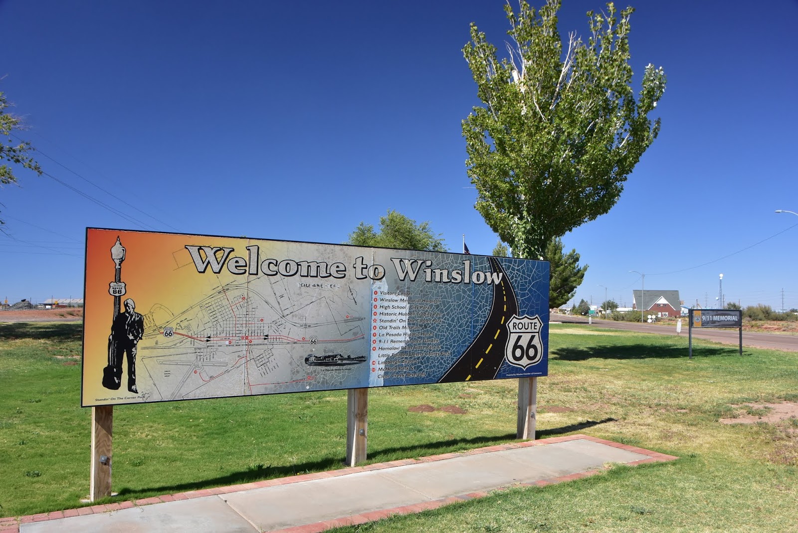
We only had two stops today that weren't connected with fuel or potty breaks. One was at the Petrified Forest Visitor Center, and the other was to have lunch in a roadside park in Winslow Arizona. Just to anticipate your reaction, I'll tell you that no, we didn't see any girls in "flatbed Fords" slowing down to take a look at us. But the day was gorgeous and blue-skied, and there's nothing like throwing open the windows to the dry desert air and enjoying lunch as strains of 1970s Eagles' music wafts through your head.

The little park that we chose on the eastern approach to Winslow turned out to be dedicated to the 9-11 attack and had attractively displayed two large girders from the twin towers. I was certainly surprised at first to see that magnitude of patriotism be manifested so far west, but then again maybe it's not really surprising. I suspect many villages, towns, and cities in the country applied for their own Twin Towers memorial pieces as well. I say bravo to the degree of patriotism that brought this memorial park to life in Winslow in 2002.

Our morning stop at the Petrified Forest National Park was brief, but enjoyable. I knew we couldn't actually venture into the park proper because of the piece of petrified wood that I purchased weeks ago in the state of Michigan from a roadside vendor. Still, we could venture into the Visitor Center, watch the education movie about the park, and peruse the book store and gift shop without getting ourselves into trouble. So that's what we did. Impressively, there was ample parking for RVs and even a gas station if you needed one. The whole complex was modern and thoughtfully-designed and we had a great time. I even scored a "Petrified Forest" T-shirt for my collection.

Here's what I found on Wikipedia about the Petrified Forest: "Petrified Forest National Park is in Navajo and Apache counties in northeastern Arizona. Named for its large deposits of petrified wood, the fee (chargeable) area of the park covers about 230 square miles, encompassing semi-desert shrub steppe as well as highly eroded and colorful badlands. The park's headquarters is about 26 miles east of Holbrook along Interstate 40 (I-40), which parallels the BNSF Railway's Southern Transcon, the Puerco River, and historic U.S. Route 66, all crossing the park roughly east–west. The site, the northern part of which extends into the Painted Desert, was declared a national monument in 1906 and a national park in 1962. The park received 644,922 recreational visitors in 2018. Typical visitor activities include sightseeing, photography, hiking, and backpacking."

"Averaging about 5,400 feet (1,600 m) in elevation, the park has a dry windy climate with temperatures that vary from summer highs of about 100 °F (38 °C) to winter lows well below freezing. More than 400 species of plants, dominated by grasses such as bunchgrass, blue grama, and sacaton, are found in the park. Fauna include larger animals such as pronghorns, coyotes, and bobcats, many smaller animals, such as deer mice, snakes, lizards, seven kinds of amphibians, and more than 200 species of birds, some of which are permanent residents and many of which are migratory. About one third of the park is designated wilderness—50,260 acres (79 sq mi)."

"The Petrified Forest is known for its fossils, especially fallen trees that lived in the Late Triassic Epoch, about 225 million years ago. The sediments containing the fossil logs are part of the widespread and colorful Chinle Formation, from which the Painted Desert gets its name. Beginning about 60 million years ago, the Colorado Plateau, of which the park is part, was pushed upward by tectonic forces and exposed to increased erosion. All of the park's rock layers above the Chinle, except geologically recent ones found in parts of the park, have been removed by wind and water. In addition to petrified logs, fossils found in the park have included Late Triassic ferns, cycads, ginkgoes, and many other plants as well as fauna including giant reptiles called phytosaurs, large amphibians, and early dinosaurs. Paleontologists have been unearthing and studying the park's fossils since the early 20th century."

"The park's earliest human inhabitants arrived at least 8,000 years ago. By about 2,000 years ago, they were growing corn in the area and shortly thereafter building pit houses in what would become the park. Later inhabitants built above-ground dwellings called pueblos. Although a changing climate caused the last of the park's pueblos to be abandoned by about 1400 CE, more than 600 archeological sites, including petroglyphs, have been discovered in the park. In the 16th century, Spanish explorers visited the area, and by the mid-19th century a U.S. team had surveyed an east–west route through the area where the park is now located and noted the petrified wood. Later, roads and a railway followed similar routes and gave rise to tourism and, before the park was protected, to large-scale removal of fossils. Theft of petrified wood remains a problem in the 21st century."

There's lots more to learn about the Petrified Forest and I certainly think that it's worth a re-visit sometime when we're headed back to Arizona and the southwest. I'd like to stay locally and spend at least half a day appreciating the ancient geology.

So that's it for now. Tomorrow we're headed west and north toward Las Vegas and Mesquite where we hope to visit with some long-time friends and ex-coworkers of ours. And when you head out on the two-lanes, The Happy Wanderers wish you happy travels and exciting destinations as well.

Monday, October 7, 2019

Day 55 -- Clayton to Grants, New Mexico -- 374 Miles

As you can see by the miles traveled, we didn't end up stopping for much today. At lunch we squeaked out a few moments to visit the La Castenada Hotel in Las Vegas, New Mexico, but stopped for little else all day. We wanted to break away and see that famous hotel in Las Vegas because on our last trip in the area we learned that an investor had purchased the property with the intent of refurbishing it. Though we were skeptical at the time, today we were marvelously surprised to see that the refurbishment is well under way, and some of the rooms are already available for rent.

Looking back on our previous visit, I found the following write-up: "We arrived at Fred Harvey's old Castaneda Hotel which dates to 1898. I looked around on the web for more info and found the following: 'A northern Arizona hotelier, who restored La Posada in Winslow, has purchased the century-old railroad hotel in Las Vegas, N.M. Allan Affeldt said he bought the 25,000-square-foot La Castaneda earlier this month for $400,000.'

'The mission revival hotel was one of the first of the Harvey Houses, Fred Harvey's chain of hotels and restaurants that furthered tourism development in the Southwest. La Castaneda in 1899 hosted the first reunion of Teddy Roosevelt and his Rough Riders from the Spanish-American War.'

'Affeldt thought that the town has been waiting for this for decades. After World War II, Fred Harvey closed most of their buildings and they were sold off or torn down. Las Vegas leaders had long feared La Castaneda would be torn down, but Affeldt stepped in just as he did at La Posada, a 1930 Harvey House that had an uncertain future two decades ago. With his wife, artist Tina Mion, Affeldt bought La Posada in 1997 and together they transformed it into a tourism and cultural attraction with an acclaimed fine-dining restaurant and a wealth of historical artifacts.'

Since the town of Las Vegas arrived just about lunchtime as we motored down Interstate 25 from our camp last night in northeast New Mexico, we decided it was a great opportunity to check out the La Castenada again. As it turned out, though I didn't know where the vintage hotel was situated in town, I accidentally picked the right route which led us right to the front door.

Since it was a tad early for lunch by the time we found the hotel, we did a mini tour of the grounds. When we circled around to the side of the building facing the railroad tracks, I was thrilled to see a mason laying red bricks in the courtyard area. Naturally, I had to go watch him as I've mixed perhaps dozens if not hundreds of wheelbarrow-loads of mortar for all the projects at our house, including brick, block, and rock, and just love to watch someone work their masonry magic.

It didn't take me long to discover that the mason was an expert at his craft and had laid hundreds of the courtyard bricks. When we got to talking to him -- his name was Rodney -- I liked him instantly. He knew his craft, he was well spoken, and he was willing to pause a moment in his work and talk to us. Back in Carson City, I had watched endlessly our favorite mason, Charley LeClair ply his craft on our Jacks Valley property between 1978 and 2010. During those three decades I had become quite a connoisseur of the masonry craft. I know what good work looks like and when I saw Rodney's work, I saw immediately he was the real deal.

I was so impressed with what I saw, I asked Rodney if he ever got to northern Nevada. If so, I'd be willing to hire him to do a small project for me. He told me that he sometimes works in our area, which was just what I wanted to hear. He didn't have a card, but I left him mine and I truly hope that someday he comes to visit me and brings his mason's tools.

The reason we're picking up the pace is that we're starting to get very close to experiencing freezing temperatures at night. In fact, the whole reason we dropped south from mid-Kansas to central New Mexico is to try and get home before we have to worry about our RV water lines freezing with the overnight temperatures.

We had hoped to stay in Albuquerque tonight, but when we arrived at the KOA there we discovered that they were experiencing an increased number of guests because of the hot air balloon weekend coming up. When I stood at the check-in counter and asked about spaces, the attendant just shook her head and said, "Sorry, we're full up."

So we motored on to Grants, New Mexico which still had a few spaces available. It was 78 miles further west, but it's a pretty nice camp, and if you're fan of train spotting, the rail line runs by just a block away to the north.

Traveling this route in New Mexico couldn't help but remind Concetta and me of our very first vacation together in 1977. We had known each other for only about ten months and were not married yet when I suggested that we take a vacation together. Naturally she wanted to know what kind of a vacation I had in mind. "A camping vacation," I said. "We'll take a tent and a camp stove and stuff and we'll travel around the Southwest. It will be fun."

I don't think Concetta was as sold on the idea as I was in the beginning, but that didn't stop me from gathering the equipment together and making sure the car was ready for the open road. At the time we owned three cars between us. I had a couple of two-seater sports cars, and Concetta had a rather neglected 1964 VW bug with a very tired engine.

Deciding that the sports cars would not be quite as handy for hauling all the camping equipment, we decided to take the VW. I had it serviced, and I bought a large aluminum roof rack for the top which went a long way toward holding most of the larger pieces of gear.

About the 1st of July, as I remember it, we were ready to go. Mom agreed to watch Concetta's son, Jason, who was about six at the time, and we both took two weeks off from work. This trip would turn out to be only the first of a great many adventures we'd have together. We had so much fun on that southwestern trip that only three months later we got married.

The trip didn't exactly get off to a blazing start. We'd only traveled east from Carson City about fifteen miles when the linkage for the accelerator pedal fell apart and I had to effect a repair right on the roadside.

When we reached the town of Flagstaff, Arizona, we got up in the morning and discovered that the car would turn over but wouldn't start. Not sure what to do, I loosened the nut holding the distributor in position. Then I told Concetta to try and start the engine while I twisted the distributor one way, then the other. Amazingly, at one point in this procedure the engine roared to life. I tightened up the distributor nut, and we were off.

Later that day, when we were traveling toward Albuquerque, New Mexico, the cotter pin holding the right front wheelnut on the axle broke and fell out, and the nut and the wheel came close to falling off. At first we just started smelling something burning. But when we stopped, we discovered that the wheel had gotten so hot that all the paint had blistered. I re-tightened the wheelnut, and we later bought some grease in Albuguerque to re-grease the bearing just in case. Thankfully, we had no further problems there.

The worst quirk the VW Bug had was it's tendency to blow one or two spark plugs right out of the head when you made the mistake of downshifting going down a hill. This happened to us when we were visiting White Sands, New Mexico. But this wasn't all the car had in store for us. While we were motoring around the White Sands area we started hearing a significant "knock" in the engine, which prompted us to seek a mechanic forthwith.

When we finally found one, he just shrugged and told us he didn't really work on VWs. "But," he said, "there's a guy at the other end of town who does." Feeling pretty apprehensive since we didn't really have much money, we headed across town to the shop the mechanic had recommended. But incredibly, once we got to the other side of town, the engine had quieted down and we drove the car for another fifteen hundred miles, all the way back to Carson City, without further trouble.

We have a lot of memories from that trip: of camping in a cherry orchard in Salt Lake City; of eating the best Mexican food and sopapillas we'd ever had in Albuquerque, New Mexico; of climbing the spindly cliff house ladders at Mesa Verde, Colorado; and of seeing miles and miles of the wonderful southwest at 40 mph, which is the fastest the VW would go.

Well, that's it for now. Until next time the Happy Wanderers wish you happy travels and exciting adventures.

Sunday, October 6, 2019

Day 54 -- Dodge City, Kansas to Clayton, New Mexico -- 211 Miles

Not much to report on the Blog tonight as we spent the better part of the day cruising the lightly-used Interstate 56 all the way from Dodge City, Kansas, to the sparsely-populated village of Clayton, New Mexico. I chose Clayton as it appeared to have three things we needed: a driving distance from Dodge City of around two hundred miles; a suitable, full-service camp once we had driven that distance; and a miles-saving diagonal route to central New Mexico where we hope we can avoid the worst of the freezing temperatures of the Rocky Mountains.

The owner, Jeff, tells me that they have dinosaur prints in the sagelands north of town if we're looking for something out of the ordinary to see while in the area. He says townsfolk and other interested New Mexico state politicos are trying to come up with a way to protect the prints from the elements, but so far have not hit upon a plan that guarantees funding.

Speaking of Jeff, he is an ex-Los Angeles County boy just like me and is thoroughly acquainted with northern Nevada as his grandparents lived just down the road from Concetta and me in the Nevada town of Gardnerville.

Since I've been wondering just who would move to an isolated town like Clayton where you're probably 200 miles from everywhere, I decided to see what Wikipedia has to say about the place: "Clayton is a town and county seat of Union County, New Mexico. As of the 2010 census, the city population was 2,980. Clayton is a crossroads for tourists heading from Texas to Colorado, Kansas to Oklahoma, and Texas to Taos, New Mexico." Presumably this means I guess that there are plenty of tourists passing through who drop just enough cash in local businesses to support the people not involved in ranching or farming.

Digging deeper into Clayton's past via Wikipedia, I learned that: "The Cimarron Cutoff of the Santa Fe Trail brought some of the first Americans through the Clayton region. The Santa Fe Trail was first established in 1821 after Spanish rule was evicted from Mexico, which opened up trade between Santa Fe and the United States."

"William Becknell, also known as the Father of the Santa Fe Trail, became the first person to utilize the Santa Fe Trail as a trade route between the state of Missouri and Santa Fe. He established the Cimarron Cutoff, also known as the Cimarron Route, as a faster route between countries as the Cimarron Route shortened the Trail by more than 100 miles. The Cimarron Cutoff went straight through the Clayton region where travelers used the Rabbit Ear Mountain as a guiding landmark."

"Eventually travelers along the trail began to appreciate the rich soil around Clayton and the rolling green hills which were perfect for raising livestock. Cattle ranchers and sheepherders established ranches in the area, though they tended to be large and far apart. That changed when the railroad came to the area and Stephen Dorsey, a nearby rancher, received the rights to the area where the railroad ran. He soon laid out a town site."

"Clayton is named for a son of U.S. Senator Stephen W. Dorsey, an Arkansas Republican, originally from Ohio, who served during Reconstruction. The town was established in 1887. The town was a livestock shipping center for herds from the Pecos River and the Texas Panhandle."

And indeed Concetta and I saw quite a few feed lots for livestock as we piled on mile after mile along the Route 56 corridor. Most of Route 56 is our favorite two-lane, though part of it has some pretty marginal pavement, mostly in Oklahoma.

The Kansas portion of Route 56 is also made up of thousands of acres of corn and milo. If you remember reading yesterday's Blog when we actually discovered the existence of milo, you know that it is a grain source that requires only about 2/3 the amount of water than more common crops require.

Ever since I learned about milo, I've been wanting to pull over and clip off a seed head to take home with me. Unfortunately, most of the time there just isn't a place to pull a 32-foot rig to the side of the road so I could go forage in the nearby field. But today I finally found a convenient pull-out and scored a seed head of my very own. I look forward to planting the seeds in my veggie garden just to see if it will grow in Nevada.

And now for a bit more from Wikipedia on our night's residence: "According to the United States Census Bureau, the town has a total area of 4.7 square miles, all land. Clayton has an elevation of approximately 5,050 feet above sea level. It is located about 130 miles northwest of Amarillo, Texas. Clayton is considered to be in the Plains region of New Mexico."

"This region stretches to the Sangre de Cristo Mountains down to the Guadalupe Mountains. Clayton is located in the northeast corner of New Mexico, 10 miles from the border of Texas and 11 miles from the border of the Oklahoma panhandle. Clayton is also located near two parks, Clayton Lake State Park, and Capulin Volcano National Monument. Not far away is Black Mesa State Park in Oklahoma. A carbon dioxide field called Bravo Dome can be found near Clayton and stretches nearly 1 million acres."

Here's an explanation of the "Bravo Dome from OSTI: "The Bravo Dome carbon dioxide gas field is located in Union and Harding Counties of northeast New Mexico. The Bravo Dome field covers approximately 800,000 acres, but areal boundaries of the field have not been fully defined. Production in 1989 was 113 bcf of gas from 272 wells. Cumulative production at the end of 1989 was 626 bcf. Estimated recoverable reserves are more than 10 tcf. The gas is 98-99% CO{sub 2}. Most CO{sub 2} produced from Bravo Dome is used for enhanced oil recovery in the Permian basin." I read elsewhere that the dome was discovered in 1917 and was allowed to bleed CO2 into the atmosphere for a year until shut off.

CO2 is interesting, but of more interest to me is the history of the Santa Fe Trail. At one time I was researching to discover if my two times great grandfather's brother, Stephen Daley had worked as a teamster during the Mexican war and perhaps met his end in August of 1847 while freighting goods to the troops in Mexico. I was unsuccessful in that endeavor, but I still find the history of the trail to be totally fascinating.

Thankfully, Wikipedia is here to give us more history of the trail: "The route skirted the northern edge and crossed the north-western corner of Comancheria, the territory of the Comanches, who demanded compensation for granting passage to the trail, and represented another market for American traders. Comanche raiding farther south in Mexico isolated New Mexico, making it more dependent on the American trade, and provided the Comanches with a steady supply of horses for sale. By the 1840s, trail traffic along the Arkansas Valley was so heavy that bison herds could not reach important seasonal grazing land, contributing to their collapse, which in turn hastened the decline of Comanche power in the region."

"After the U.S. acquisition of the Southwest ending the Mexican war, the trail helped open the region to U.S. economic development and settlement, playing a vital role in the expansion of the U.S. into the lands it had acquired. The road route is commemorated today by the National Park Service as the Santa Fe National Historic Trail. A highway route that roughly follows the trail's path through the entire length of Kansas, the southeast corner of Colorado and northern New Mexico has been designated as the Santa Fe Trail National Scenic Byway"

So there you have it. We may be parked in a tiny plains village of no apparent significance, but in reality much history has taken place hereabouts. Though I might have found Santa Fe Trail ruts today as we rolled southwest toward Clayton, there was darn little else to photograph. I'd already shot enough milo fields yesterday, and the few corn fields we passed didn't look all that vigorous. Hence, these few photos must suffice.