Friday, August 16, 2019

Day 3 -- Twin Falls to Idaho Falls, Idaho -- 184 Miles

Today promised to be easy from the start. First of all, we were camped next to Route 93 which made it super easy to head north out of Twin Falls since that's the route we wanted to take toward Idaho Falls. Second, we both got a great night's sleep and didn't get up until 6:30 which meant we'd be well-rested for whatever came our way. Third and last, I've fallen back easily into the routine of setting up and breaking down the rig so I encountered no problems in pumping the tanks and stowing the gear.

Despite the fact that we overslept a bit, we were somewhat earlier than usual leaving camp at 8:45 a.m. We plugged in the GPS and fed in a fictitious address in Shoshone, Idaho, along our intended route and sure enough camping next to Route 93 had been a great idea. The GPS just had us exit the camp and head directly north and out of Twin Falls. Once we crossed the Snake River, we stopped to top up the tank, then we were quickly back on the highway. When driving the RV I never let the gas gauge drop below a half tank if I can help it. Since we travel the two-lane highways whenever possible, you never know when the next gas station will appear on the horizon.

We very quickly arrived at the fictitious address we had fed into the GPS for the town of Shoshone. From there we switched to Idaho Route 20 and headed east toward the town of Idaho Falls. Idaho Falls didn't hold any particular significance, but was just a probable destination for the next camping opportunity. Traveling Route 20, we soon entered the boundaries of the Craters of the Moon national park and began to see ever larger fields of volcanic rock. We were intrigued, since the rock was, for the most part, coal black and jagged and not covered by any sort of vegetation.

I thought perhaps that the lava fields were probably just a few tens of thousands of years old, but later in the day when we stopped at the Craters Visitor Center, we would find out that the further you were away from Yellowstone Park the older the lava fields became. On the western fringes of the Craters of the Moon site the lava fields were some 10 million years old. Now THAT'S old!

Since Concetta and I had toured the lava fields a couple of times in the past, we opted not to take the tour this time. Still, the visitor center parking lot had ample space for our rig so we decided to stay, tour the visitor center, and then have lunch with the singular vistas of the park in our living room window. If you've not yet seen the Craters of the Moon Park, by all means put it on your next vacation itinerary. The visitor center is quite thorough in their explanation of the ancient events in the park, and I found that their library of reading material was just excellent. I especially liked their variety of books on the subject of geology. If I hadn't been already carry a half dozen books on the subject, I would have definitely picked up a couple of their excellent guides.

After leaving the Craters of the moon park there wasn't much of a historic nature to see save the magnificent scope of the Idaho prairie. We passed hundreds of acres of corn, kale, potatoes, hay, alfalfa, and possibly other green things we couldn't identify at 60 miles an hour. Still the landscape varies from obviously volcanic with not much vegetation at all, to full-blown agricultural fields with only the occasional volcanic outcroppings to mar the beauty of the magnificent fields of crops.

Possibly the most intriguing geologic features of the Idaho prairie in this area is the many volcanic cones rising up from the sage lands that mark the existence of extinct volcanoes. The land is so flat and golden that the black and burnt-red volcanic cones are startling in their incongruity with the surroundings.

One thing you usually have to contend with when motoring along in your RV is that very nearly everyone wants to go faster, and usually a LOT faster than you want to travel. For me, cruising along at 60 mph is a fine speed for taking in the surroundings, as well as avoiding panic stops when you want to pull over for some reason. But the bulk of traffic seems intent on risking life and limb to get around you. Naturally, I pull over if space is provided for such a maneuver, but much of the time it's not. More than once today we found ourselves holding our breath as cars went past us at seventy-five or eighty miles per hour and just managed to squeak back into line ahead of oncoming cars. Fortunately today most of the two-lane highway we traveled was open to passing, so traffic didn't pile up behind us too much.

When we were approaching Idaho Falls, Concetta pulled out her trusty IPhone and queried suitable camps. After reading about a couple, she checked the GPS for its recommendation and discovered the same ones listed. By this time we were cruising through the outskirts of the city and I once again began looking for a hardware store. While traveling yesterday I mentioned to Concetta that I had forgotten to pack the rock hammer, which would be necessary if we wanted to do a little rock hunting. I've also been meaning to look for a couple of hardwood handles for two hammer heads I brought along for which I have been unable to find suitable handles online.

Fortunately, before we had to head north toward our camp for the evening, I spied a True Value Hardware store just off to the left which appeared to have ample parking for the rig. You can't always assume that you can squeeze 32 feet of RV into a strip mall's parking lot. But the choice of True Value appeared to be just what I needed. Not only did they have the rock hammer, but a HUGE selection of hammer handles to pick from. So in one opportunity I was able to fulfill all my shopping desires.

Leaving True Value, we soon found our camp ground. The camp hosts said they had a spot for us, which didn't turn out to be in the nicest area of the camp, but in fairness they usually reserve the nicest spots for long-term guests. The spot turned out to be basically level and I had the rig set up in a jiffy. Concetta meantime had my cocktail mixed, the pretzels plated, and we were soon enjoying the remainder of the afternoon under the extended awning.

Thank goodness the techs back in Carson City had been able to fix the broken awning last fall. The awning had broken the last time we were in Montana and there were no spare parts ANYWHERE to be found. Now, not only do I carry two sets of spare pivot parts for the awning structure, but I also have an extra awning extension arm. When you're RVing, spare parts is the name of the game in a lot of cases.

So ends our third day on the road. We've had great traveling weather. It's been just a bit warm, but this afternoon we're not running the air conditioner and things seem just fine. Concetta has been sitting in the shade reading her book for the past hour and, well, you know what I've been doing -- pursuing that skill I acquired in the 7th grade as only one of a couple of boys in the typing class.

Tomorrow we're headed east again. We're skirting Yellowstone Park this time. In fact, our encounter with lame-brained, buffalo-petting tourists and huge irritating traffic jams in the park during our 2017 visit may have cured me forever from wanting to visit Yellowstone. This time we'll cross north of the park and then begin to edge our way further east in hopes of catching South Dakota Route 212 toward Minneapolis-Saint Paul. There I have to pick up a couple of front seats for a 1929 Ford which I purchased on Ebay.

Of course taking the northern route was planned from the beginning as we hoped that cooler temperatures would prevail up there. So far, the temperatures and weather have been pretty reminiscent of Carson City. But you never know, they had several inches of hail in the Dakotas last week. Maybe things will begin to cool down a bit when we reach the Dakotas.

So that's all for now from the "Happy Wanderers." We wish you the best of traveling conditions as you take to the road for your wandering adventures. And if you see us somewhere out there on the Great Plains or in the High Lonesome, give us a wave!

Thursday, August 15, 2019

Day 2 -- Elko, Nevada to Twin Falls, Idaho -- 174 Miles

Today is the day that the vacation truly began. No rushing to get on the road; no long distance driving contemplated; No particular schedule to keep. We intended to just sit back and enjoy the scenery. We rolled out of our Elko camp about a quarter to nine, stopped at a local Albertsons supermarket to pick up some milk, then jumped on Interstate 80 for the forty-mile run to Wells, Nevada where we planned to catch Interstate 93 north towards Twin Falls Idaho. Aside from a bit of road construction we had an easy run.

We took the wrong exit when we got to Wells, which ended up being a good thing since we got to cruise by a slice of the residential neighborhoods on the outskirts of Wells that neither of us had ever seen. Nice new retirement homes adjoined the golf course and the homes were obviously up-scale and expensive. Despite having to take a short gravel stretch that lay at the end of a series of zig-zags through a neighborhood of modular homes, we managed to wend our way east until we found where Interstate 93 intersected Interstate 80. Then, before we left town, we gassed up the rig, then began our sojourn north towards the Idaho border. It was still only about 10:00 A.M.

If you've never traveled the route between the one-horse town of Wells, Nevada and the thriving metropolis of Twin Falls, Idaho on Route 93, you're certainly missing some of the most intriguing stretches of high-desert landscape we have ever seen. The distance is something just over one hundred miles and it's two-lane highway all the way. But the magnificent vistas roll away to the horizon and are something you will have a hard time duplicating anywhere else. On both sides of the narrow stretch of blacktop, we saw huge mahogany-colored outcroppings where ancient lava flows had been broken and thrust above the surface of the land by plate tectonics. We saw other areas where the lava was arranged in huge, towering outcroppings looking much like a pile of biscuits on a plate. I suspect that those volcanic piles were once created beneath the surface of a long-vanished body of water.

Though Route 93 is pretty thoroughly traveled by cars, RVs, and 18-wheelers, most of the land through which the highway travels appears to be sparsely inhabited. We saw only a few ranches on the whole 100-mile stretch. Folks who think that Nevada's Route 50 is the loneliest road in American simply haven't traveled Route 93 to Twin Falls. We passed one vacationer on the drive today who had somehow shredded the left rear tire on his travel trailer. Fortunately, the trailer was a double-axle model and still had one tire on that side that was okay. But he didn't appear to be attacking the problem himself so I suspect that he hadn't thought of a way to jack the trailer up so he could remove the shredded tire. There was no shoulder of any consequence on either side so there was no way we would have been any help to him even we had a jack that would lift the trailer.

At one point we came upon the entrance to the San Jacinto Ranch and we pulled in and parked in their driveway so we could get out and stretch our legs. The ranch house was at least a mile away and we thought we'd be able to see anyone coming who would want to get out on the highway past our rig. Of course once we had disembarked and walked a hundred feet away from the rig, along came a ranch hand from out on the highway who was forced to use a bit of ingenuity to squeak by our parked RV. But he was good-natured about it and we apologized to him for blocking his access. He was a young Hispanic chap who smiled and laughed a lot and told us that folks were always parking in the ranch entrance and it didn't bother him a bit. He told us he really liked working at the ranch and he evidently didn't mind at all being 50 some odd miles from the nearest civilization. In the end we wished each other a great day and went our separate ways, but once again we had been reminded that folks on the frontier are just downright neighborly and friendly most of the time.

Once we reached Twin Falls it happened to be lunch time so we set about finding a nice piece of shade in which to park. After considerable looking we had failed to find a suitable park setting, so we wheeled into a Swenesons Supermarket that we happened upon (photo above left) and found a patch of greenery to arrange outside the dining room window. It wasn't shady, but it was mostly green.

During lunch I did a bit of computer research and decided on the Herrett planetarium and adjacent museums for our afternoon entertainment. So, when lunch was over, we fired up the GPS and it informed us that the Herrett was actually quite near us. So off we went and were soon pulling up to the campus of the College of Southern Idaho wherein we were led to believe by the trusty GPS that the planetarium and museum would be located. Unfortunately, we just didn't know where. The campus is composed of acres and acres of beautiful lawns and mature trees, but not much in the way of roadside directions. With a sigh, we parked the rig in a lightly-used parking lot on the south side of the campus and set out to find a human who could help us locate our quarry. This we did in short order, but he informed us that the planetarium building was a good half mile away on the other side of the campus. "No problem," we told him, "we need the steps."

Well, we soon had cause to regret the decision as the temperature was in the mid nineties and we had forgotten our hiking boots! But soon enough we arrived and discovered quite a nice museum that held just about anything and everything you could imagine. We saw a mastodon and a sabre-toothed tiger (2nd photo upper right). We saw an amazing variety of native American crafts and historic objects. We saw displays on geology and fossils, even from as far away Saudi Arabia. We even saw an Andean mummy. The display that turned out to be my personal favorite was the list of native plants and examples of rope that could be made from them. That was really interesting and, of course, useful if you chanced to be stuck in a deserted patch of desert and wanted to climb somewhere up high to get away from critters trying to kill you.

Once we'd seen the museum, we hiked back to our rig in the ever-present heat and gratefully got inside and cranked up the air conditioner. After that it was a fairly short ride out to our evening's camp called the Twin Falls "93" Park for it's location on route 93 presumably.

So there you have it. We had a spectacular and relaxing day full of new vistas and discoveries. Tomorrow I have no idea where we're going and where we might end up for the night, so you will be just as surprised as we will when you see the blog tomorrow. So until then, we wish you happy travels and new discoveries of your own. As Slim Barnard used to say, "Go out and be a Happy Wanderer." Right now I have one of Slim's Happy Wanderer bumper stickers on the rear window of the RV. It was sent to me by Slim's son to reward me for still remembering his dad. For extra credit, try looking up Slim and Henrietta Barnard and the Happy Wanderers TV show.

Long before I could even drive and the Happy Wanderers were on the TV, I'd insist that Mom take me down to the Ford Dealer every week after the show had aired so I could pick up that week's Happy Wanderers map to the exotic places they had visited. That was fifty-five years ago and I still have those maps in my collection. In those days I just knew that I wanted to be a Happy Wanderer myself, and in addition to Slim's maps handed out at the Ford Dealers I collected articles from Sunset magazine about all the places the magazine's contributors had visited and wanted to recommend to the magazine's readers. I think I even have a few of those articles around somewhere. Perhaps it was fate from the very beginning and now I finally get to live what I only imagined fifty-five years ago.

Wednesday, August 14, 2019

Day 1 -- Carson City, Nevada to Elko, Nevada -- 320 Miles

Today we began our 2019 vacation to the far off land of Ohio by making the extra long (for us) drive from Carson City where we live, to Elko, Nevada in our state's northeastern corner. Usually we only drive about 150 miles a day, which allows us ample time to see the local sites surrounding our campsite of the previous night. However today, since we had seen the sites along Interstate 80 so many times, we opted to double our usual mileage which would allow us to reach Twin Falls, Idaho tomorrow night while still sticking to our usual distance of about 150 miles.

But first we had some chores to do along the Interstate 395 corridor. First of all we needed to top up our propane tank which had not been filled since we returned from my fifty-year high school reunion trip of 2018. This we were able to do quite easily since just over the hill to the south of our house was an RV camp that had a suitable propane filling station. Once that was done, and rather quickly since we were the only ones in line to have our tank filled, we headed north on Hwy 395 in the direction of our next task -- a nice bath.

What with all the frantic comings and goings over the past few months as we got ready to hit the road for another adventure, we just hadn't gotten around to washing the Los Angeles dirt off the RV. Add in a winter of regular snowfall and snow melt, and the outside of the rig was positively grungy. So our next stop was the big rig truck wash in Sparks east of Reno. We had determined in advance that we would only stop for a wash if there wasn't too many big rigs ahead of us. So we were excited when we rounded the curve before the washing bay and discovered that there was no one at all in line ahead of us. Then, for the mere cash outlay of a dollar a foot, we were immediately ushered into the bay and the boys set about making the rig look like new.

After the wash job we jumped on Interstate 80, cranked up the air conditioner to ward off the hot desert air that had ratcheted into the mid nineties by then, and cruised on down the road toward Elko and our anticipated visit to Elko's California Trail Interpretive Center. We always love taking advantage of the Trail Center as the exhibits are wonderful, the staff super dedicated and friendly, and the opportunity for pictures pretty nice as well. In addition I always like to look over their selection of gifts and books on the western history and the westward expansion experience. This time I scored a jar of Raspberry/Rhubarb jam containing real sugar and no corn sweetener, and a copy of Keith Heyer Meldahl's 2007 book, "Hard Road West," which is subtitled "History and Geology along the Gold Rush Trail." Since I'm a huge sucker for anything to do with geology, I snapped it right up.

In between Sparks and Elko we stopped occasionally to stretch our legs and get some steps on the pedometer. We also tarried awhile for lunch in the slumbering town of Lovelock, a town that was especially hard hit by the twin whammies of being bypassed by the interstate, and the incredible gas mileage that cars come with nowadays that make mid-state stops unnecessary. The rest of the ride we just admired the local flora, puzzled over the sometimes strange geology of the Great Basin, and tried to stay well away from the 18-wheelers. Tomorrow we should be back on two-lanes after we leave Wells, Nevada, about forty miles from here, and head north on Route 93.

Friday, July 6, 2018

Day 48 - Westwood, California to Jack's Valley, Nevada - 142 Miles

Nothing much to report. We drove through Quincey and Portola, and then over Beckwourth Pass until we reached Highway 395, then we rolled on home through pretty familiar territory. We had lunch before we left the treed part of the highway across the street from a Jehovah Witness hall. Can't wait until the next great adventure.

Wednesday, June 27, 2018

Day 47 - McCloud to Westwood, California - 155 Miles

Today I was all ready to be unenthused about the drive. It appeared that, as we approached our home base after a month and a half on the road, our options for routes to take to Carson City were few. Yesterday afternoon we left Interstate 5 in northern California, stopped off in McCloud, California to shop for groceries and do some photography. Then, when we realized that it was too late to reach Susanville at any reasonable hour, we decided to stay in McCloud at a very lovely camp west of the main highway.

But today it looked like we had to just get on with it, drive to Susanville, then tomorrow it would be at most a three-hour drive for home. We've been the McCloud to Susanville route countless times, and there's just not that much we haven't seen at this point between the two towns.

Resigned to our fate, we took off from the McCloud and headed east south east about 9:00 a.m. Our Route was California 89 and it was pleasant enough. There was not much traffic, only the occasional logging truck, and enough turn-outs for me to let any speed demons go by who were in tremendous hurry for some unknown reason.

It's always very soothing rolling mile after mile through groves of tall pines. That combined with the book we were listening to on the disk player made the morning go by rather quickly. But it wasn't until we had to make a turn from Route 89 onto Route 44 which headed toward Susanville that I got an idea. We had stopped at the intersection turn-out for a potty break and while glancing at the map I noticed that if we stayed on Route 89 it would take us right through Lassen Volcanic National Park.

Looking closely at the map I could see that going through the park instead of going to Susanville would add no negligible number of miles to our drive for the day. AND, we would be experiencing a spot on the map that we had never experienced before. That sounded like a win/win to me. I told Concetta about my idea, and stressed that we'd still get home roughly at the same time. She agreed that it sounded good.

So we turned around, took the Route 89 branch, and headed in a counter-intuitive southwest direction. But very soon we reached the turnoff for the park where Route 89 separated from route 44 west. Moments later we were pulling up the park gate. Thankfully, once again, we had our senior pass so instead of paying the going rate of $25.00 for two people, we got in for free.

Ladies and gentlemen, we were about to have our socks knocked off! Driving into the park we almost immediately came to the park office and museum property. There, the Park Service had thoughtfully provided us (and others) with ample space in which to park an RV. We pulled right in, selected a semi-level spot, and turned off the engine. Grabbing our gear we headed for the museum.

Once again we were oh so pleasantly surprise to see what a nice job the Park Service had done with their small, but effective museum. Combined with their twenty-minute movie explaining the park's evolution through time, the museum's displays were very fine and succinct enough to allow us to see it all. Just in case I didn't remember some of what I read I was also able to photograph the display explanations. Here's what I learned in using Wikipedia as my narrator:

"Native Americans have inhabited the area since long before white settlers first saw Lassen. The natives knew that the peak was full of fire and water and thought it would one day blow itself apart."

"White immigrants in the mid-19th century used Lassen Peak as a landmark on their trek to the fertile Sacramento Valley. One of the guides to these immigrants was a Danish blacksmith named Peter Lassen, who settled in Northern California in the 1830s. Lassen Peak was named after him. Nobles Emigrant Trail was later cut through the park area and passed Cinder Cone and the Fantastic Lava Beds."

"Inconsistent newspaper accounts reported by witnesses from 1850 to 1851 described seeing "fire thrown to a terrible height" and "burning lava running down the sides" in the area of Cinder Cone. As late as 1859, a witness reported seeing fire in the sky from a distance, attributing it to an eruption. Early geologists and volcanologists who studied the Cinder Cone concluded the last eruption occurred between 1675 and 1700."

"After the 1980 eruption of Mount St. Helens, the United States Geological Survey (USGS) began reassessing the potential risk of other active volcanic areas in the Cascade Range. Further study of Cinder Cone estimated the last eruption occurred between 1630 and 1670. Recent tree-ring analysis has placed the date at 1666. The Lassen area was first protected by being designated as the Lassen Peak Forest Preserve. Lassen Peak and Cinder Cone were later declared as U.S. National Monuments in May 1907 by President Theodore Roosevelt."

"Starting in May 1914 and lasting until 1921, a series of minor to major eruptions occurred on Lassen. These events created a new crater, and released lava and a great deal of ash. Fortunately, because of warnings, no one was killed, but several houses along area creeks were destroyed. Because of the eruptive activity, which continued through 1917, and the area's stark volcanic beauty, Lassen Peak, Cinder Cone and the area surrounding were declared a National Park on August 9, 1916."

"The 29-mile (47 km) Main Park Road was constructed between 1925 and 1931, just 10 years after Lassen Peak erupted. Near Lassen Peak the road reaches 8,512 feet (2,594 m), making it the highest road in the Cascade Mountains. It is not unusual for 40 ft (12 m) of snow to accumulate on the road near Lake Helen and for patches of snow to last into July."

"In October 1972, a portion of the park was designated as Lassen Volcanic Wilderness by the US Congress (Public Law 92-511). The National Park Service seeks to manage the wilderness in keeping with the Wilderness Act of 1964, with minimal developed facilities, signage, and trails. The management plan of 2003 adds that, 'The wilderness experience offers a moderate to high degree of challenge and adventure.'"

"In 1974, the National Park Service took the advice of the USGS and closed the visitor center and accommodations at Manzanita Lake. The Survey stated that these buildings would be in the way of a rockslide from Chaos Crags if an earthquake or eruption occurred in the area.[8] An aging seismograph station remains. However, a campground, store, and museum dedicated to Benjamin F. Loomis stands near Manzanita Lake, welcoming visitors who enter the park from the northwest entrance."

"After the Mount St. Helens eruption, the USGS intensified its monitoring of active and potentially active volcanoes in the Cascade Range. Monitoring of the Lassen area includes periodic measurements of ground deformation and volcanic-gas emissions and continuous transmission of data from a local network of nine seismometers to USGS offices in Menlo Park, California. Should indications of a significant increase in volcanic activity be detected, the USGS will immediately deploy scientists and specially designed portable monitoring instruments to evaluate the threat. In addition, the National Park Service (NPS) has developed an emergency response plan that would be activated to protect the public in the event of an impending eruption."

"The park is located near the northern end of the Sacramento Valley. The western part of the park features great lava pinnacles (huge mountains created by lava flows), jagged craters, and steaming sulfur vents. It is cut by glaciated canyons and is dotted and threaded by lakes and rushing clear streams."

"The eastern part of the park is a vast lava plateau more than one mile (1.6 km) above sea level. Here, small cinder cones are found. (Fairfield Peak, Hat Mountain, and Crater Butte).[14] Forested with pine and fir, this area is studded with small lakes, but it boasts few streams. Warner Valley, marking the southern edge of the Lassen Plateau, features hot spring areas (Boiling Springs Lake, Devils Kitchen, and Terminal Geyser).[14] This forested, steep valley also has large meadows that have wildflowers in spring."

Lassen Peak is made of dacite,[15] an igneous rock, and is one of the world's largest plug dome volcanoes. It is also the southernmost non-extinct volcano of the Cascade Range (specifically, the Shasta Cascade part of the range). 10,457-foot (3,187 m) tall volcano sits on the north-east flank of the remains of Mount Tehama, a stratovolcano that was a thousand feet (305 m) higher than Lassen and 11 to 15 miles (18 to 24 km) wide at its base. After emptying its throat and partially doing the same to its magma chamber in a series of eruptions, Tehama either collapsed into itself and formed a two-mile (3.2 km) wide caldera in the late Pleistocene or was simply eroded away with the help of acidic vapors that loosened and broke the rock, which was later"

"On the other side of the present caldera is Brokeoff Mountain (9,235 feet or 2,815 m), which is an erosional remnant of Mount Tehama and the second highest peak in the park. Mount Conrad, Mount Diller, and Pilot Pinnacle are also remnant peaks around the caldera."

"Sulphur Works is a geothermal area in between Lassen Peak and Brokeoff Mountain that is thought to mark an area near the center of Tehama's now-gone cone. Other geothermal areas in the caldera are Little Hot Springs Valley, Diamond Point (an old lava conduit), and Bumpass Hell (see Geothermal areas in Lassen Volcanic National Park)."

"The magma that fuels the volcanoes in the park is derived from subduction off the coast of Northern California. Cinder Cone and the Fantastic Lava Beds, located about 10 miles (16 km) northeast of Lassen Peak, is a cinder cone volcano and associated lava flow field that last erupted about 1650. It created a series of basaltic andesite to andesite lava flows known as the Fantastic Lava Beds.

"There are four shield volcanoes in the park; Mount Harkness (southwest corner of the park), Red Mountain (at south-central boundary), Prospect Peak (in northeast corner), and Raker Peak (north of Lassen Peak). All of these volcanoes are 7,000–8,400 feet (2,133–2,560 m) above sea level and each is topped by a cinder cone volcano."

"During ice ages, glaciers have modified and helped to erode the older volcanoes in the park. The center of snow accumulation and therefore ice radiation was Lassen Peak, Red Mountain, and Raker Peak. These volcanoes thus show more glacial scarring than other volcanoes in the park. Despite not having any glaciers currently, Lassen Peak does have 14 permanent snowfields."

We had such a nice spot in the parking area of the museum that we just stayed there when it was time for lunch. We did coast the rig backwards one space as it was more level than ours and the former occupant had since departed. But the setting was so lovely that we didn't even mind the traffic kept up a steady pace into and out of the lot.

After lunch we knew we had to make some miles so we decided to just roll through the park and out the south end. Someday soon, we decided, we had to come back when we could perhaps spend a day and do some hiking. The setting just makes you want to get out of your vehicle and hit the trial.

This mindset lasted only a few minutes. Soon we came a parking area that occupied the part of the park they referred to as the "devastated area." This particular area was created in May of 1915 when Mt. Lassen blew its top, caused all the snow to melt suddenly, and the area was completed inundated with mud and debris. All the vegetation was simply washed away or covered in feet of mud.

Concetta suggested at this point that we do some hiking, but we soon decided that we just had to get down the road so that we would be able to get home fairly early tomorrow. But the Park just has that effect on a person. It calls to you, makes you want to pull on your hiking boots, head off down the trail.

But in the end we just drove, made a few miles, and saw some truly memorable country. The road towards the south end of the park is truly not for the faint of heart, especially if you are driving a large RV or suffer from acrophobia. We did stop near the top of the 8,500 pass to take some photos, but for the most part we rolled past all the beautiful lakes, dazzling geology, and the acres of yellow-flowered mules ears plants on our way down to the park's south entrance. One more stop as we exited the park gate netted us a fine photo of both of us next to the sign.

The last part of the trip was toward the town of Chester next to Lake Almanor. At Chester we diverged from Route 89 to dash several miles east on Route 36 to the village of Westwood and our wonderful camp next to the Mountain Meadows reservoir, just east of Lake Almanor. Here we were given a magnificent site just a stone's throw from the lake, and high enough up so that our vista of the lake and sky is absolutely unequaled.

Folks here at the camp are so nice that we've already had lengthy conversations with both the itinerant maintenance couple who live in their RV and travel around to work in various camps, and the manager and his wife who were born and raised in Carson City and have been here at the "Northshore Camp" for about six years.

So there you have it. We had a super day where we hadn't originally counted on anything special. We got to see a National Park we'd never visited in the past. And we found a dynamite camp in a tiny town where we hadn't expected anything special. I'd say today is one for the record books! And when you decide to hit the road and follow your instincts into the sunset, we wish you exciting destinations and memorable travels from the Davises, the Happy Wanderers.

Tuesday, June 26, 2018

Day 46 - Klamath Falls, Oregon to McCloud, California - 91 Miles

Well, a moment ago I bet we had gone 100 miles today and Concetta bet we'd gone 50. Truth is we drove 91 miles, and we should have gotten extra points for having to do some of it on Interstate 5 in California. Buddy John, a one-time long-haul trucker, told me that categorically, California has the worst roads in the nation. All you have to do is drive Interstate 5 and you wonder why he was so kind. The Interstate is too crowded with big rigs and it's too littered with potholes. If I had to say something good about it I'd say it's rougher than a cob. Fortunately we only drove it a very short distance, from Weed to just above McCloud, a span of perhaps just ten miles. After that we took the Hwy 89 turnoff to McCloud and didn't look back.

Our camp last night at the KOA in Klamath Falls turned to be pretty pleasant. We didn't get full hookups, but this morning the trip to the dump station went smooth as silk, and we were soon on our way. From Klamath Falls we trusted Ms. GPS to guide us to Route 97, which she did unflaggingly, much to our surprise. Well, she did tell us to stay in the left lane all the way through old town, but had we done that we would have ended up going the wrong direction when we got to Route 97. Thankfully, at the last moment we figured it out and moved over one lane to save the day and our continued sanity.

For the most part we cruised south on Route 97 past most farm fields all the way to Weed, California. We did pass through the "town" of Worden, Oregon, which probably should be called a village. It did appear they had a museum of sorts there, but we didn't stop since we wanted to put some miles on the clock.

Since we didn't stop anywhere except one roadside rest, we didn't do much in the of photography. Thankfully, our terminus this afternoon turned out to be McCloud, a town that was once a favorite of ours in northern California

Once upon a time a fabulous tourist railroad ran from McCloud to Mount Shasta, California. Before the tourist railroad, the trains had been used in the lumbering industry. Here's some information on this fabulous line that I found at https://www.american-rails.com/mccloud.html:

Most often railroads like the Southern Pacific, Santa Fe, and interurban Pacific Electric Railway are regarded as California's best remembered such companies. However, another sometimes forgotten legendary system was the McCloud River Railroad (reporting marks, MCR), a logging line operating in the state's timber rich northern region. It was established in 1897 by lumber mill interests who were looking to move their finished product as quickly as possible to market and with a nearby connection to the much larger Central Pacific (then an SP subsidiary), a railroad seemed quite logical.

During the railroad's peak years it owned a system stretching nearly 100 miles and while it was built to move timber and it also operated as a standard common carrier shipping whatever freight was available (and for more than 50 years also dispatched passenger trains). As timber demand declined the railroad slowly cut back although new ownership also led to its downfall. It closed in 2009 and the property is now for sale as a rail/trail as of 2012.

During the second half of the 19th century, and particularly with the completion of the Transcontinental Railroad in the spring of 1869, California began booming. With a demand for construction and materials and the rich timber regions located to the state's north it was not long until companies began moving in.

One such business was owned by George Scott and William Van Arsdale. By the 1890s they already were operating sawmills on the western slope of Mount Shasta with connections to the CP/SP whose main line to Oregon passed through the area. However, there were no more locations here to continue expansion so they looked east on the other side of the mountain. With no direct rail service, however, any mills they built would also need a new railroad. In 1896 they purchased a bankrupt mill from Friday George in the area and converted a former streetcar/interurban line into a heavy freight railroad.

By late 1896 about four miles of track was opened and a connection at the town of Mt. Shasta with the CP. On January 21, 1897 the McCloud River Railroad Company and the McCloud River Lumber Company were formed, both operated and owned by the same individuals.

Interestingly, Van Arsdale and Scott stuck around only long enough to see the operation during its earliest years as they sold their interests in 1902. By 1905 the railroad was completed to McCloud and continued to expand eastward, further into rich timber reserves. By 1920 the system had expanded beyond Bartle and its main line now stretched more than 35 miles. Additionally, as with most logging lines it was also building miles of temporary spurs to tap various tracts of pine timber. These short branches were shoddily built and were only meant to be used briefly before being torn out and the track relaid elsewhere.

From a corporate standpoint, the McCloud River Lumber Company divested itself of the railroad in 1917 to avoid any antitrust issues with all of shares handed over to the shareholders. The system continued to march westward after 1920. It reached more timber via a branch to the recently created town of Pondosa and the biggest feat to occur during that decade was a connection to another major Class I, the Great Northern at Hambone.

The GN had recently completed its "Inside Gateway" project with the Western Pacific where both lines established a connection with one another at Bieber, California. Being so close to the McCloud River and its heavy timber/lumber traffic, GN constructed an extension from Lookout (just north of Bieber) to reach Hambone (the WP would also have trackage rights over this branch, which essentially gave the McCloud River Railroad yet another major interchange partner).

At this point the MCRR operated exactly 47.0 miles of track from Mt. Shasta to Hambone, which did not include all logging spurs and general sidings. During the 1940s and 1950s the railroad grew for the final time. It took over a former roadbed south of Bartle once used by Pacific Gas & Electric and by 1955 had reached Burney with a branch to Sierra.

It also shifted its route to Pondosa using this line and abandoned the other branch reaching the small town. The McCloud River Railroad's new line south of Bartle was thanks to a new customer, the Fruit Growers Supply that needed wooden shipping crates to move its produce. Unfortunately, 1963 spelled not only the end of the MCRR's growth but also signaled the beginning of its decline.

That year it was acquired by US Plywood and since it was no longer locally owned, the national wood products company began severely cutting back operations. It ended nearly all rail timber rail movements, shifting these to trucks. As such, nearly its only remaining traffic became finished products such as plywood and lumber from mills at McCloud, Pondosa, and Scott.

In 1969 the line was sold again to U.S. Plywood-Champion Papers, and two times in the 1970s, Champion International in 1972 and Itel Corporation in 1977. During this time, however, the railroad still operated much of its original system that spanned 77.9 main line miles between Mt. Shasta, Hambone, and Burney. On July 1, 1992 it was sold for a final time to 4-Rails, Inc. owned by Jeff and Verline Forbis who renamed the company as the McCloud Railway. It was also during the 1990s that the MCRR fell on hard times. It lost its interchange and Hambone, losing paper traffic. By 2005 it only operated about 16.8 miles of main line between Mt. Shasta and McCloud, despite the fact that shippers remained east of McCloud. The final hammer fell in 2009 when the entire property was shuttered, even the once popular Shasta Sunset Dinner Train that had been operating the route to McCloud for a number of years. In early April, 2012 it was announced that the entire property was looking to be sold to a non-profit group and turned into a rail/trail.

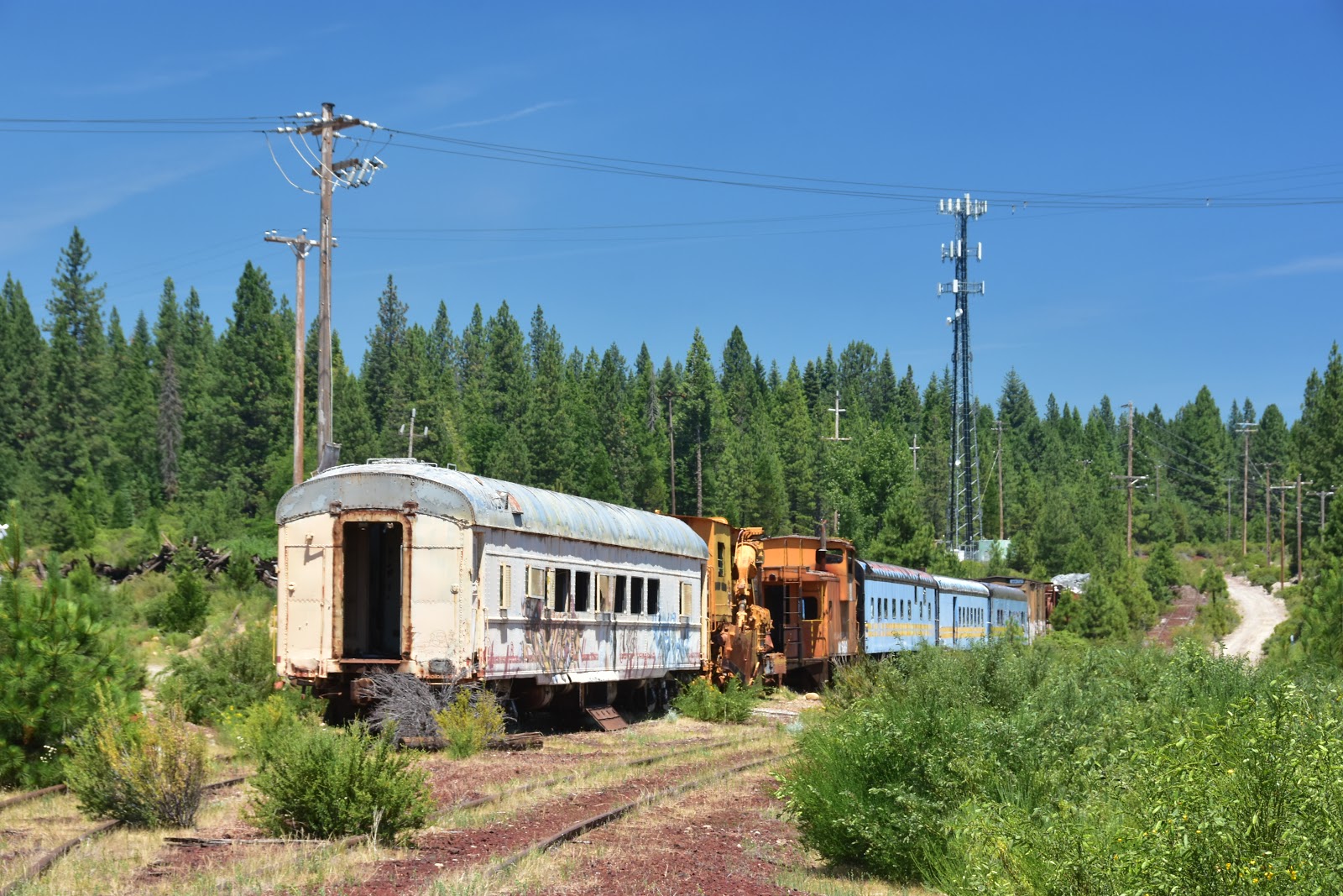
And there you have it. Yet another wonderful old railroad has become a moldering derelict. It looked to me as though workers were busily piling things up for the scrappers. I hope the cars don't get scrapped, but I have to guess that someone would really have to fall in love with any of the old equipment before they would be willing to pay to transport it to their property.

If you're traveling around in your RV a truly great thing to do is find yourself one of the tourist railroads and take a ride before it too is gone. And when you go, we wish you exciting destinations and memorable travels from the Davises, the Happy Wanderers.

Monday, June 25, 2018

Day 45 - La Pine to Klamath Falls, Oregon - 108 Miles

As we approach the Fourth of July holiday, things are getting a bit dodgy when we try to find a camp spot for the night. Last night when we rolled into the La Pine County camp grounds, the girl in the entrance shack told us that she had four spots available as far as she knew, and two of them were reserved already. We squeaked in just under the wire.

This afternoon we had an even tougher time finding a spot. It being a Monday, we thought that most everyone who had gone camping this past weekend had now gone home. Au Contraire! Evidently people have reserving camp spaces for all this week and into the Fourth of July weekend. This makes it really tough to find a spot.

We started looking as soon as we left the Crater Lake area where we spent much of the day. The very first camp we came across had absolutely no spaces left at 3:00 p.m. and had no suggestions for us, forcing us to travel on down the highway. The next camp was one suggested by Concetta's iPhone, but when we arrived we noted that cell phone reception was almost nil. Having experienced that bit of inconvenience last night, we weren't thrilled to put up with it again tonight. Without a cell phone signal we can count on, we'd have no signal for the internet device, which means no way to post the blog.

No internet reception meant we kept moving. Next we trusted Ms. GPS to take us to a camp, which she did with a great deal of alacrity. But alas, once we arrived we saw immediately that it was a mobile home park for permanent residences, not a park for overnight RVers.

We next trusted Ms. GPS to take us to the local KOA camp, which she did without further adieu. But when I went to the office the young man there said, "Sorry, no sites that would accommodate our 32-foot length adequately. With a heavy heart I retraced my steps to the RV and climbed aboard. "No sites available," I told Concetta when she asked if I'd been successful.

With that we drove into the park in order to get back to the entrance. But as we drove I could see that they had lots of sites, though many without full hookups. Maybe some were reserved, but ALL of them couldn't be spoken for. At Concetta's urging, I stopped at the front gate again and went inside to inquire if they hadn't been mistaken about having no sites. This time I ran into a more senior employee, and he thought that perhaps one of the sites I had seen would probably work for us. With that he signed us up, and told me to follow him to the site.

Once we pulled in, we discovered we fit just fine and actually had room to spare. The site didn't have a sewer connection, but it won't slow us down too much to use the dump station in the morning. We thanked the guy profusely and counted our lucky stars that we weren't going to have to stay in the Walmart parking lot tonight.

"We chose Oregon Route 97 this weekend for it’s proximity to the northern entrance road to that most glorious of all deep-water lakes, Crater Lake. To quote the National Park newspaper, “Crater Lake National Park protects the deepest lake in the United States. Fed by rain and snow (but no rivers or streams), the lake is considered to be the cleanest large body of water in the world. The water is exceptional for its clarity and intense blue color.”

"The lake rests inside a caldera formed approximately 7,700 years ago when a 12,000-foot-tall volcano collapsed following a major eruption. The eruption may have been the largest in North America in the past 640,000 years. Later (smaller) eruptions formed Wizard Island, a cinder cone near the southwest shore."

"The park is central to the cultural traditions of local American Indian tribes, whose ancestors, according to legend, witnessed the lake's formation. Today, old-growth forests blanket the volcano's outer slopes, harboring a wide variety of plants and animals, including several rare species. The park provides unique opportunities for scientific study and public enjoyment."

"The first European-American to see Crater Lake was lucky to survive the experience. On June 12, 1853, gold prospector John Wesley Hillman was riding his mule up a long sloping mountain. He was lost, tired, and not paying attention to the terrain ahead. Suddenly, his mule stopped. Hillman sat up and found himself on the edge of a cliff, gazing in astonishment at 'the bluest and most beautiful body of water I had ever seen.' He added: 'If I had been riding a blind mule, I firmly believe I would have ridden right over the edge to death and destruction.'"

And this from the web site http://oe.oregonexplorer.info/craterlake/history.html: "The lake was later rediscovered on August 1,1865 by two hunters working with road crews from Fort Klamath. Sergeant Orsen Sterns and several others came to see the now-legendary lake. Sterns was the first non-Native American to climb down into the caldera and reach the shore of Crater Lake. Captain F.B. Sprague soon joined him and suggested the name "Lake Majesty." In July of 1869, newspaper editor Jim Sutton and several others were the first to lower a canvas boat into the lake. Despite the many other names for this lake, Jim Sutton finally named it "Crater Lake" for the crater on top of Wizard Island in his article describing his exploration inside the lake."

"William Gladstone Steel is credited with the founding of Crater Lake National Park. He was fascinated with the enchanted beauty of Crater Lake when he first learned of it from a newspaper that was wrapped around his lunch when he was a school boy. His first glimpse of this exquisite beauty in 1885 inspired him to devote his life and fortune to set aside this scenery for all of us to enjoy. After 17 years of dedication and hard work, his dream came true when President Theodore Roosevelt signed the bill on May 22, 1902, to establish Crater Lake as the nation's sixth national park."

When we left Crater Lake, we rapidly descended from the lake's mountain crags and before we knew it we were back on the green rolling ranchlands of southern Oregon. At that point it was our intention to find a good campsite with good web reception and be settled in by cocktail hour. Such was not to be, as almost immediately we stumbled upon the historic site of Fort Klamath. Now we don't know anything about the history of southern Oregon, so we immediately swung into the parking lot and stopped.

I learned from the site https://oregonencyclopedia.org/articles/fort_klamath/#.WzGVEPZFyUk: "During the Civil War era, tens of thousands of people emigrated to the Pacific Northwest. While they avoided the war, they faced conflict with Native people whose homelands were being threatened. On the Applegate Trail, the new settlers met particular resistance from the Modocs, and the Oregon legislature called on the U.S. Army to build a fort in south-central Oregon. Brigadier General Benjamin Alvord, who was in command of the army's Department of Oregon (1862-1865), approved the creation of the post. In 1863, Captain William Kelly led C Troop, First Oregon Cavalry, into the Wood River Valley to build and occupy Fort Klamath."

"The fort was constructed in a particularly scenic spot. As an army surveyor wrote, 'There can be no question of the fitness of the place selected for the new fort if the only considerations are the health of the troops and the concern of their support.' Over a thousand acres were selected for the fort proper, with more than three thousand acres designated as a hay reserve to supply the cavalry’s mounts."

"One of the first buildings constructed was a sawmill, which was used to produce the material to build officer quarters, barracks, storehouses, hospital, a bake house, an arsenal, and stables. The buildings surrounded a parade ground with a 125-foot-high flagpole. By the time the post was abandoned in 1886, it had thirty-nine buildings, including a hotel and a theater."

"In 1864, the post was near the site of a treaty between the U.S. government and the Klamath, Modoc, and Yahooskin Paiute Tribes. It was this treaty, signed in Council Grove, which created the Klamath Reservation (just south of the Fort) and denied the Modocs their traditional homeland along the Lost River, leading to the Modoc War in 1872-1873. Throughout the remainder of the 1860s, soldiers from Fort Klamath played a major role in patrolling wagon routes across southeastern Oregon, skirmishing regularly with Northern Paiute Indians in what was known as the Snake War."

"The fort usually had one or two troops of cavalry present. With the enlistment of the First Oregon Infantry into federal service, a company of infantry was added in 1865 to help build a military road across the Cascade Mountains, which created an easier route to the western valleys and stimulated more white movement into the area."

"With the end of the Civil War, the regular army returned to soldier in the Pacific Northwest, and the Oregon Volunteers were replaced by men of the First U.S. Cavalry Regiment. At the same time, the Modocs, unhappy on the Klamath Reservation, often slipped away to their homeland on Lost River. In 1869, Indian Agent Alfred B. Meacham persuaded them to return to the reservation, promising to help the tribe gain its own reservation on Lost River."

"The U.S. government did not keep Meacham’s promise, partly because a new Indian agent was appointed. Captain O.C. Knapp, who drank to excess and was insensitive to the Indians’ needs, was removed in relatively short order; but the damage had been done. The new Indian agent, Thomas Odeneal, was more sympathetic, but the Modocs still refused to live on the Klamath Reservation."

"When the Bureau of Indian Affairs called on the army to remove the Modocs from their homeland on Lost River and return them to the reservation, the troops at Fort Klamath took to the field. They established a temporary camp on Lost River to watch the Modocs, but then received the order to force the Indians to return to the Klamath Reservation. General R.S. Canby, commander of the Department of the Columbia, issued the order and added that “the force employed should be so large as to secure the result at once and beyond peradventure."

"In late November 1872, the fort’s commander, Major John “Uncle Johnny” Green, ordered only one troop of cavalry to join with a company of militia from Linkville (present-day Klamath Falls). Rather than overwhelm the Indians with the size and strength of the force, as Canby had intended, the outnumbered cavalry allowed the Indians to achieve tactical advantage."

"Fort Klamath was a supply depot during the subsequent war, which lasted until the spring of 1873 when the last of the Modocs surrendered. The leaders were held as prisoners and taken to Fort Klamath for trial. Of the six men tried for murder—General Canby had been killed during a peace council—four were found guilty. On October 3, 1873, Captain Jack and three other Modocs were hanged and buried near Fort Klamath."

"President Grover Cleveland ordered the fort closed. The post closed in 1887, the last of the soldiers left in 1890, and Fort Klamath became part of the Bureau of Indian Affairs. Eight acres of the original site are now a county park. There is a small museum on the grounds, along with the graves of the four Modocs who were executed in 1873."

Naturally, I had a terrific time photographing all the soldier hardware, uniforms, and weaponry. And Concetta like the story of Captain Jack and the Modoc war. We both had a great time wandering the museum and ground. But a glance at the clock revealed that it was 3:00 p.m. by the time we were set to leave and no firm campsite on the agenda. But as you can see by reading the beginning paragraphs of this blog, all's well that ends well. It may have been tense at times, but here we are in Klamath Falls at a nice, quiet (mostly) KOA, and tomorrow we'll be heading into California.

We hope that anyone reading this blog consider visiting Crater Lake as soon as you can. The beauty cannot easily be described or photographed, you just have to see it for yourself. And when you go, we wish you exciting destinations and memorable travels from the Davises, the Happy Wanderers.

Day 44- Redmond to La Pine, Oregon – 46 Miles

Today was the day that we really started for home, not too swiftly for sure, but it was at least in a southerly direction. Our plan was to spend the best part of the day at the High Desert Museum that we first encountered on our way north some 45 days ago. At that time we spent only a couple of hours before moving on, but we were aware that we had missed the majority of what the museum had to offer.

The High Desert Museum was also the place where I unwisely decided to climb to the top of a pillar that had been constructed to hold the Museum’s entrance-way sign. My motive was to produce an unusual photograph for the blog. But unfortunately I lost my footing and fell off the pillar backwards onto some rather sharp-edged rocks

For almost the entire trip since then I have been slowly recuperating. An ER doctor that we visited in Oregon City, just across the river from Portland, told us that it didn’t appear to him that I had broken anything. But, he said, I had no doubt acquired some painful contusions that I would suffer with for some weeks, or even months to come. The good doctor was indeed correct and my improvement, while steady, has been a slow process.

Putting that sad tale aside, we decided that since we were going to be traveling through Oregon again on our way to Nevada, why not stop and finish our tour of the High Desert Museum. Of course Concetta made me promise NOT to try and repeat my performance on the pillar, a concept with which I readily agreed.

The last time we visited we had walked through the Western History section compliments of a Museum tour guide, and the tour was excellent. Today we wanted to participate in the “Raptors of the Desert Sky” demonstration, visit the American Indian room, walk out to the Miller Family ranch and sawmill, as well as a slew of other attractions like the Birds of Prey hall, the otter exhibit, and the trout pond viewing area.

Unbelievably, though we spent at least four hours at the Museum, we still didn’t get to everything. But a major chunk of our day we devoted to watching the “Raptors of the Desert Sky” demonstration. Neither of us had ever seen anything like this program. Five different predator birds were each in turn lured by their trainers to fly toward our large group of observers and land on convenient limbs or snags so that we could watch them and photograph their movements.

Though I had my doubts as to how anyone could get good shots of moving birds, especially since they would be dark objects against a brilliantly lit background, I did manage to grab a few shots that came out okay. But the birds in flight move so quickly and change their perches so quickly, that you had to be constantly firing the shutter to capture at rest. Overall, the experience was not to be missed. I had never in my life been close enough to an actual raptor to capture his or her portrait.

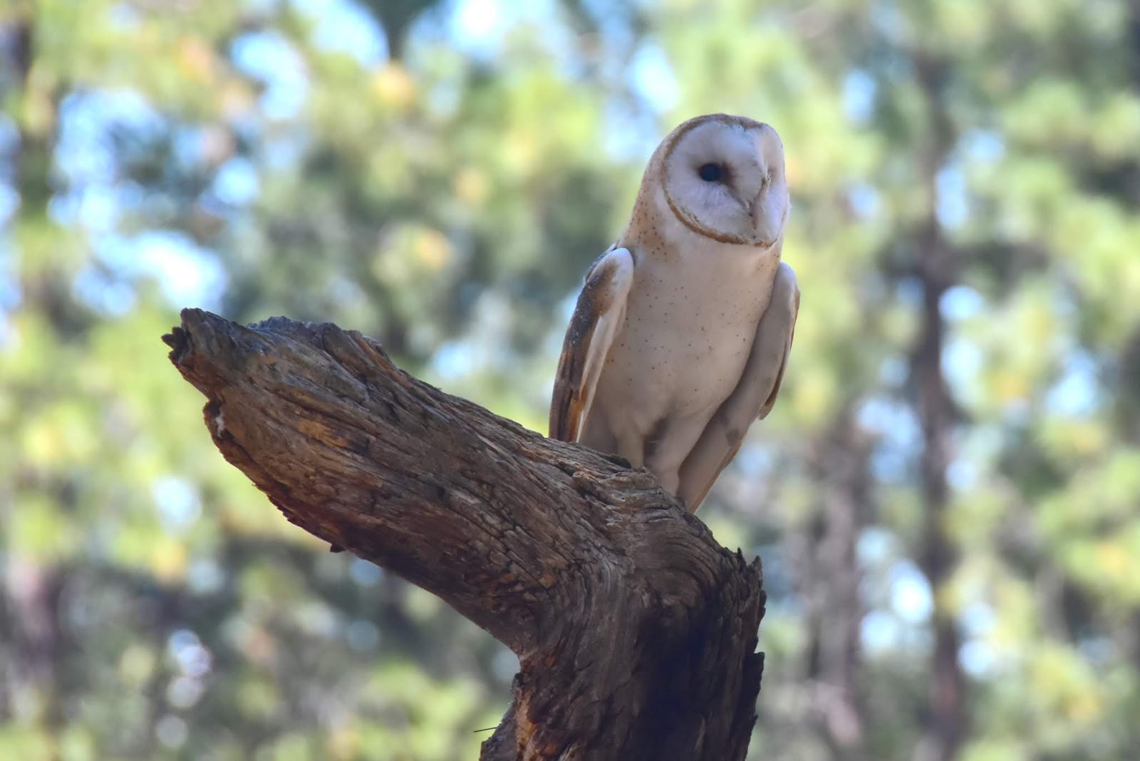
We started with a barn owl with a perfect snowy face. He was notable for his silent flying. When he would go overhead, you did not hear him at all. The most impressive thing about the Barn Owl, the narrator said, is that he can eat his weight in field mice each and every year. That amounts to about 1,100 mice out of your barn and fields. Pretty impressive.

Next came the Harris Hawk, which is an Aplomato Falcon. The person doing the program narration said he likes to bite the backs of the neck of his future dinners. Incredibly, the next bird that we watched and photographed was a Turkey Vulture. They fly very slowly, use the thermals, and the narrator said they are exceptional among birds as they have a sense of smell, a very handy thing for a bird that must find dead things to eat.
Next we got to watch two Swanson Hawks that swopped and played and chased each other around the meadow by which we were sitting. These birds are from Argentina and migrate north during the summers down there.

Finally came the most incredible bird of all, the Peregrin Falcon. Capable of flying at anywhere from seventy to two-hundred miles an hour as they dive from great heights to swoop down and seize their prey. They can’t do their flying in forested areas like where we were sitting, but must call the wide open countryside their home. The narrator said that as they have lost habitat they often can be found inhabiting tall buildings in the city.

After the raptor show, we walked out to the parking lot and had lunch in the RV. After lunch, Concetta and I went our separate ways. I wanted to visit the Miller Farms and photograph the sawmill and other farm buildings. Concetta was anxious to visit the American Indian part of the Museum indoors. Agreeing to meet in an hour, we went off to our respective destinations.

I was so excited to start shooting that I forgot to change out the battery in the camera when we had lunch at the RV. So it was that I had only done a dozen shots of the Miller Farm, and the battery went completely dead. There was nothing for it but to retrace my many steps out to the parking lot, and secure the spare battery. This required a good ten walk in each direction.

Once back at the Miller Farm, I took up the shooting where I left off. I visited the cabin, the root cellar, and the barn where I found a wonderful old freight wagon. Everything in all the farm buildings was just as you would have found it a hundred years ago.

My next shooting subject was the saw mill, which looked to be a full-scale version of that most essential of frontier businesses. Not only did the saw mill look like it could actually mill lumber, there was a stack of milled planks in the run-out area to prove it.

I especially liked the mill since it had all of its vintage machinery, blades, and conveyors. The whole operation appeared to run on steam, though there was no one around to ask. It had what looked like a boiler and a drive piston arrangement, so it probably was steam driven.

After my photo shoot at the farm, and Concetta’s tour through the Native American Museum, we met at the gift shop where I purchased a cool book on the the life of John Riis, one of the earliest forest rangers in the brand new U.S. Forest Service that was formed by Gifford Pinchott back in 1905.

Concetta was hoping to find gifts for the grandkids, but didn’t find anything that took her eye. On the other hand, while Concetta shopped I drifted over and bought an ice cream bar at the snack bar and read a few pages in my new book.

We didn’t have far to travel after we left the museum as our camp was only ten or twelve miles away. We’re staying at the La Pine recreation area just north of the town of La Pine, though when we pulled up to the gate we found that there were only three or four spaces available. Thankfully, we were able to snag one and it turned out to be easy to maneuver the rig into.

Tomorrow we’re headed for Crater Lake. Perhaps if we get lucky we might even be able to camp there overnight. But since we never make reservations, we never really know where we’ll get to stay.

I can't emphasize enough that the High Desert Museum is a wonderful place to spend a day. As you probably noted, even on our second visit Concetta still didn't get to see everything we wanted to see. We hope you decide to come. And when you do, we wish you exciting destinations and memorable travels from the Davises, the Happy Wanderers.